Timerider (SF Bay Interstate Edition)
The marvellous David Rumsey has attacked yet another set of maps for our historical education.
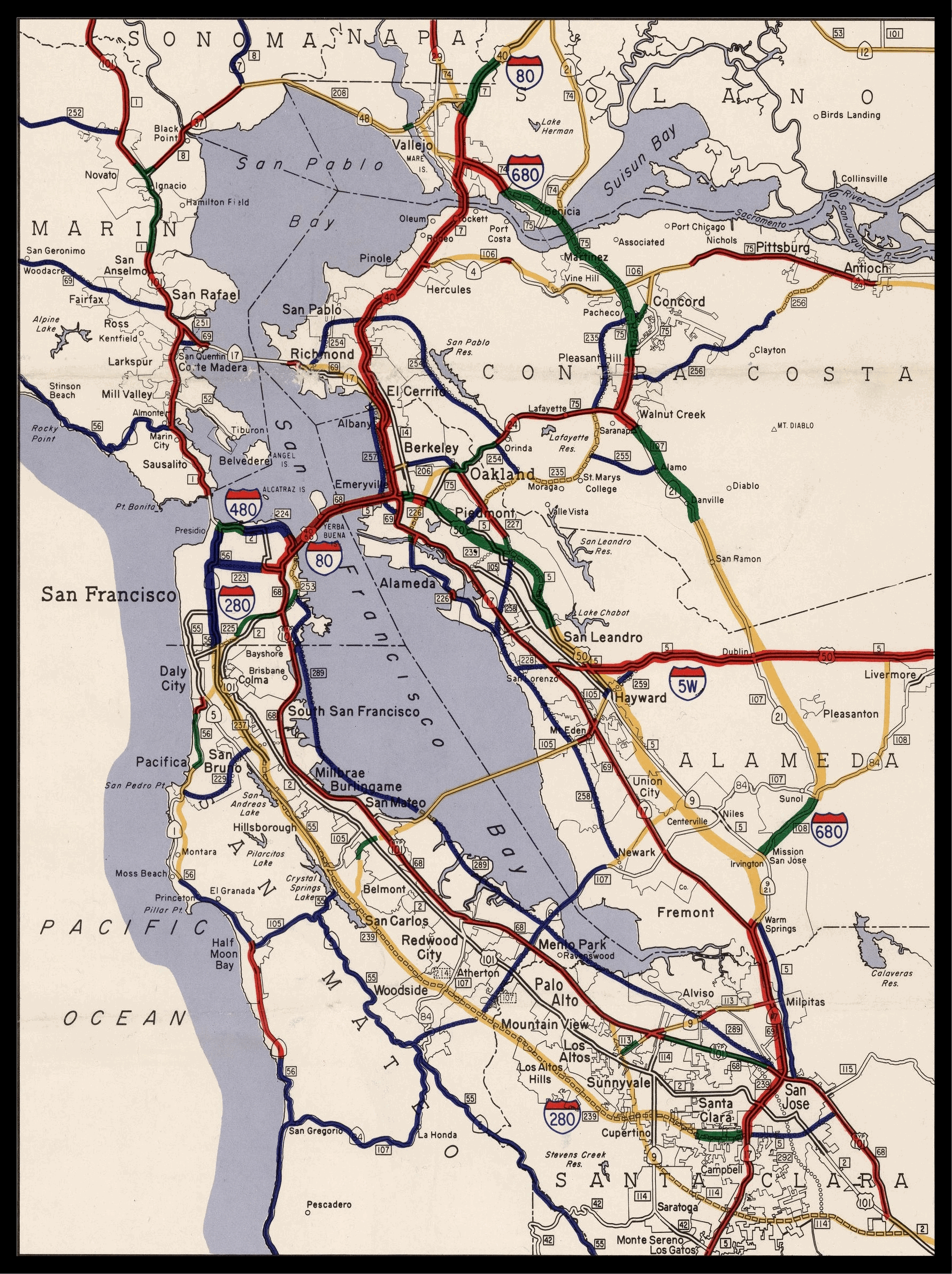
Eleven California Freeway and Expressway Maps, 1962 – 1975
California Department of Transportation, Division of Highways, Sacramento.
These maps show the development of the freeway and interstate highways in California over a period of 13 years, from 1962 to 1975 when the system grew exponentially. The maps include regional enlargements of San Francisco Bay Area, Sacramento, San Diego, and Los Angeles. Maps obtained from the Institute of Transportation Studies Library (Harmer E. Davis Transportation Library) at the University of California, Berkeley.
These maps show in remarkable detail the growth of highways and interstates we know and love like 280, as well as “ghost” highways that were planned but didn’t make it. They are absolutely enormous — here’s the full 1962 map on davidrumsey.com with pan and zoom controls.
As not to bury the lede, using the power of BurritoVision, I made a GIF showing highway construction (and plan evaporation) in and around San Francisco from 1962 to 1974.
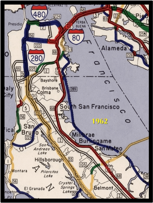
Here’s the key:
- Red: finished
- Green: under construction
- Yellow: route accepted
- Blue: planned, not yet adopted
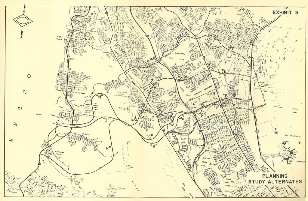
Here’s the inset map for San Francisco and the Peninsula in 1962.
There is all sorts of fascinating on this map. In addition to the highways that were to cut through San Francisco, perhaps the most flabbergasting is “Highway 289” (aka Highway 87) which was to run on/along/in the western coast of the Bay. (A small nub of 87 was built down in San Jose, but stopped at 237).
We saw this particularly destructive piece of Bay-eating engineering a few years back when we discussed it in the 1960 San Mateo County Master Plan.
And yes, that is a dam along the Dumbarton Bridge. Newer readers may want to review the various proposal to dam the Bay over the years.
Anyway, back to these new maps.
The intra-SF highways disappear after 1965 when the Great Highway Revolt finally shot them down…

And 1969 is the last year that Highway 87 shows up.

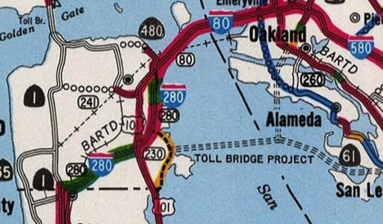
380 was originally supposed to stretch from 87 (just north of SFO) all the way to Pacifica — so you’re not imagining things when you drive westbound on 380 towards 280 and it looks like they forgot to finish it.
It should come as no surprise that Eric Fischer recently dug up the proposals for the path 380 might have taken to the Pacific:
This and many other 380 maps over on Eric’s always educational highway and bridge plan Flickr set.
The 1971 map looks more familiar in terms of highways, and BART shows up as well. One notable exception is a Southern Crossing bridge from Hunters Point, with a split to both Alameda as well as to the Oakland Airport.
(I think this path would make a fine extension to BART, anchored by a 30th St La Lengua station, naturally.)
Most Interstate construction as we know it today is complete by 1974-1975. So you can see the progress, I jammed the Bay Area insets from all 11 maps in a gianormous 53 MB GIF — each frame is 1800×2400 frames, so once it downloads you can zoom in to your area of interest. (Someone feel free to do the same for Los Angeles. Or better yet, vectorize the entire state with an HTML5 playback mechanism…)
Edwin Fox IPA
Let us all bow our heads and remember the 300,000 IPAs that were lost when the Edwin Fox ran aground off Chennai in 1869.
May god have mercy on their hops.
🍺😵🍺😵🍺😵🍺😵
Asteroid 2012 DA14
Roses are red,
Violets are blue.
Asteroid 2012 DA14
just misses you.

California for Beginners
Created by the esteem’d @seismogenic (aka Julian Lozos)

Sutro From SPAAAACCE
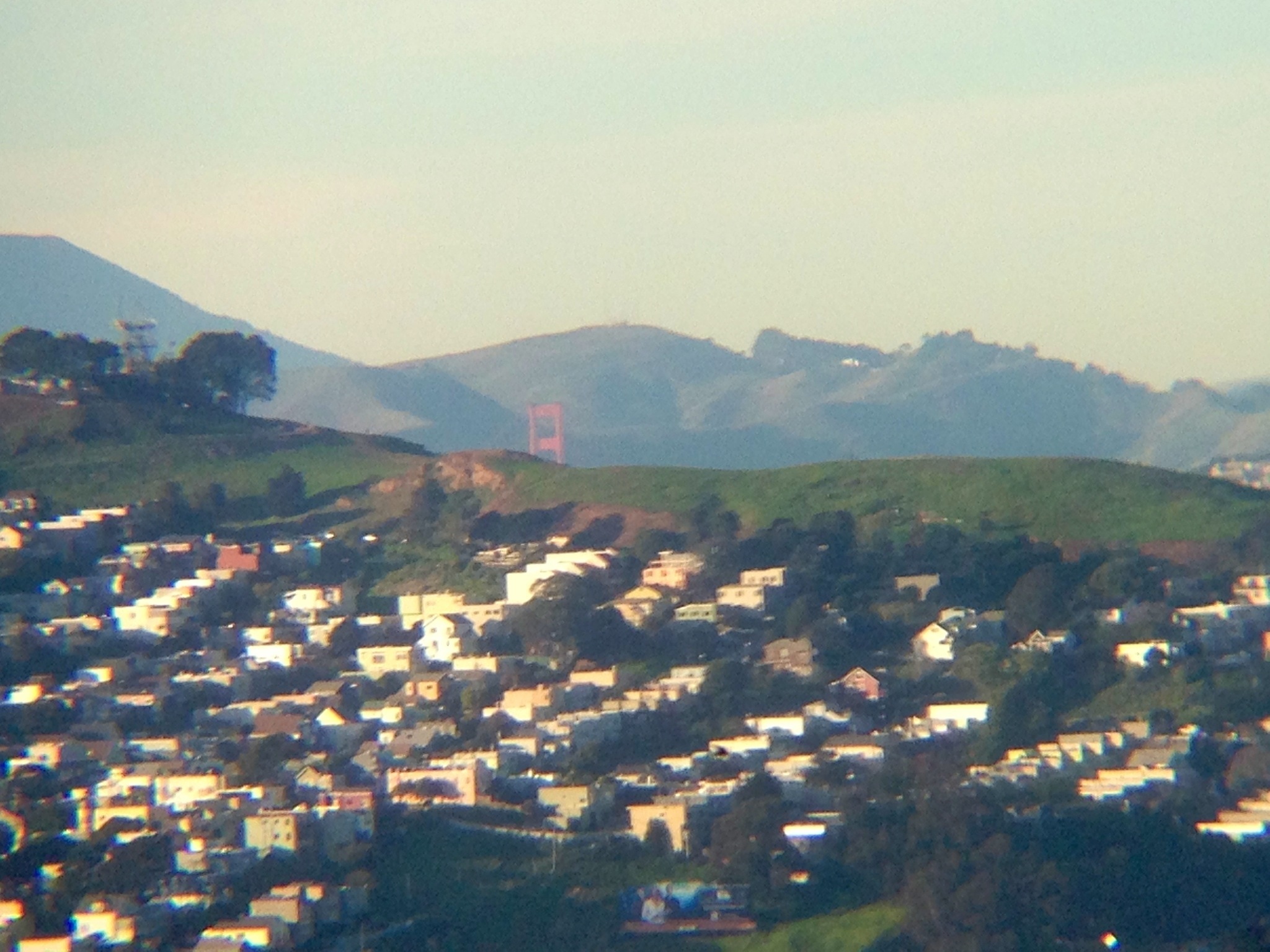
Views of San Francisco from the International Space Station are a primary mandate of this blog. Pictures of Sutro from space, even more so! Hey Sutro!
This and many other fine photos of our planet are being taken by Canadian astronaut Chris Hadfield aboard the ISS — he is simply killing it on Twitter.
Here’s the full shot from which I pulled the Sutro crop:

It includes a nice angle on our bridges:

In addition to those showing up on Twitter, all the photos taken by astronauts on the ISS are archived by NASA at The Gateway to Astronaut Photography of Earth. While it takes a while for them to be catalogued and geotagged, you can search through the raw feed and find sequences of pictures as the ISS travels at Mach 25 over SF.
I’ve been experimenting with creating stereograms out of closely timed photo sequences, with varying levels of success. If you can do the cross-eyed thing, here’s a Sutro stereogram made from this and this shot.
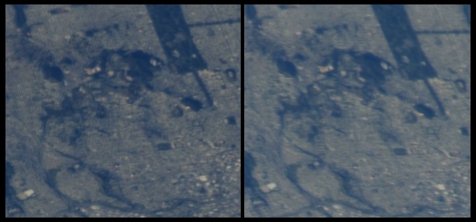
(Note also Dolores Park and Bernal.)
And the Golden Gate Bridge:

Not quite as much relief visible as I’d hoped. Given the altitude, I think stereograms would work best with oblique shots of mountainous terrain, taken tangentially (sideways) to the direction of travel of the ISS. (Then again, I am neither an astronaut nor a photographer.)
And mainly because they are awesome, a quick review of previous shots of the neighborhood from the ISS:
2011, by @astro_soichi:

California Rising (1), (2) (click for GIF):


ISS from my yard:

p.s. You can’t save search results on the The Gateway to Astronaut Photography of Earth site, so to save you some time, here are the most recent SF sets:
http://eol.jsc.nasa.gov/scripts/sseop/photo.pl?mission=ISS034&roll=E&frame=33066
http://eol.jsc.nasa.gov/scripts/sseop/photo.pl?mission=ISS034&roll=E&frame=33067
http://eol.jsc.nasa.gov/scripts/sseop/photo.pl?mission=ISS034&roll=E&frame=33068
http://eol.jsc.nasa.gov/scripts/sseop/photo.pl?mission=ISS034&roll=E&frame=33069
http://eol.jsc.nasa.gov/scripts/sseop/photo.pl?mission=ISS034&roll=E&frame=33070
http://eol.jsc.nasa.gov/scripts/sseop/photo.pl?mission=ISS034&roll=E&frame=33071
http://eol.jsc.nasa.gov/scripts/sseop/photo.pl?mission=ISS034&roll=E&frame=33072
http://eol.jsc.nasa.gov/scripts/sseop/photo.pl?mission=ISS034&roll=E&frame=33073
http://eol.jsc.nasa.gov/scripts/sseop/photo.pl?mission=ISS034&roll=E&frame=33074
http://eol.jsc.nasa.gov/scripts/sseop/photo.pl?mission=ISS034&roll=E&frame=33075
http://eol.jsc.nasa.gov/scripts/sseop/photo.pl?mission=ISS034&roll=E&frame=33076
http://eol.jsc.nasa.gov/scripts/sseop/photo.pl?mission=ISS034&roll=E&frame=33077
http://eol.jsc.nasa.gov/scripts/sseop/photo.pl?mission=ISS034&roll=E&frame=33078
http://eol.jsc.nasa.gov/scripts/sseop/photo.pl?mission=ISS034&roll=E&frame=33079
http://eol.jsc.nasa.gov/scripts/sseop/photo.pl?mission=ISS034&roll=E&frame=33080
http://eol.jsc.nasa.gov/scripts/sseop/photo.pl?mission=ISS034&roll=E&frame=33081
http://eol.jsc.nasa.gov/scripts/sseop/photo.pl?mission=ISS034&roll=E&frame=33082
http://eol.jsc.nasa.gov/scripts/sseop/photo.pl?mission=ISS034&roll=E&frame=33083
http://eol.jsc.nasa.gov/scripts/sseop/photo.pl?mission=ISS034&roll=E&frame=33084
http://eol.jsc.nasa.gov/scripts/sseop/photo.pl?mission=ISS034&roll=E&frame=33085
http://eol.jsc.nasa.gov/scripts/sseop/photo.pl?mission=ISS034&roll=E&frame=33086
http://eol.jsc.nasa.gov/scripts/sseop/photo.pl?mission=ISS034&roll=E&frame=33087
http://eol.jsc.nasa.gov/scripts/sseop/photo.pl?mission=ISS034&roll=E&frame=33088
http://eol.jsc.nasa.gov/scripts/sseop/photo.pl?mission=ISS034&roll=E&frame=33089
http://eol.jsc.nasa.gov/scripts/sseop/photo.pl?mission=ISS034&roll=E&frame=33090
http://eol.jsc.nasa.gov/scripts/sseop/photo.pl?mission=ISS034&roll=E&frame=33091
http://eol.jsc.nasa.gov/scripts/sseop/photo.pl?mission=ISS034&roll=E&frame=33092
http://eol.jsc.nasa.gov/scripts/sseop/photo.pl?mission=ISS034&roll=E&frame=33093
http://eol.jsc.nasa.gov/scripts/sseop/photo.pl?mission=ISS034&roll=E&frame=33094
http://eol.jsc.nasa.gov/scripts/sseop/photo.pl?mission=ISS034&roll=E&frame=33095
http://eol.jsc.nasa.gov/scripts/sseop/photo.pl?mission=ISS034&roll=E&frame=33096
http://eol.jsc.nasa.gov/scripts/sseop/photo.pl?mission=ISS034&roll=E&frame=33097
http://eol.jsc.nasa.gov/scripts/sseop/photo.pl?mission=ISS034&roll=E&frame=33098
http://eol.jsc.nasa.gov/scripts/sseop/photo.pl?mission=ISS034&roll=E&frame=33099
http://eol.jsc.nasa.gov/scripts/sseop/photo.pl?mission=ISS034&roll=E&frame=33100
http://eol.jsc.nasa.gov/scripts/sseop/photo.pl?mission=ISS034&roll=E&frame=33101
http://eol.jsc.nasa.gov/scripts/sseop/photo.pl?mission=ISS034&roll=E&frame=33102
http://eol.jsc.nasa.gov/scripts/sseop/photo.pl?mission=ISS034&roll=E&frame=33103
http://eol.jsc.nasa.gov/scripts/sseop/photo.pl?mission=ISS034&roll=E&frame=33104
http://eol.jsc.nasa.gov/scripts/sseop/photo.pl?mission=ISS034&roll=E&frame=33105
http://eol.jsc.nasa.gov/scripts/sseop/photo.pl?mission=ISS034&roll=E&frame=33106
http://eol.jsc.nasa.gov/scripts/sseop/photo.pl?mission=ISS034&roll=E&frame=33107
http://eol.jsc.nasa.gov/scripts/sseop/photo.pl?mission=ISS034&roll=E&frame=33108
http://eol.jsc.nasa.gov/scripts/sseop/photo.pl?mission=ISS034&roll=E&frame=33109
http://eol.jsc.nasa.gov/scripts/sseop/photo.pl?mission=ISS034&roll=E&frame=33110
http://eol.jsc.nasa.gov/scripts/sseop/photo.pl?mission=ISS034&roll=E&frame=33111
http://eol.jsc.nasa.gov/scripts/sseop/photo.pl?mission=ISS034&roll=E&frame=33112
http://eol.jsc.nasa.gov/scripts/sseop/photo.pl?mission=ISS034&roll=E&frame=33113
SESF
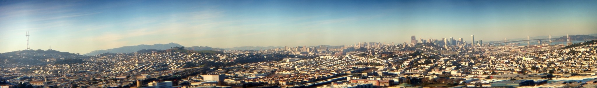
The views from Bayview Hill (420′) are amazing — a clear view from Sutro to the Bay Bridge.
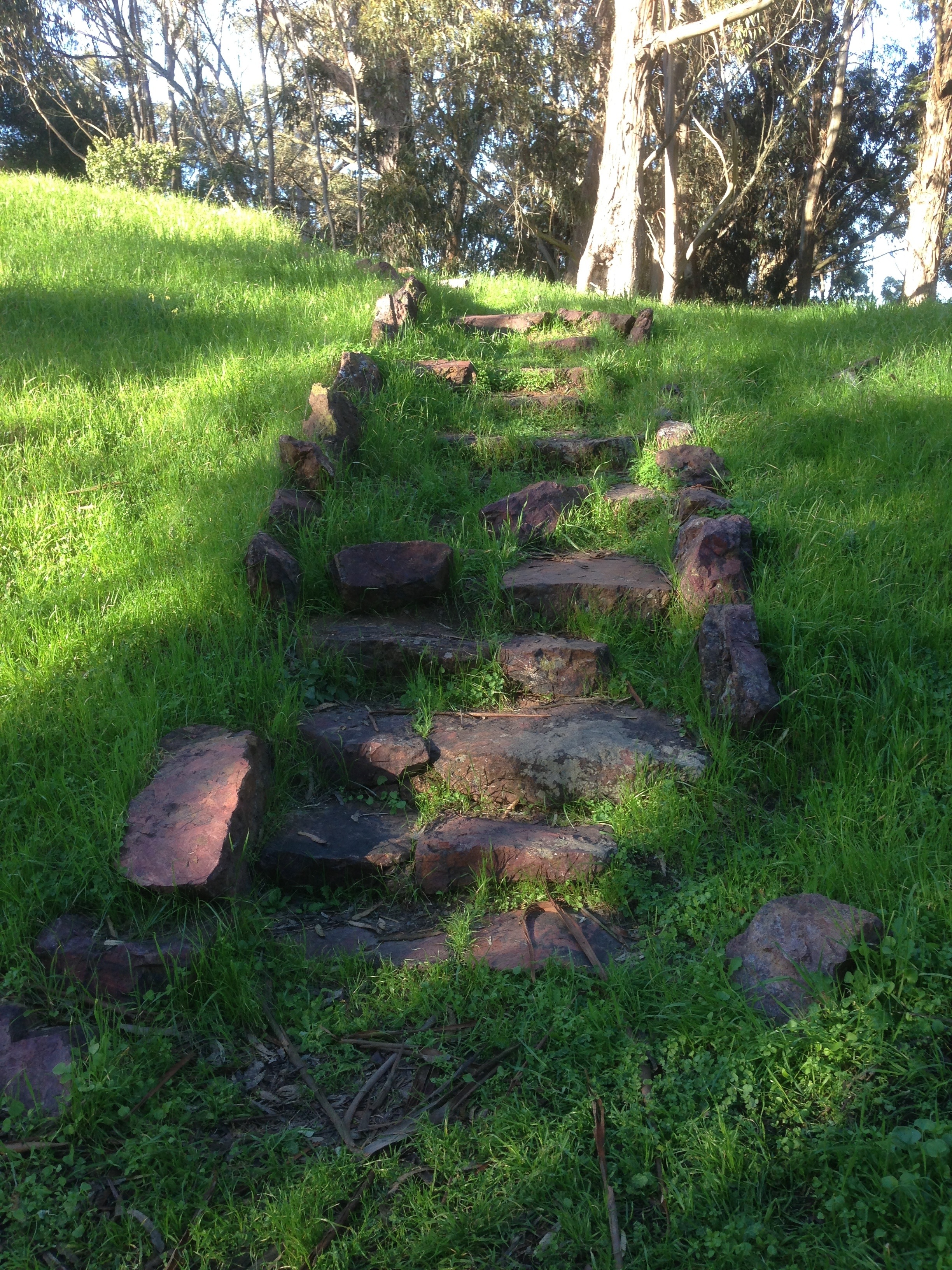
There’s a nice trail that takes you all the way up to the top, and the plants are pretty distinct (PDF).
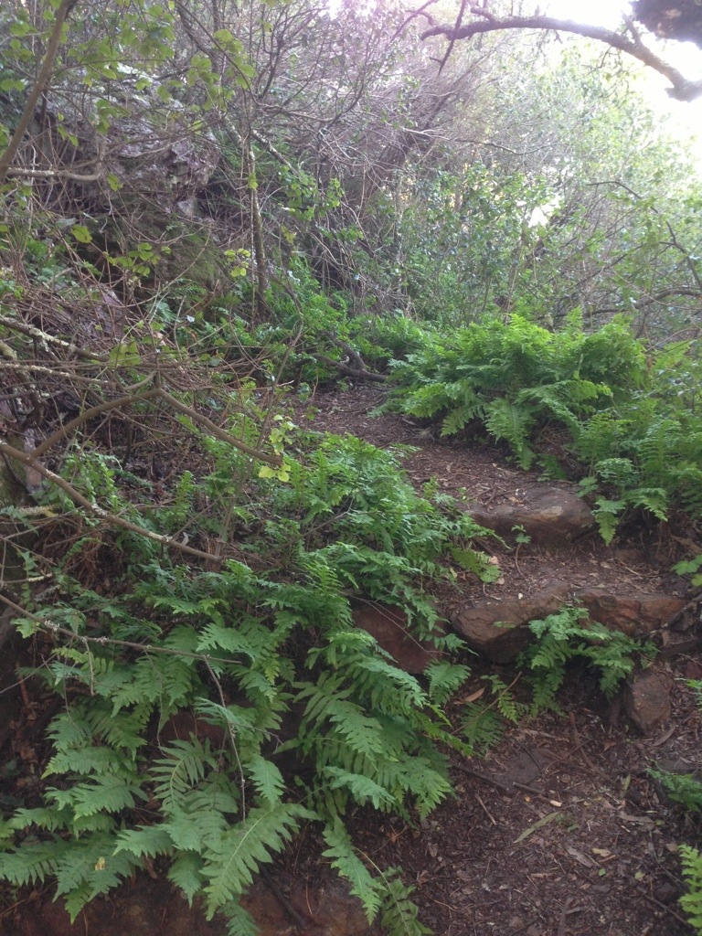
Cool WPA-era stairs (that are apparently covered with poison oak, so watch out).
Here’s what the very top of Bayview Hill looks like.
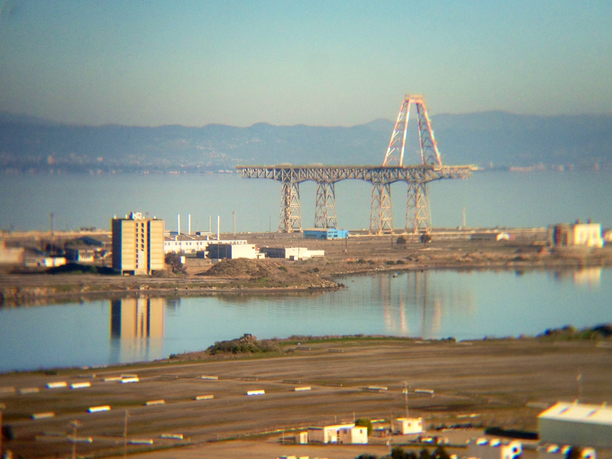
You can also see the Burrito Railgun in its native habitat:
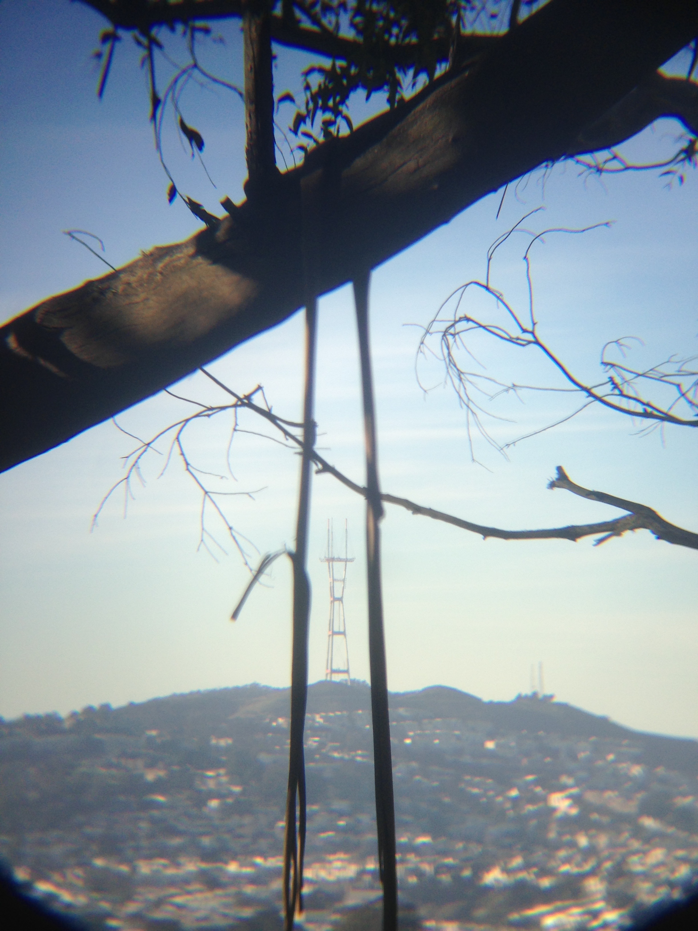
And Sutro, naturally.
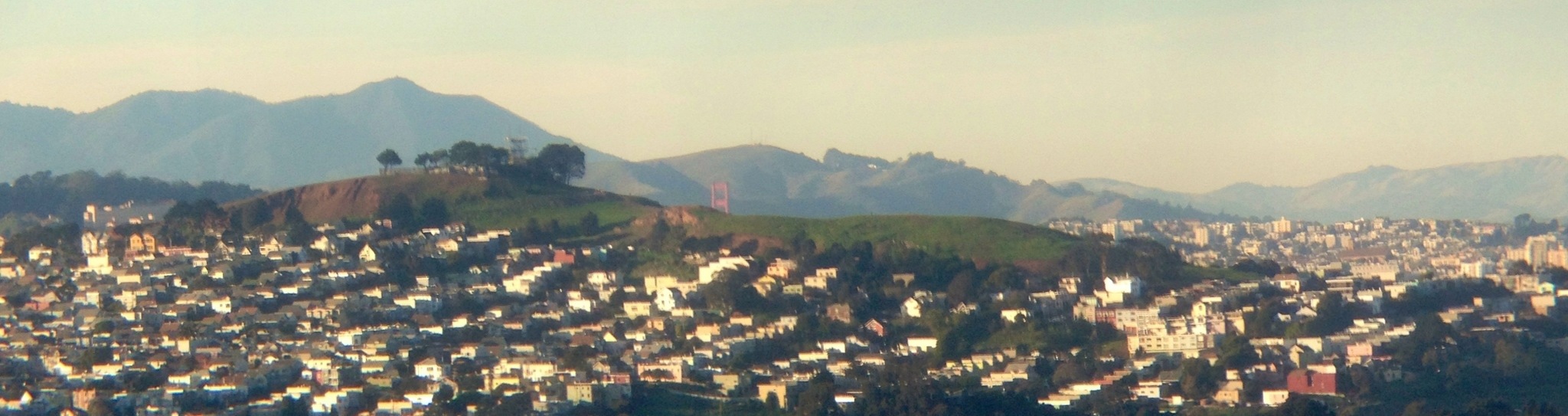
Behold Bernal and the tip of the GGB:
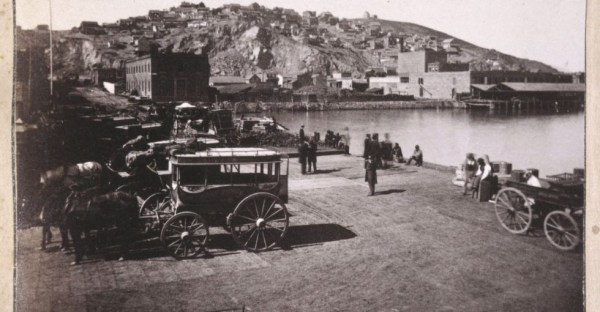
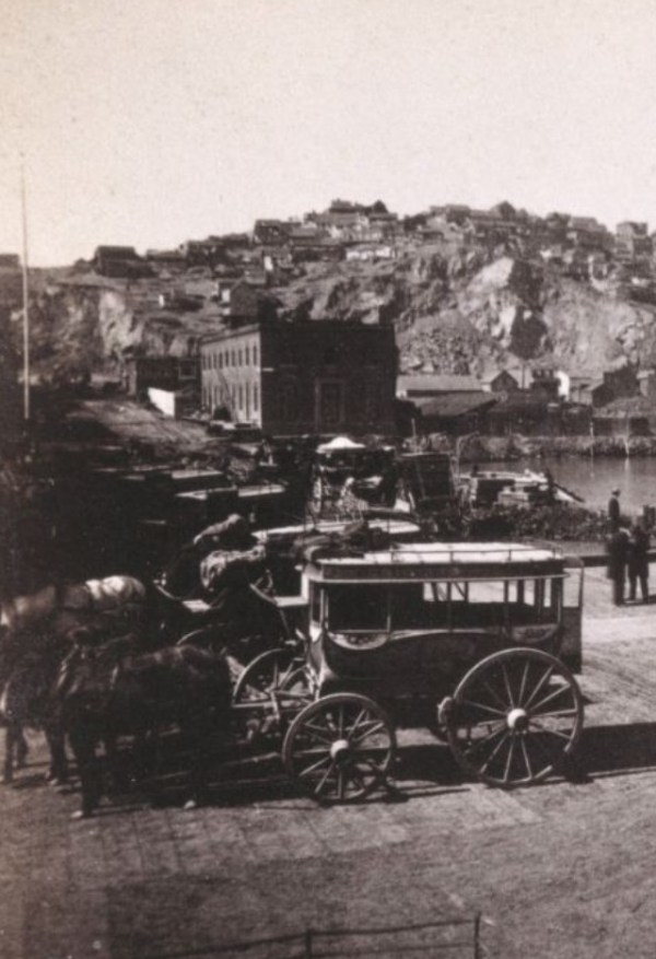
Hashagen’s, meet La Taqueria
1956, via SFPL’s Flickr feed, vs today:
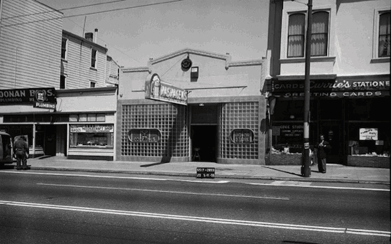
Just think: the people drinking in Hashagen’s would only have to wait 33 years for animated GIFs, and then a bit longer for epickry such as this:
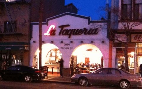
I do wonder if the Hashagen’s beer sign was animated.

It is a little spooky that four years ago I unknowingly stood in just about the same spot as that photographer 57 years ago.
(h/t Bernalwood, KevMo)
IMPORTANT UPDATE: Reader gevin shaw alerts us to this Hashagen’s cocktail napkin!

You’ve Tried The Rest, Now Try The Best
For the first time in recent memory, I was in North Beach during a weekday.
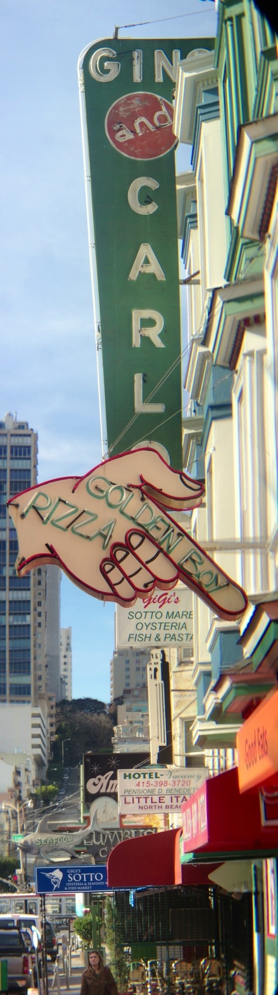
Does not suck:
Proto-ASCII art:
I ventured to this strange diagonal land to finally meet @SF_Historian who is now on Twitter and fucking KILLING it.
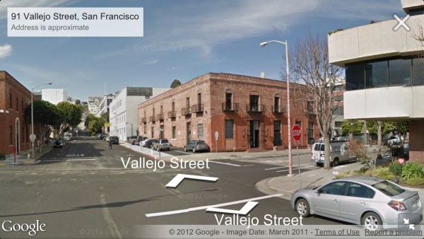
(Yup, Front Street once fronted the water.)
Alas this warehouse had yet to be constructed for the 1853 Coast Survey and isn’t (yet) visible on Pastmapper:
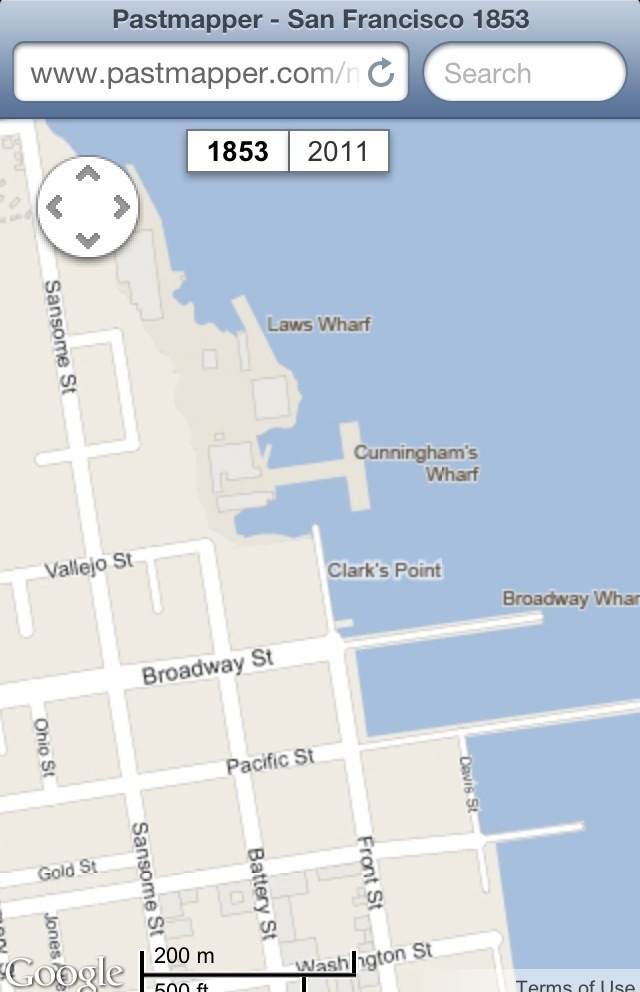
Though you can see it on the 1859 Coast Survey map (which I hope to Pastmap soon):
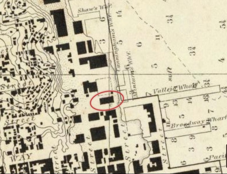
(Looks like Vallejo Wharf consumed Cunningham’s Wharf.)
But fret not, those in SESF, @SF_Historian is a pan-chronofriscan:
(But let’s face it, anyone who has a Sanborn maps avatar is an automatic follow.)
The Reemergence of the Islands of SF
Being a grumpy old man, I am not on the Face-book, but it seems that my “Islands of San Francisco” neighborhood map is being “liked” by the kids. Flattering to watch it circulate!
Take this opportunity to obtain a lovely physical copy of this map for a very affordable $20 over on Zazzle.

Look at the detail! And no streets to argue over! I mean, I’d easily lay down some platinum coins for this.

It can be seen on the walls of many a discerning San Franciscan.
http://twitter.com/jasonbentley/status/285974660569518080
For full effect, I recommend getting a version that’s at least two-thirds of your height.
Hey @burritojustice. Look what I got today. http://t.co/gGp3EPWI—
Sara Mauskopf (@sm) January 12, 2013
If you WANT to pay more money, I can help. A reader bugged me to make a version available on Zazzle’s wrapped canvas option. I had never considered this, but turned out to be pretty damn awesome.


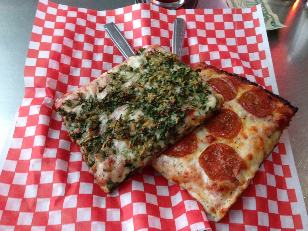
It’s not cheap, but neither is matting and framing. And you also get the satisfaction of imagining that Zazzle accidentally sent you a pizza.

Just keep your eye open for Zazzle discount codes.
I’ve had a couple of requests to reproduce it — if you go to the SFAR building on the corner of Grove & Franklin, you can see a rather giant version in their entryway.


If anyone wants to put this on the side of a building or trace it out in the desert, I’m game — ping me on Twitter!
And let us not forget the inspiration for my map, @optshiftk‘s lovely diagram of Seattle, also available for sale on Zazzle.

Una Lampadina Napoletana
Few know the true secret of Una Pizza Napoletana is cooking over a giant multi-filiment lightbulb.
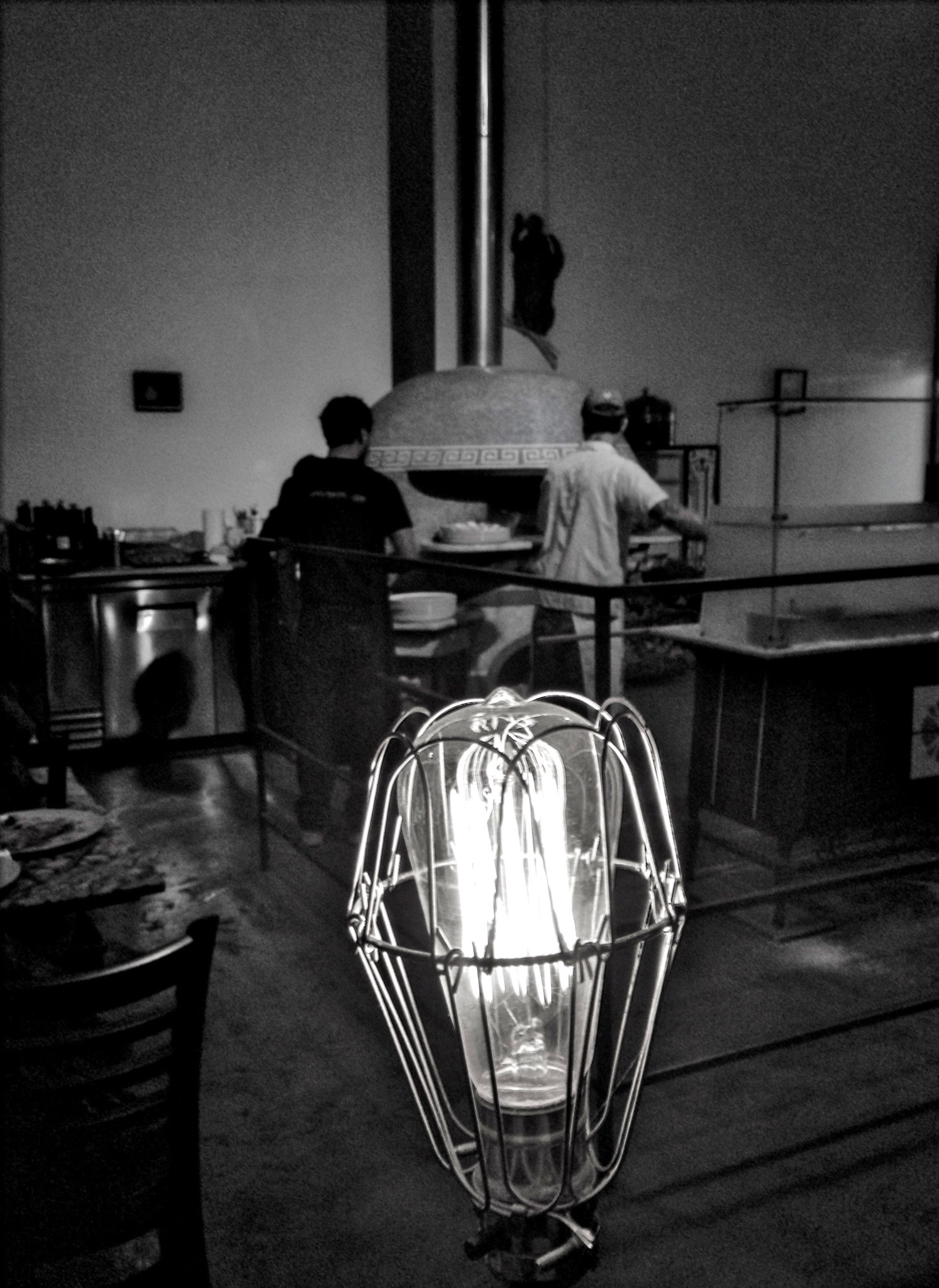
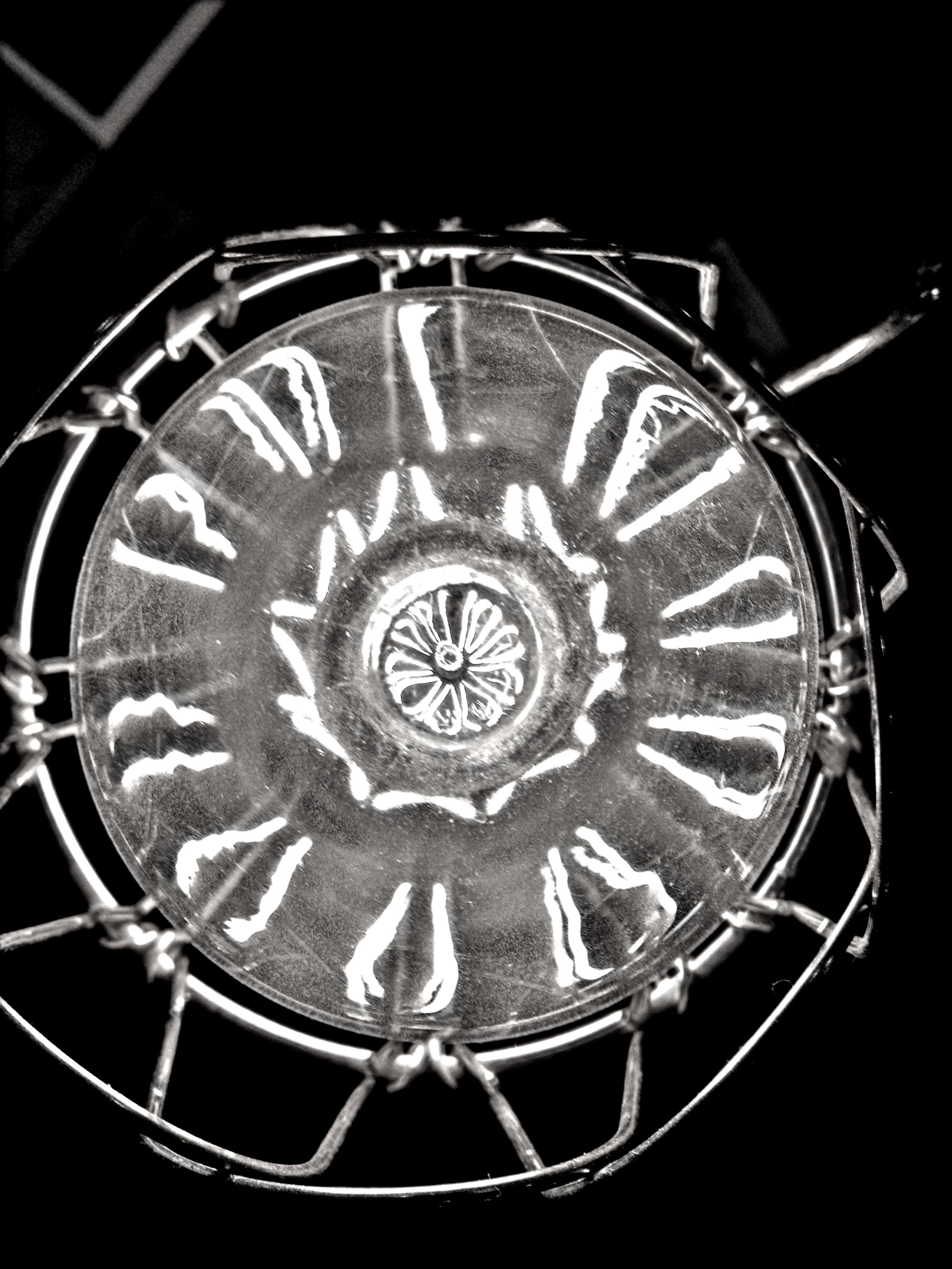
Seriously. This is the world’s coolest lightbulb.
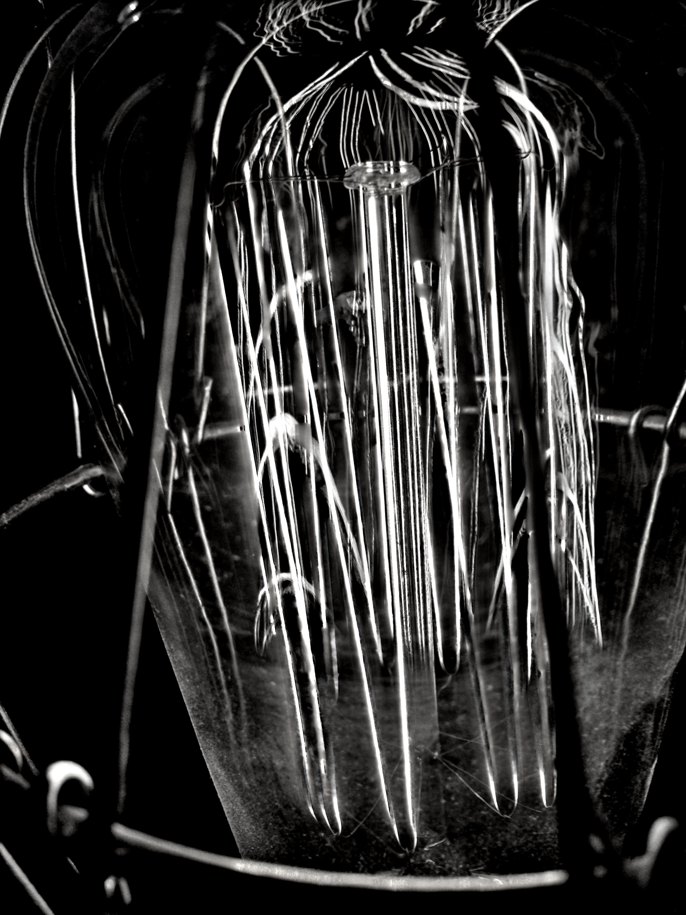
I think there’s an entire world in there, yearning to be free.
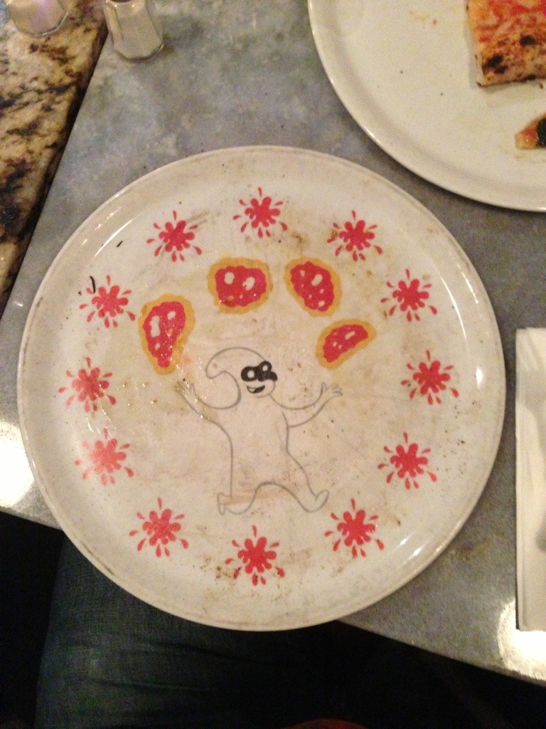
Also, this plate is awesome. (I wish it had been what Ray imagined in Ghostbusters.)


