Mission Public
I just discovered Mission Public on 14th & Natoma.
I really like the space.
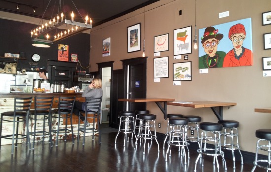
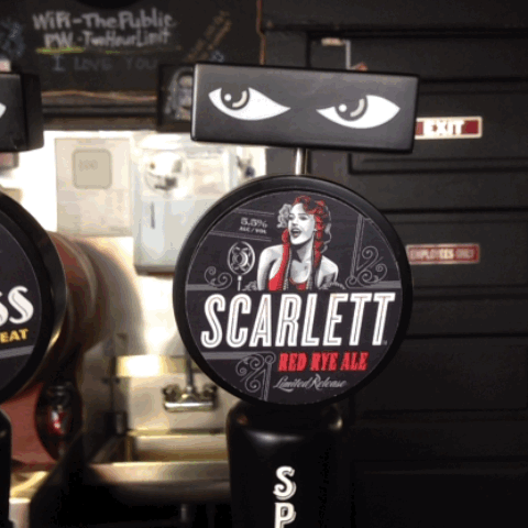
Hours are now greatly expanded. Breakfast to beers! Gratuitous tap GIF.
Anthony the owner is awesome. He is also very knowledgeable on San Francisco Burrito History of the early 1990s, which I hope to make a post about soon.
Go by and say hi. Oh, and Mission Public‘s on Twitter now.
Burrito Justice Radio, Nov 6 2013


2072: Taqueria Wars
2072. Ice sheets have collapsed. Sea levels have risen 200 feet. San Francisco, thanks to its hills, has fared better than most coastal cities and is now a thriving archipelago.

Double-blink to have this map delivered in 2D linear format via pnuematic tube from the undersea ZazzleDome.
Tensions between Google and San Francisco have always been high, especially after Google’s controversial (and eventually futile) levelling of San Bruno Mountain to just 100 feet for its new headquarters in 2032.
Zoning and Board of Sups resolutions have forced most Google corporate assets and employees to be based on enormous barges floating along the coasts (with an especially high concentration along Market Shoals and Mission Gulf).
However, construction of these barges requires tremendous quantities of aluminum, which has caused foil prices to skyrocket. And any remaining sympathy towards Google evaporated when their partnership with Chipotle was announced.
For the Taco Boat Fleet (which maintained critical supply lines in the 2060s as Meltwater Pulse 3A quickly turned San Francisco hills into islands), this existential threat of both foil and soul cannot go unchallenged.

The Flotilla takes matters into their own hands against the Google-Chipotle duopoly.


Even Oracle is taken aback by the Google-Chipotle’s response.
But the tide turns. “The more you tighten your grip, Google, the more burritos will slip through your fingers.”
Google has made many corporate enemies over the years, and they move to support the rebellion:

Google Barges, once feared, are now a liability, not a strategic asset.
Google’s partner Chipotle provides covering fire during their inglorious retreat with their burrito attack craft (while managing to simultaneously offend both culinary and design sensibilities). While the removal of foil provided a better turning radius, the thermal and structural integrity of the airframe is fatally compromised. The entire Chipotlan fleet is lost.

Google retreats to its lunar datacenter facilities and the San Francisco Archipelago rebuilds its taqueria infrastructure to its former glory. But Earth celebrates too soon.
Luckily, the SFA’s fleet of deep space BRVs (Burrito Research Vessels) return from the Kuiper Belt to neutralize Google orbital and lunar assets.

The space burritos deorbit satellite fragments, enabling the era of Pax Burriticus and socialized al pastor.
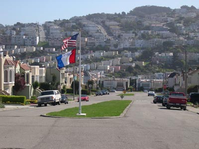
The Once & Future 16th & Mission
Finally! A giant glass Apple Store in the Mission at 16th!
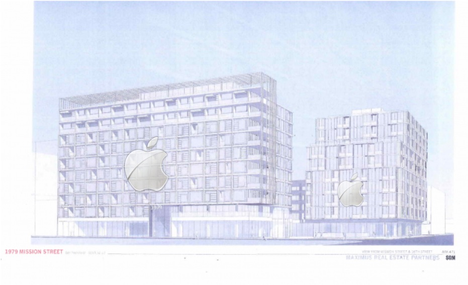
OK, maybe not, but 351 new units, whoa. Definitely should be called the Royal Gate though. More diagrams over at Mission Local. Density is coming whether we like it or not — just hope it doesn’t look like crap.
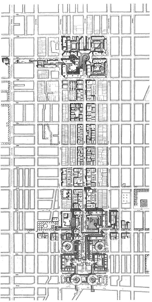
Proposed redevelopment of this area is nothing new. Back when the city looked upon the Mission as full of blight, a massive project along the lines of One-Two-Three Embarcadero was proposed along Mission from 16th to 24th:
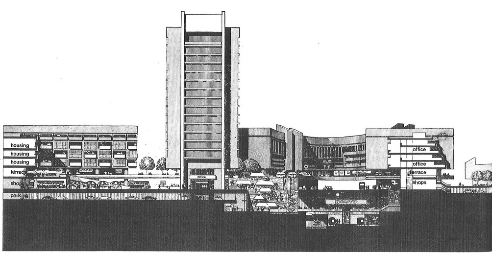
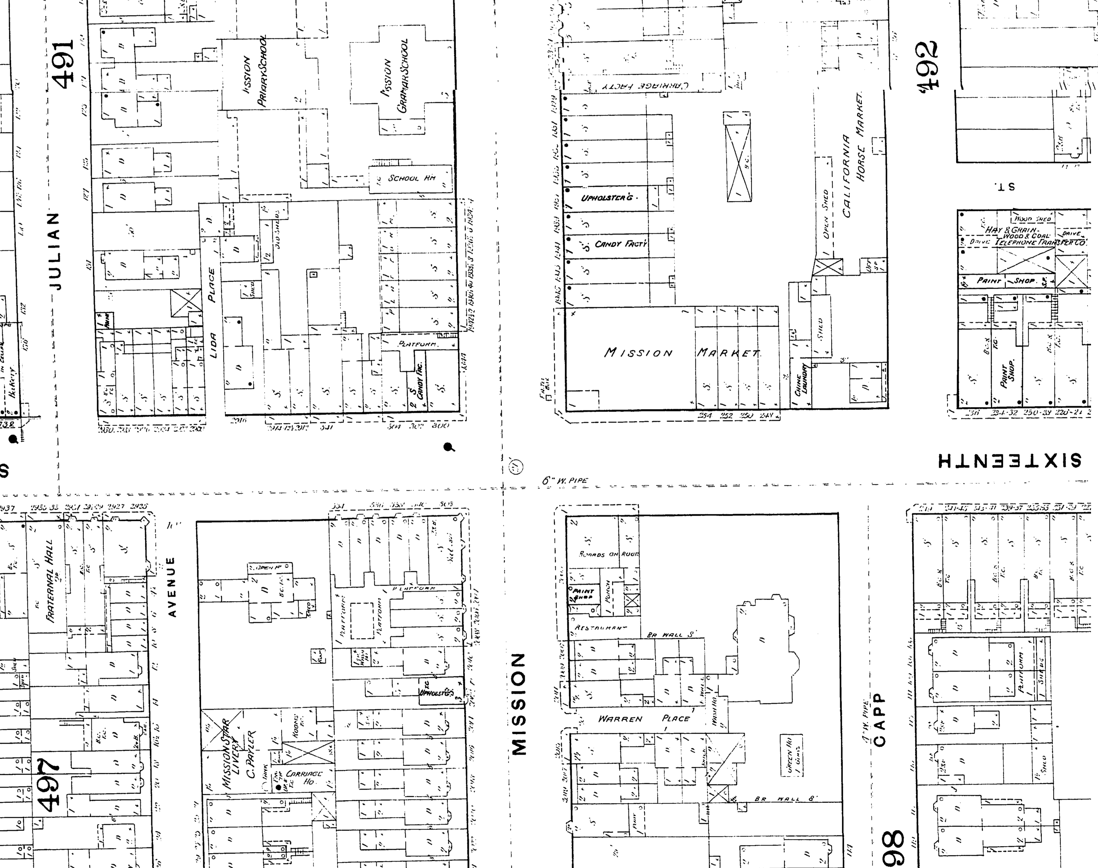
Details of 16th & Mission: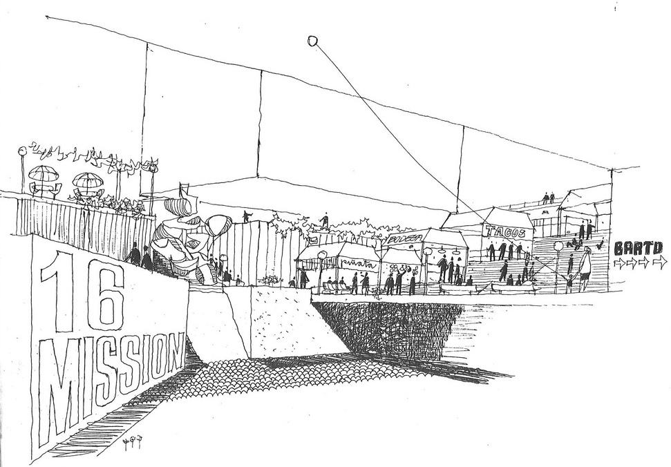

And a quick view of what 16th and Mission looked like pre-BART:


And the Sanborn maps from 1889:
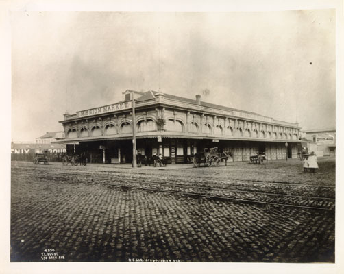
Another view of the Mission Market via SFPL/OldSF:
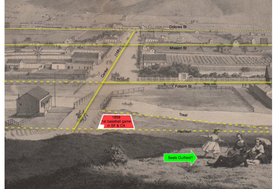
16th used to be called Center Street, this intersection was not far from what might have been the first baseball game played in California. Looking west down 16th/Center in 1859:
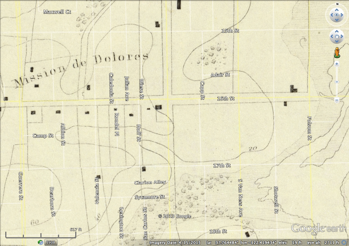
And a GIF of the Coast Survey maps from showing 16th & Misison building up from 1853 to 1859 to 1869 – click to animate:
Velvet Correlation
The Velvet Underground’s first album in 1967 was massively influential. An apocryphal quote: “The album may have only sold [x] copies, but everyone who bought it started a band.”
However, there is great variation on the value of x. Mother Jones reporter @daudig collected a number of the quotes, and the figure varies wildly.
More in @daudig‘s feed. Since he was too lazy to Storify them all, I decided to collect the data in a handy chart:
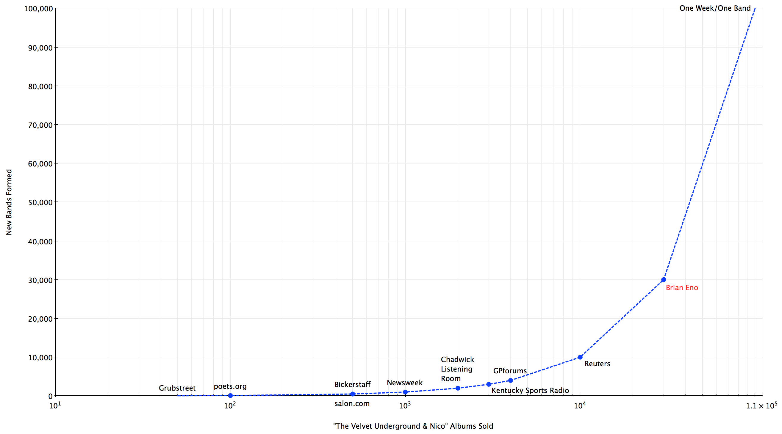
Sorting these by year shows an interesting deflation of Brian Eno’s original 1982 quote of 30,000, followed by a rapid inflation:

Thus concludes this infographical tribute to Lou Reed, who will soon spawn ONE MILLION BANDS.
Burrito Justice Radio, Oct 23
Burrito Justice Radio, on now at BFF.fm!
chain factory GIF:

how shrinky dinks are made:
GIF 1839a:
https://twitter.com/pbump/status/390995611882770432

past and future BART


Nazis in SF City Hall:


Balkanize Bernal
In a pathetic attempt at disinformation, the cold-blooded hill people seek to imply La Lenguans wish to rejoin the oppressive Bernal regime. Nothing can be further from the truth.
In fact, La Lenguan agents have detected fractures in the Bernalian Hegemony. The LaLeReCaMi (La Lenguan Revolutionary Cartographic Ministry) has assembled this map of the impending breakup of Bernalwood.
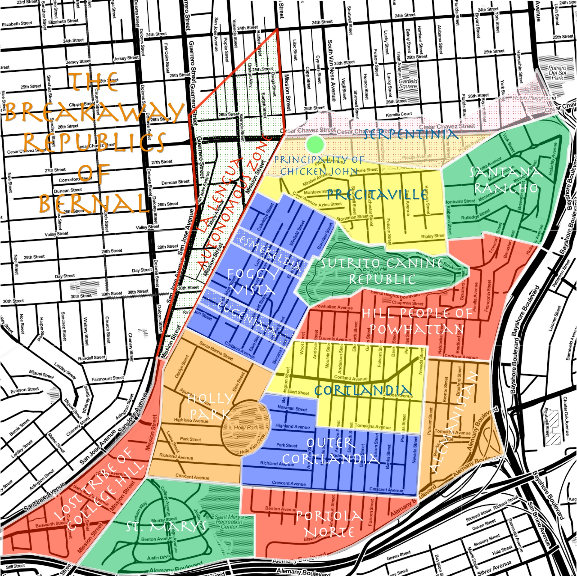
The glorious breakaway of La Lengua was just the first step in the fracturing of Bernal microhood self-determination. A quick review of the chertish fault lines:
Holly Park and St. Mary’s Park have long questioned the need to follow the heavy hand of the Bernalwood Authority. St. Mary’s already have signs and a flag, so this was just a matter of time.
The Lost Tribe of College Hill still resents the lack of higher education services promised in its name. Bernal simply doesn’t deliver, and Portola Norte seeks to regain association to its brethren across the long lost Islais Creek.
Outer Cortlandia has long resented being looked down upon by the Cortlandia center of Bernal commerical power. Alemanistan shows its commercial independence with the farmers market and swap meet and night market.

(photo via TL)
The eastward facing Hill People of Powhattan have long felt a sense of alienation from the Cortlandian core, with little to no easy access to food or entertainment services, and spotty transportation options.
The radioactive chert of Bernalwood has increasingly led to cases of animal giganticism — a dramatic evolutionary leap in canine intelligence has inevitably followed. The dogs of Bernal have given notice and broken away, forming the Sutrito Canine Republic. Run free, Fido, run free.
Santana Rancho is the cultural heartland led by spiritual leader Carlos Santana, and protected by an amazonian league of black magic women, no less.
@karlthefog is the new cultural leader of the slopes of Foggy Vista. Yet these Sutro-facing denizens are battling their own micro-microhood secessions with Esmereldia and Eugeniaia corridors seeking to yearn free.
The case of Precitaville, base of Industrial Magnate Telstar Logistics, is a curious one. Nominally the progenitor of Bernalwood, this cartographic charlatan has in fact been planning a break from the Bernal Hegemony. However, the twisted history of Precita Creek is far too strong, and Precitaville is already facing the revolt of the valley of Serpentinia. Then there is the Principality of Chicken John, a cultural force whom few dare challenge.

So, Bernalian Pretenders, your day is done. Long live the independent peoples of Bernalwood!
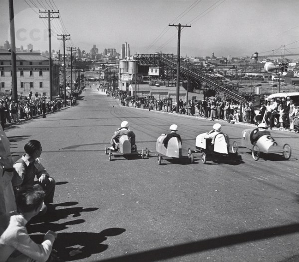
Soapbox Derby (1930s)
Last night, @daudig @telstarlogistic came across a motherload of San Francisco photos from the 1930s-1940s, including this rather startling photo of a Nazi rally put on by the German consulate at City Hall in 1935:
Nazis. I hate these guys.
This was also the sentiment of the photographer, John Gutmann, a German Jew who emigrated to San Francisco as the Nazis came to power:
“In 1933, the Nazis forbade the Jewish Gutmann to teach or exhibit. Given the increasingly dangerous political climate, he realized that he would have to leave Germany. The editor of the magazine Die Neue Revue (whose mother was American) told him: “There is only one country, that is the United States, the only state is California, the only city, San Francisco.”
Further digging by Mother Jones reporter @daudig revealed that this 1935 rally was in conjunction with the visit of a German cruiser, the Karlsruhe (sunk in 1940 after the invasion of Norway).
Reception for the German Admiral, 1935.
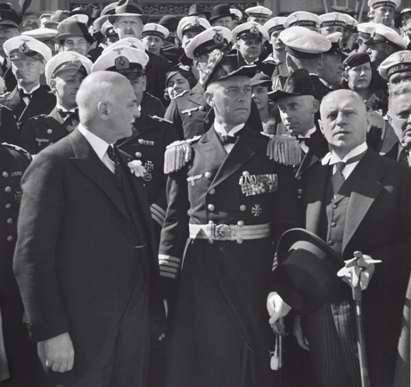
Mayor Angelo Rossi is on the left. The “Admiral” in the middle is in fact just a Captain with a really big hat — Captain Gunter Lütjens of the Karlsruhe to be precise. Guessing that the German (Nazi) Consul is on right?
(Lütjens would later be promoted to Admiral, and during WWII was a Kriegsmarine Fleet Commander. He would die aboard the Bismark in 1941. He was one of just three admirals to protest in writing against Kristallnacht in 1938. He was one-quarter Jewish, and it seems his wife was half-Jewish. At least for the first years of the Nazi regime, the German Admiralty fought to protect Jewish officers in the ranks.)
Gutmann’s photo archive at the University of Arizona’s Center for Creative Photography is rather amazing, and includes a frankly astounding number of photos of San Francisco from the 1930s to just before Gutmann’s passing in 1998. @bernalwood found this great picture of the old Soapbox Derby.
Somewhere in Potrero, but what street? I initially thought Arkansas, as I figured that might be the old Pac Bell tower lining up in the distance downtown. Lots of Google Streetviewage turned up no matches however. I called upon my super Twitter powers to force multiply an answer, and @donnyo came carolining to the rescue:
At the same moment @donnyo was sleuthing through newspaper archives, I took a different tack — I figured the giant conveyor belt would be easy to find on Sanborn maps. Sure enough, in the 1950 Sanborns, along Carolina, below 18th, what do we see?

Note also the soap powder ad on the right, which must have been for the Pioneer Soap Company.
As @donnyo notes, resurrecting the race today would be impossible as Carolina no longer exists between 18th & 19th.
The spirit of the soapbox derby lasted beyond the Potrero days — Outside Lands shows it was held in the Sunset in the 1950s:

![]() and of course the secret underground Bernal soapbox derby:
and of course the secret underground Bernal soapbox derby:
Anyway, take a look at Gutmann’s archive of over 1000 San Francisco photos, and let me know what interesting things you see. Just a few that caught my eye:
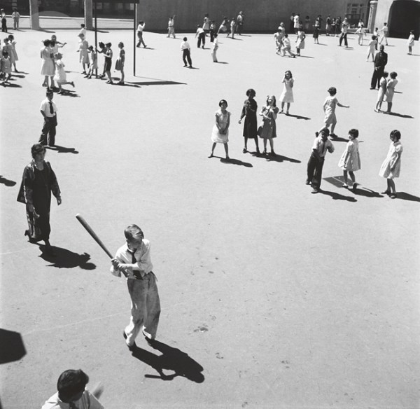
An integrated school in 1934.
Cops Checking out Hunters Point, 1947:
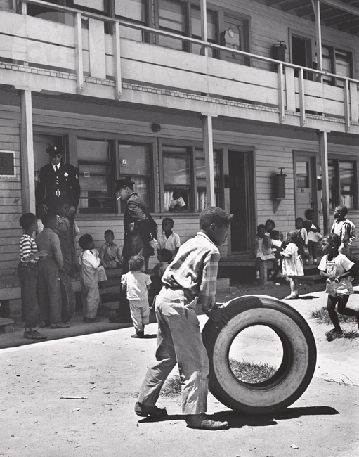
If it’s not already done, the history of blacks in Hunters Point (and San Francisco in general) is a book waiting to be written. These 1937 redlining maps are sobering.
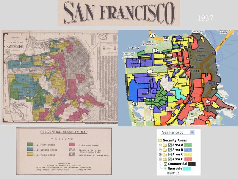
Description of grades and Interactive map by city and neighborhood on the T-Races site.
The First Two Towers of the Bay Bridge, 1935:

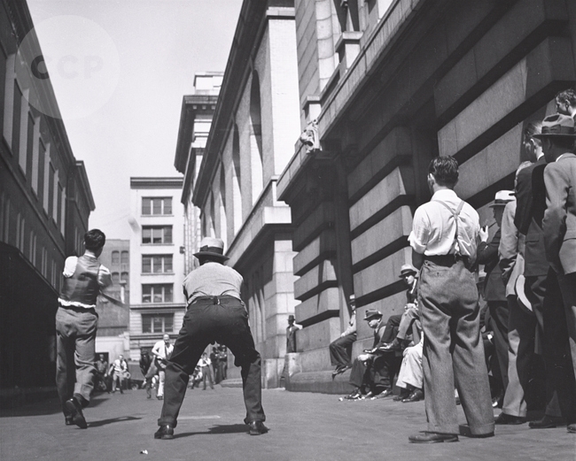
@daudig found this rather unbelievable shot, Fooling Around With Cable Cars, Castro Hill, 1934:
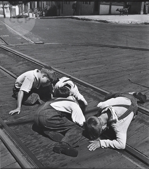
UPDATE: David Gallagher notes:
old timers used to tell me they would do something like tie a string to a piece of wood, then lower the other end of the string into the slot twirling it until it caught the cable, then watch their personal “cable car” take off.
Sutro Parallax

El Rio’s 35th
Celebrate Saturday, 2PM at El Rio, in the heart of La Lengua, until the cows come home!
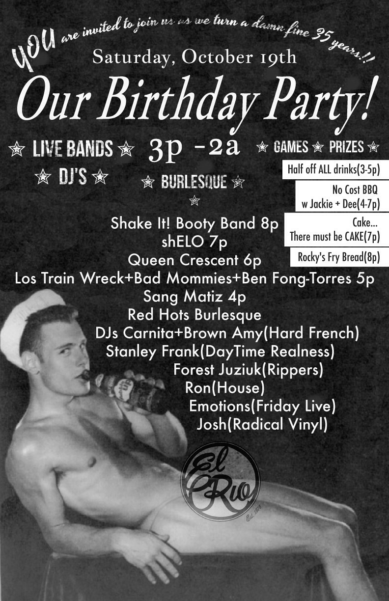
Here’s to another 35 years! But long time readers will remember the way-back history of El Rio and the land underneath.
1858 – the red box is El Rio:

Jose & Carmen Bernal’s adobe was not far away from the back patio:

and they got this sweet seal:
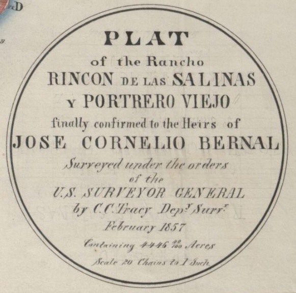
Much, much, much more in this historiful post.


