Transamerica Cone of Invisibility
Mission / La Lengua / Bernal residents hold a deep, dark secret.
The glorious Transamerica Pyramid is invisible to us, thanks to the unfortunate placement of the evil and golem-like Bank of America tower.
@rrmutt has named this tragically sad shadow “The Transamerica Cone of Invisibility” and took the time to map it out. I took the liberty of extending his work INTO THE THIRD DIMENSION (click to download a rather epic Google Maps kmz file).
For those not willing to eat 115% of your CPU, some screenshots from the GE KMZ:
The view of the B of A shadow of darkness:

Why B of A building, what an attractive air conditioning unit you have upon your glorious crown!

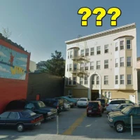
The Bernal / La Lengua / Mission NPZ (no-pyramid zone):
![]()
A rare look INSIDE the cone of invisibility:

(Hey Transamerica Pyramid, this is what you’re missing — dude, I just realized you get NO good burritos.)
Anyway, one edge of the shadow dissolves towards the eastern, lower part of Bernal Hill (aka “dogtown”). Sadly, my planned surveying session from atop Bernalwood got called on account of rain.
However, before Sunday’s maelstrom started, I *did* get the chance to explore the western shadow line from the rarely explored and little-known land of “Diamond Heights”.
I walked a curve from DH Blvd to Walter Haas playground (above Billy Goat Hill), then down between Everson and Digby, and on to the very edge of the world, Fairmont Plaza (nope, I had never heard of it before either).
I stitched together a quick animated GIF of the Sadly Disappearing Transamerica Pyramid:

Along the way, it of course started pouring rain, though for my readership I persevered, sacrificing both my physical and electronic health (ok, not really, but it was pretty rainy and visibility really started to suck — the fuzzier shots are me shooting through the rain, trees, or a combination thereof while standing in mud).
However, the rain and clouds let let me get a couple of fairly interesting shots:
The lines of San Bruno Mountain.

Sutro Tower could have been built here, but the FAA nixed it. But my favorite San Bruno Mountain story is the guy who wanted to level it and use it to fill the Bay (no I’m not kidding).
“…this barrier which otherwise would continue to plague San Francisco and the Peninsula FOREVER. Also, eliminating this barrier would provide more land for homes, cemeteries, and rapid transit facilities; and it would remove the ever-present hazard of plane crashes against this mountain.” (more here)
Obligatory Sutro Tower shots:


How can you not love that thing?
I do love Bernal when it gets all green. This particular angle makes the old quarry pretty obvious.

Hunters Point Shipyard, and the sun beyond the Bay.


Anyway, Billy Goat Hill and Fairmont Plaza FTW!


OSSM GIF FTW! NPZ, LOL.
Great angle on that green Bernal for sure. I was only recently informed that it’s only in SF that winter = green. Apparently other places have trees that lose leaves and other such nonsense…
Having spent a very major part of my childhood Billy Goat Hill (which is terrible and nobody should ever go there ever ever ), and now that my dog spends a major part of his days on exactly the route you’re talking about (DH, GP, NV, he knows no boundaries!), I was surprised when I didn’t recognize Fairmount Plaza, just a few blocks away. My guess is Google made it up, or Noe Valley really was miles away from Glen Park when I was a kid. Very possible, since I also assumed those towers in San Bruno were for the landing aliens.
I saluted da Tower when I was home for T-giving. She looks good. When I got back here, a new overlord greeted me.
jeesus…….that shaking picture of BofA is simply scary. that’s a serious quake.
Thanks for this. It’s always amazed me that SF’s tallest building is invisible from much of the city. I could never see it in FolSoMa either.
The irony is you’ll have a better view of it from Berkeley that we do here.
In fairness, near the Pyramid you can get a decent burrito at Tlaloc.
Who cares you can’t see the transamerica building? Why is this a big deal?
I’m pretty sure that Bank of America building has been here over 3 times the time you’ve lived in SF.
Move to a place with a view or stop bitching.
Talk about casting a dark shadow.
On a more positive note, Coit Tower is visible through a gap in the buildings of financial district from the Mullen Peralta Mini Park in Northeast Bernal. Visualization requested!
Nice! I did not know that.
Google Earth-fu seems to indicate Coit is also visible from Bernal’s saddle, will test this soon.