Clooney’s Busts a Move
Following up on our look at buildings moving across Army Street and the history of Clooney’s: On the left, the funkily angled Clooney’s, 2012. And on the right, 1938.
“Wait a second,” you say. “The intersection is different.” Indeed! For it is a different intersection entirely — San Jose & 30th, not 25th & Valencia. Yes, it’s true — as we have all suspected, Clooney’s is capable of travelling through both SPACE AND TIME.
Here’s the building comparison in GIF1938 neutrino format.
You can all thank the esteemed Jonathan Lammers, architechælogist, who went on an historical building hunt using the 1938 aerial photo set scanned by the honorable David Rumsey.
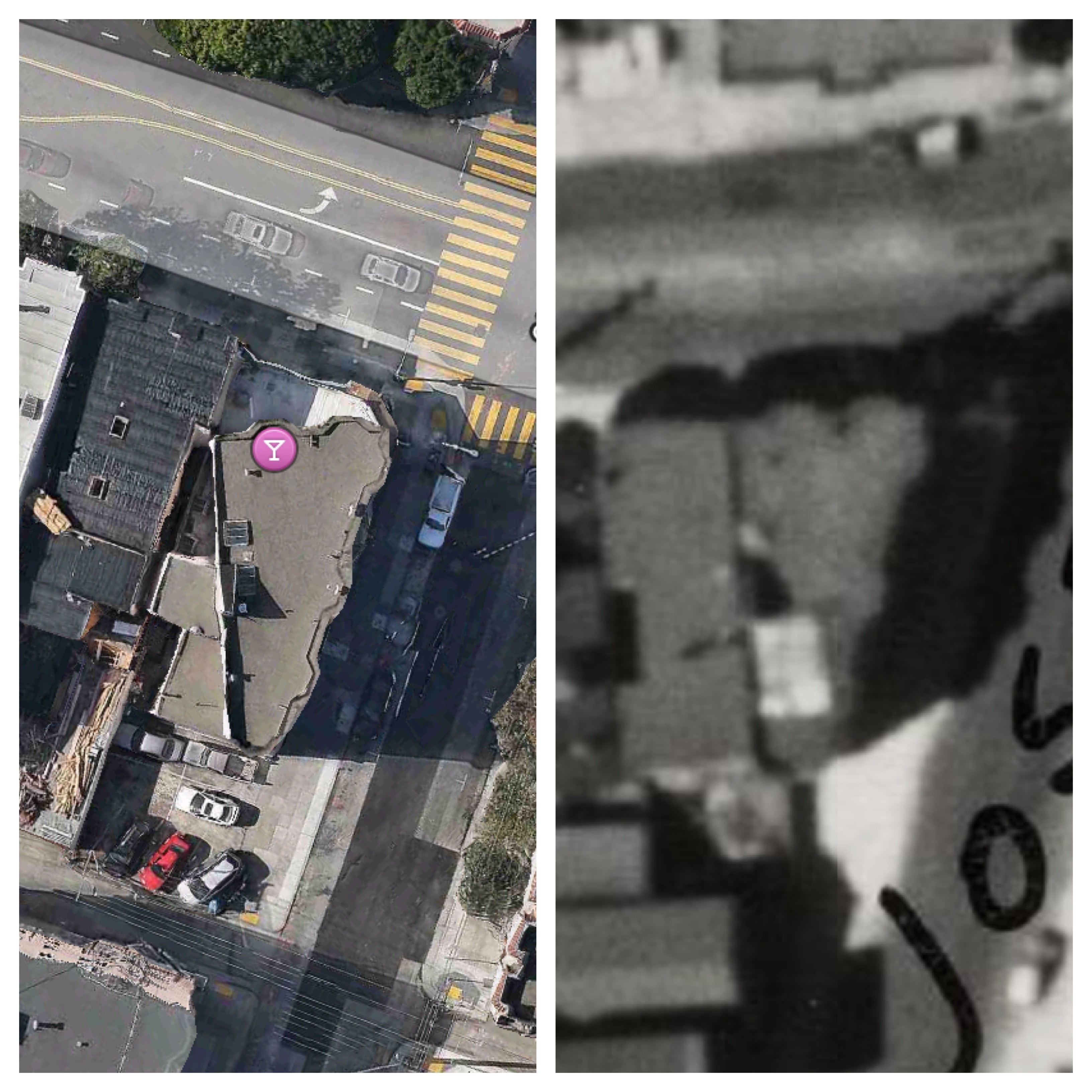
I am not exaggerating in saying that I found a good candidate for Clooney’s in less than thirty seconds: an odd-shaped building on the southwest corner of San Jose Avenue and 30th Street. It had two slanted bays facing north onto 30th Street, and three slanted bays fronting the diagonal line of San Jose Avenue. The location of the light well also seemed just right. Feeling lucky, I decided to take a quick look at the SFPL historic photo collection to see if it might have an old photo of the intersection. Miraculously, it does. And there on the right hand side of the photo is what I feel certain is today the building housing Clooney’s at 1401 Valencia Street.
Obviously, the first story of the building as it appears today is quite different. But it is not hard to extrapolate that when they moved the building onto a new foundation, they left a generous setback at the street so that they could construct a one-story extension for the pub.
And why was it moved? Once again, street widening was the culprit. Comparisons of the 1938 aerial map and current views make it clear that many, many buildings were removed along the west side of San Jose Avenue. In fact, the current building standing on the southwest corner of San Jose and 30th was, in 1938, the third building west from the intersection!
Almost certainly, the street widening was done in conjunction with the construction of I-280, which opened in the late 1950s. The fact that Urbane Libertine mentions that the electric meter at Clooney’s was installed in 1951 would appear to indicate that was the year the building was moved.
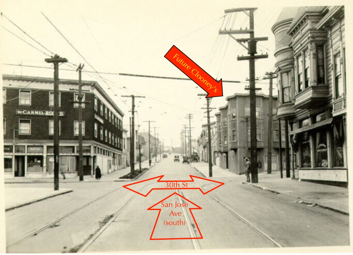
The intersection of San Jose and 30th is almost completely unrecognizable compared to today. I wrote about this intersection over at Mission Mission last year and unbeknownst to me, I even marked the proto-Clooney’s apartment buildings at 800 San Jose Ave in my BurritoVision overlay!
“Blue were the apartments across 30th on the right. All those are long gone.”
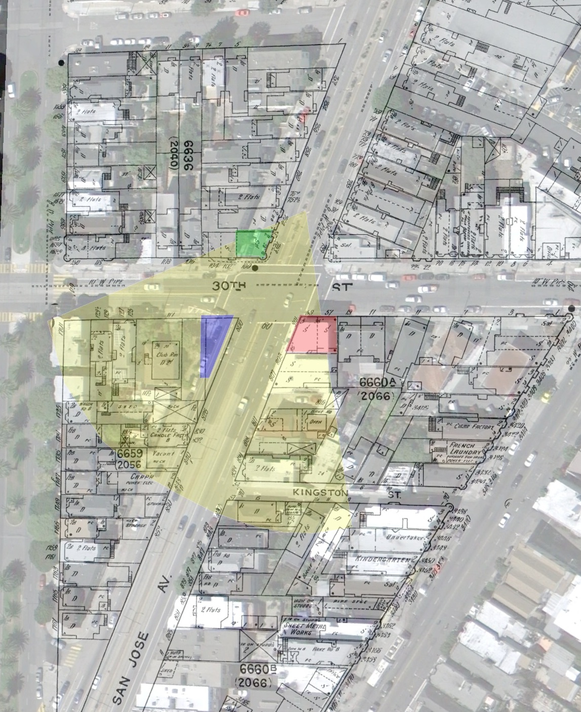
San Jose Ave was widened quite a bit to the west in preparation for 280 — here’s a BurritoVision GIF of San Jose Ave & 30th in 1938 versus today, with the proto-Clooney’s in red (click for 800 pixel wide GIF):
So be on the lookout for strangely shaped buildings throughout San Francisco — it may not be due to drunken architects like you thought.
“House Movers” is hard to search for online, but I did find one photo of from the SFPL:
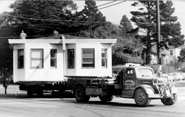
However, I have a hard time imagining an entire apartment building on the back of a truck.
You can see “Hanson Bros House Moving” on the side of the truck. They were in the SF city directories in the 1930s through the 1950s (along with Pearson & Johnson and the Sullivans).
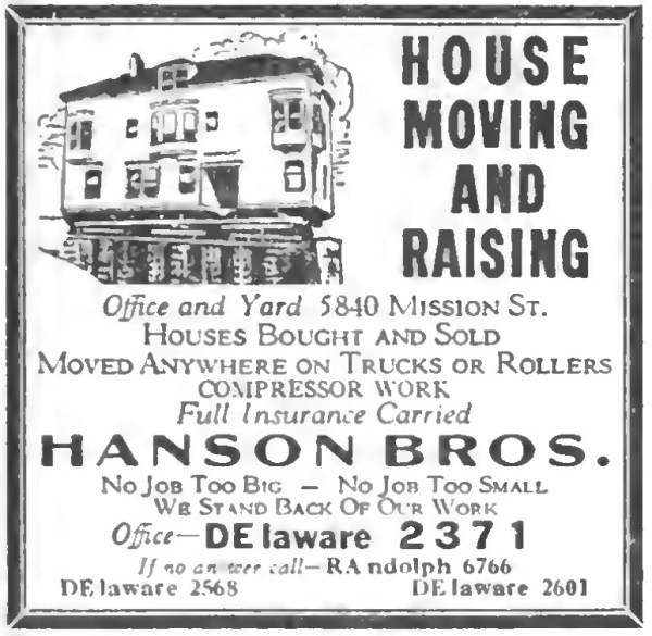
Here’s an ad for the Hanson’s from 1938:
Anyone have any idea how much it cost to move a house (or an apartment building for that matter)? Anyway, here’s to whoever decided it was worth moving 800 San Jose Ave to 1401 Valencia, if only because it gave us this Clooney’s story in the Noe Valley Voice.
Findery trackback:
https://findery.com/burritojustice/notes/in-the-1950s-san-jose-avenue-was-dramatically
Burrito Railgun HVAC
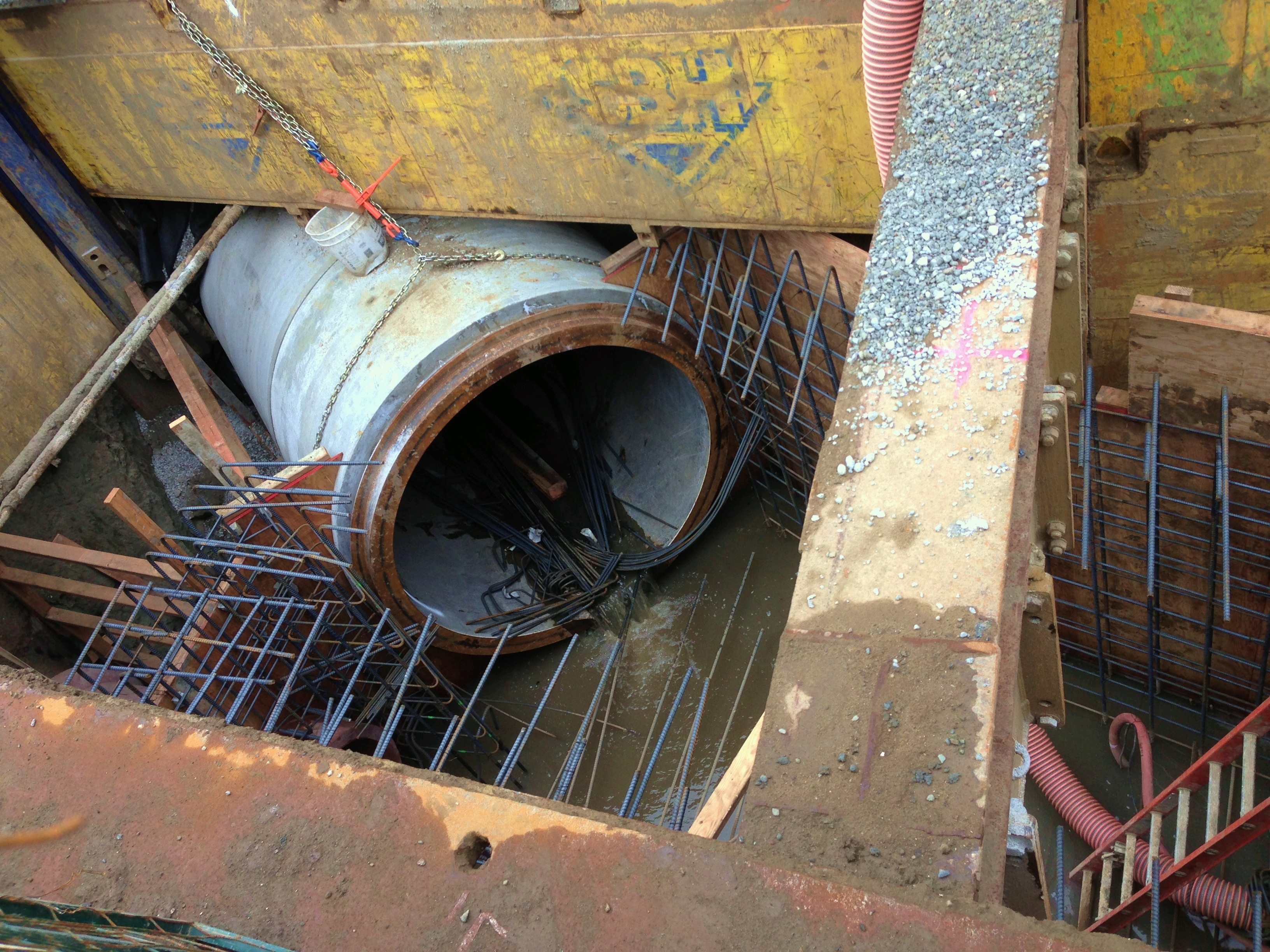
Now that it has been covered up, the sewer upgrade new cooling system for the Burrito Railgun along Valencia and Duncan can be entered into the historical record.
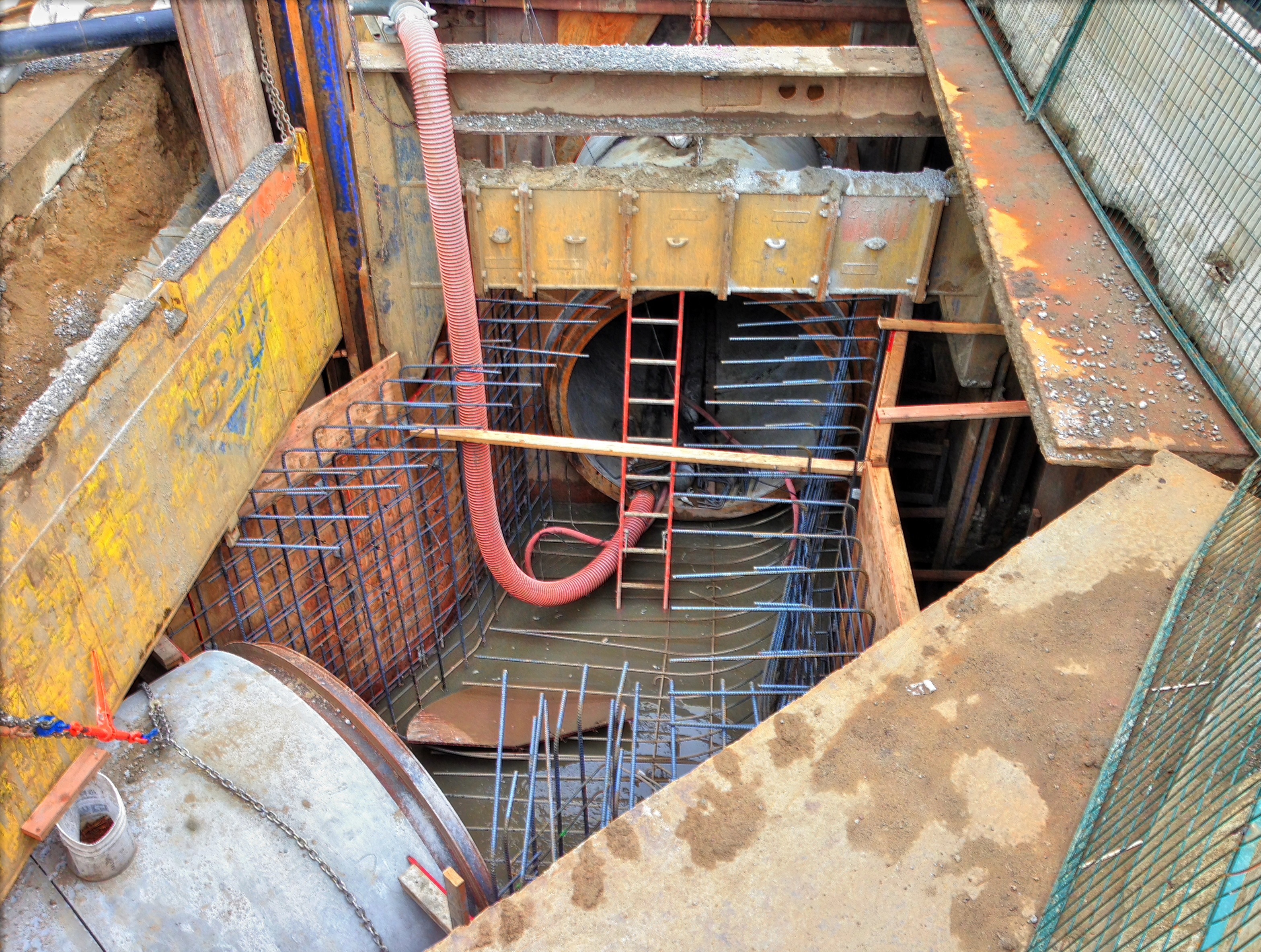
Fortunately we were able to utilize old spur lines of the Alameda-Weehawken Burrito Tunnel which brought capital costs to reasonable levels.
La Lengua shall always be safe from the Bernalian Hegemony.
Ring the Moon
Please thank ice crystals in high clouds for the lovely ring around the moon last night.

The iPhone did a surprisingly good job capturing the ring, but it was too wide to capture in one shot. Luckily I fished out my fish-eye lens (and applied some judicious filtering to cut down the grain).
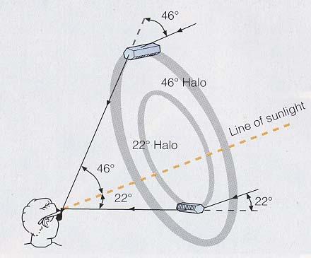
@rrmutt pointed to nice diagram explaining how the whole ring thing works (please substitute moon for sun):
Not bad, but we can do better — despite the temperature dropping to the MID FORTIES, I ventured outside long enough to try some longer exposures with my trusty old Lumix. 15 seconds did the trick:

That’s Jupiter on the right of the full icebow. (The dot immediately to the right of the moon is just lens flair since I didn’t line up the shot perfectly.)
And as @rrmutt noted, you can see the refraction!
http://twitter.com/rrmutt/status/284735855384481792
Zoom and enhance:

And thus concludes today’s lesson in atmospheric optics.
Rainbow attacks Mission, Bernal narrowly escapes
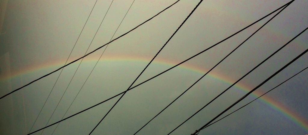
Angry rain gods hurled storms at San Francisco today, striking the Mission with Class IV EM refractory pulses (rainbow-class). La Lengua was hit with a secondary visible-spectrum assault.

(Thanks to our Twin Peaks agent Arianne for transmitting this image down from the highlands.)
The Burrito Railgun is unfortunately ineffective on refractory EM pulses above Class III, but La Lengua’s secondary defense grid was able to absorb the pulse (and get a substantial PG&E grid tie-in credit).
It is curious that Bernal avoided any damage. Zoom and enhance:

Some think this is not coincidence.
https://twitter.com/pmonks/status/282643028789837824
UPDATE:
I sure hope this guy has rainbow insurance:

Sutro Never Sleeps
Via @nelson and Tom N, a GIF of workers atop Sutro at night.

(There’s a Corey Hart joke in there somewhere (though it’s quite likely I’ve already crafted a Sutro-Corey Hart joke here in the past.))
Anyway, there’s lots of work to do to get Sutro’s shields up to spec with the big storm rolling in. (via @sky1ron)

The Streets of Submerged San Francisco
Dec 18, 2072 (AP), Northern California Association of City States:
In the keynote speech of the 2072 AGU meeting at the New Moscone Convention Center on Nob Island, NASA and NCCS (Northern California Coast Survey) scientists have declared the stabilization of sea levels at 61 meters (200 ft) above 2012 sea level datum. Meltwater Pulse 1d followed the unexpected collapse of the Greenland and West Antarctic ice sheets, surpassing even the 20 meter, 200 year sea level rise during Meltwater Pulse 1a-1c 12,000 years ago that originally created old San Francisco Bay.
Bowing to public demand, SFMTA and SFDPW have finally approved the release of the San Francisco archipelago street maps showing both current and former streets created by centenarians Burrito Justice and Brian Stokle.
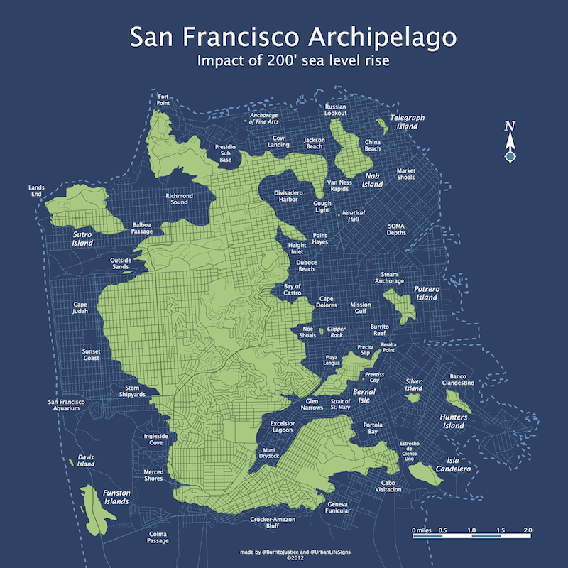
Detail:

(Note that the 200 ft topological maps are also available.)

Note: AP has opened its paywall for SF Archipelago articles from March 2072 and June 2072.
New transit and ferry lines have yet been finalized by the SFMTA and will be released in the holographic map in early 2073. Bridge placement is now open to discussion given the stabilized waterfront. (Also note that this map will be used to assess property taxes based depth of the property. All lots will continue to be taxed unless owners have taken advantage of the 220 sq foot sea dome tax credit. High tidal current regions in the Van Ness rapids and the Straight of St. Mary are exempt.)
The SFPUC has declared that all land reclamation efforts will have to be vetted in light of the unfortunate 2038 decision to raze the San Bruno mountains down to 150 feet for the relocation of the Google and Apple campuses. (On the other hand, the SF Port Commission has finally declared the Colma Passage to be navigable).
The SF Archipelago Board of Supervisors would specifically like to thank the SHSFPA (Submerged Historic San Francisco Preservation Association) for retrieving irreplaceable GIS data from the old City Hall data center as well as Stamen‘s former offices on 16th & Mission. Migurskibot 2.3 and Shawnbot 1.7 stated, “We thought those records were lost forever in 2032 when the Hurricane Ed breached the SoMa sea wall and the Mission permanently flooded.” These records will now be permanently stored off-world in the SFA’s lunar data center.
The SHSFPA also retrieved several invaluable al pastor and carnitas recipes from sunken taquerias. “The terrible reign of Chipotle Bell has ended — San Francisco has finally recaptured its burrito legacy.” The SF Department of Health will immediately approve any food boat applications using pre-flood menus. (Upon hearing this news, Burrito Justice and Brian Mount shook their fists in the air and immediately pushed their walkers to the dock to taste the first legitimate carnitas in 40 years.)
The updated SF archipelago street map is available in time for Christmas, shipping via Zazzle. It is available in the following two-dimensional poster form factors:
(Note: old-style US measurements, pre-inflationary dollars. Triple-blink for access to the 3D printer .obj file.)
Important Christmas shipping information: for former U.S. city-states with stabilized NewDollar economies, the poster can still be ordered as a present:
- Standard Boat delivery is available through midnight of Tuesday the 18th
- Premium Drone delivery is available through the midnight of Wednesday the 19th
- Express Railgun delivery can be chose up until 3PM on Thursday the 20th.
(Other regions and countries will vary depending on sea-level rise infrastructure recovery efforts and governmental stability.)
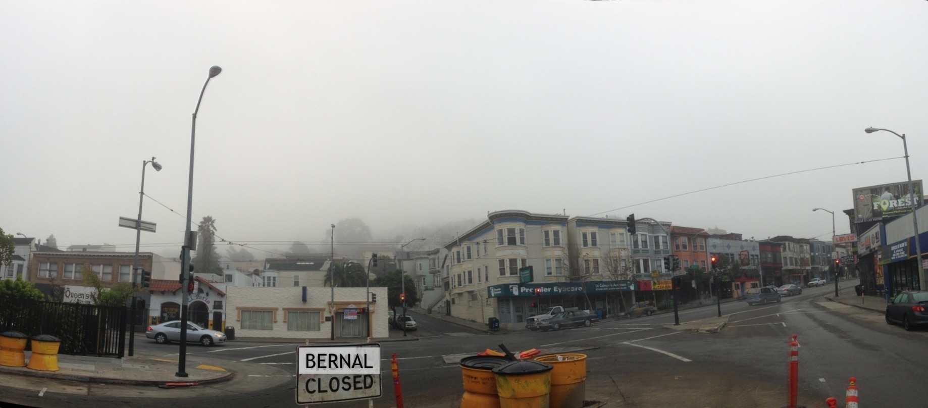
Bernal Closed
I know it was foggy this morning, but I think SFDPW is taking things a bit too far here.
Diablo Sutro Sunset


A Brief GIF History of Army Street (and Clooney’s)
By this point anyone who reads this blog has seen the excellent detective work by Bernalwood and Associates on the mystery of the oddly angled apartment on Cesar Chavez:

The esteemed Jonathan Lammers, architechælogist, used the 1938 Aerial Survey of SF to make a giant conceptual leap. The building was moved from across the freakin’ street as so lovingly diagrammed by Bernalwood:

I mean, let’s just stop and look at that diagram for a minute. That is a thing of absolute beauty. And I shall ruin it via GIF! (click to animate). It’s shocking how far back they moved the northern side of Army (click for a slightly wider version).

Given our angular building was only built in 1927 and they widened Army in the 1940s, it makes a lot more sense that it was moved. The two buildings towards the point of the triangle (3390-3398 Army) were considerably older at the time, never mind much smaller, so I suspect they were not considered worth the effort.
As for the old address of the pre-rotated and translated 3365 Cesar Chavez, I believe it is 3370 Army. I have references to 3380 Army being torn down in the 1940s, and a significant number of people are listed as living in 3370 Army in the Polk Crocker-Langely city directories of the 1930s.
You can see 3398 Army (the one on the right, with the nice round cupola and double doors) in the SFPL archive (looking north on Mission, across Army St.)

Side note: that Redlick-Newman sign is by the same guys who did the 17 Reasons sign!
While I couldn’t find any specific dates or pictures of the widening of Army around Mission, I did find another picture of work on Army on what I think is between Guerrero and Valencia, dated 1949 (via eBay…) Pretty sure this is taken near Guerrero and Army, looking east towards Valencia.

I think you see the top of the Sears Building by the trees.)
It’s pretty much the opposite view of this one (via this older post):

and this one from 1946 via SFPL — you can see the white buildings in the top shot:

I was looking for other highly acute buildings in the Mission to see if our other friends along Army were moved elsewhere, as was Bernalwood reader Joseph:
Could it be that the trapezoidal building on the corner is now clooney’s pub on valencia? i’m not a scientician but it looks like it to me.
…
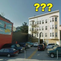
OK I’m totally wrong that building is still there and it’s the palace steak house. do smarter people than me know what the deal it with the clooney’s building??

I’d always assumed the angu-tacular Clooney’s was associated with the old Southern Pacific Railway that used to pass through the neighborhood.But upon further research, this is utterly incorrect!
The old SPRR station was on the west side of Valencia — behold another explanatory GIF:

Here’s an overlay of the 1915 Sanborn map that shows the station:

It turns out the turn of the century (19th, that is) predecessor to Clooney’s was a place called O’Reilly’s. You can just barely see the building here in this 1906 photo (via Calisphere) of earthquake survivors gathering around the Valencia St train station, on the right.

If you zoom and enhance, you can actually see what we think is O’Reilly’s sign starting with O’RE… (hat tip to Bernalwood reader WJE).
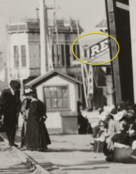
This is a very different building that today’s Clooney’s — and there’s a possibility that the angular building was dumped ON TOP of O’Reillys.
It turns out that Urbane Libertines and Atrocious Saints is working up a detailed history of Clooney’s, and published the first part just a month ago! Lots of legwork resulting in some epic finds. Lots on the O’Reillys, and their patrons too!
In 1906, shit got real. Not only was San Francisco in the grips of post-earthquake trauma (O’Reilly got his liquor license restored in June), but the railroad depot for the Southen Pacific railroad line was located right across the street from O’Reilly’s saloon, bringing a variety of people down Valencia on the streetcar and from the SP depot at Townsend and 4th. The line cut diagonal across the intersection (coming from what’s now the Synergy School and through the ugly (sorry!) building housing the chiropractic clinic (an oasis amidst the ugly angles) and the Siron Norris gallery (also an oasis, dude).
One night in 1906, a patron was drinking at O’Reilly’s, waiting for his train to head home to Redwood City. Reports go that he had gotten paid for a job on Howard Street earlier that afternoon and had made his way from saloon to saloon, eventually perching himself on the (I’m only imagining) fine-grain walnut stool to drink some spirits with ol’ Jeremiah. Around 2 in the morning (guess he missed his train?), two patrons lured the carpenter outside under the pretense of getting him a hotel, and then on Bartlett street, savagely attacked him, lacerating his face and breaking his shoulder. He limped to nearby Bethany church and got help there. Sounds kind of like Clooney’s right now, minus the train to Redwood City.
It is an epic read, and apparently there is a part two on the way (which covers how the apartments got on top in 1934…)
But more importantly, in 1904, the SF Call tells us that O’Reilly had the misfortune to got robbed by the “worst burglars that have infested the Mission district” — which happened to be two 12 year olds.)

And we will conclude on an inflationary note — in 1904, you could buy two revolvers and ammunition for about $6.80, equivalent to $167 dollars today. Also, “Rimmer & Railton” (hey, free band name) were able to buy revolvers in San Mateo. As 12 year olds.
Findery trackbacks:
https://findery.com/burritojustice/notes/move-an-apartment-building-across-the-street
https://findery.com/burritojustice/notes/a-train-station-and-a-bar
1906 Post Fire and Earthquake Panorama
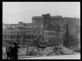
Thanks to the bountiful twitter and web feed of Philip Bump, I came across a 5 minute film showing the aftermath of the San Francisco earthquake and fire from the Internet Archive. This may have been filmed by Thomas Edison himself. Since WordPress hates iFrame I can’t embed the video, but here’s a GIF and yet another link.

There’s a tremendous 240 degree pan taken on 4th near Natoma, right where Moscone Center is now. It turns out there is a much clearer version of this pan over at the Library of Congress.
 |
 |
 |
 |
Someone at the Library of Congress saved me a tremendous about of time and described the buildings and ruins seen in the pan. However, I got annoyed at scrubbing back and forth in the video, so I just extract screenshots from it and built a panorama, and added the descripions to it. 8000 pixels, so click to zoom.
![]()
More later — I actually have work to do today so I don’t have time to integrate this with the buildings you can see in the Sanborn maps from 1905, but you can take a look over at maptcha.org to get your bearings.

Here’s a quick and dirty amalgamation of the 1905 Sanborns from 5th to 3rd between Howard and Market — you can see many of the buildings mentions in the pan. Achtung, crazy big, 80MB.

https://findery.com/burritojustice/notes/may-1906-someone-from-thomas-edisons-group
More later!