Wide Baseball
Took Taquita Justice to the baseball game. She’s now in love with Lou Seal.
She has also realized that by yelling “Go Giants Go” she can get lots of people around her to do the same. (She does throw in an occasional “Go Canucks Go” for good measure.)
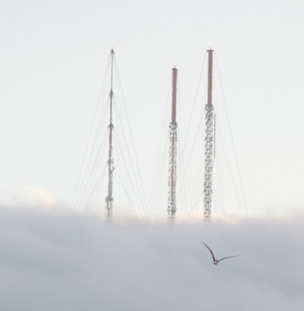
Anyway, some fun with the new iPhoto zoom lens and panorama software (AutoStitch). Click images to zoom in for 10,000 pixels of sunny baseball — managed to capture some remarkable detail.
Interesting fringing – the lens is pretty good, but a little chromatic aberration brought on by way the iPhone camera scans and my wobbly hands. Also some unintentionally creative ghosting of the pitcher, batter and shortshop (just think of it as a field of dreams kind of thing).
Here’s the uncropped original, btw — proof that I can’t hold an iPhone steady with a zoom lens while also wrangling a 2.83 year old.

Anyway, thank god for those slides under the giant coke bottle. Looks like we’ll be sitting in the bleachers for a couple of years.
There was a respectable Sutro painted on the side of the kids mini-baseball diamond:

And not one but TWO seagulls photobombed my efforts at taking foggy real-Sutro shots from the parking lot:


Dusky Bernal
iPhone + iMotion HD + 8x zoom lens on the summer solstice.
Wide, Wide, Bernal and Capp
Longtime readers know that map scanologist Eric Fisher is a wonderful source of early 20th century constructo/destructo-porn. While many plans did not happen (a skytrain down Valencia St, for example, or an elevated Capp St Railway, or the Mission Freeway, or a Mission corridor from 16th to 24th the likes of Embarcadero Center), some did.
Here we have a map revealing 1924’s “contemplated projects” – Mission detail shown below, click the map to see the entire city.

Unlike the blight-driven plans of neighborhood-splitting projects like the Mission Freeway, it seems many of these came to pass. (Oh, people from the 1920s, your city planning is so quaint compared to the dreams of your children.) Two things stand out on this map:
1) Capp St extension — it was to be a backup artery to Mission St. While it never hooked up to Van Ness, it did get slightly widened.
Here’s a 1939 shot of Capp and 25th from our friends at the SFPL.

and today via MapJack:

Other than the tree and the curb very little has changed.
Here’s 23rd and Capp under construction in 1940:

And today:

Alas this widening did not stop folks from moving down to the Peninsula.
2) The widening of the Bernal Cut certainly happened.
A very narrow Bernal Cut was originally dug out for the San Francisco San Jose Railway in the 1850s. Here is the Southern Pacific train in the cut, “looking north near Milton St”. Think of this while you take the San Jose exit off 280.

And “looking south near Charles St.”

(You really ought to buy the Arcadia Press Bernal Heights book — our friends at the Bernal History Project did some fine work on that one – lots of incredible pictures, especially one of the Cut that is simply amazing.)
Anyway, Charles and Milton are way the hell apart but it sure looks like the same house and tree up on the top of the cut. Could it have been the house at Mateo and Arlington? 1899 map below.

The there is the mystery of Charles St. A Twitter conversation arose on what happened to the 0-100 block of Charles St got me curious. I originally thought they widened the cut mostly to the east. The eastern-most block of Charles St also got lost in the widening, but Eric Fischer let me know that they moved Arlington as well on the west side of the cut.
Anyway, here is our vanished bridge across the cut at Charles street:
and a water main that crossed at Fairmount over to Appleton (I imagine from the Holly Park reservoir?)
(This was the weird looking one you can see in all the construction photos.)
Out of sheer amusement for making map 1000 pixels long, here are a bunch of the 1899/1900 Sanborn maps I glued together showing the cut. (The 1886 maps don’t show all of it.) You can see the two bridges quite easily.

As we all know from the San Jose exit off 280, the cut is rather larger now than the train pictures above.
Here’s a shot from Jan 1929 with the widening of the cut is well underway. This is at Bosworth (hint: you know you are in a depression when people are pushing mud around).

And later that year we see pretty much what we have today. The Richland (foreground) and Highland Street bridges, Oct 1929. (Taken at about the same place as the first train shot above).

Same view today:

I’m guessing they took out the two center supports and put those wonky braces up in the 50s when they shut down the Union Pacific rail line? (Muni didn’t run through Balboa until 1991.)
See more before/after San Jose time magick over at Bernalwood. And I just found this interesting before/after comparison video of the Cut on YouTube:
and the same person put up this rather remarkable then & now of a house in Glen Park. But I digress.
Here’s a shot from the Richland bridge in 1942 looking south towards St. Mary’s and Mateo @ Arlington. Interesting that the railroad tracks are on the inner edge of the curve, and San Jose on the outer part.

Notice the landslides on both sides of the road — that’s why we have those tall concrete walls today.
Bernal, Warhol. Warhol, Bernal.
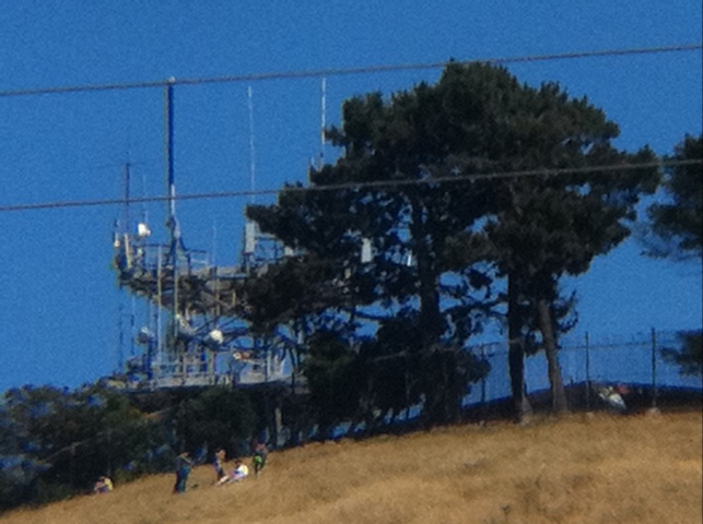
Bernal via La Lengua. Fun with plastic colored filters:
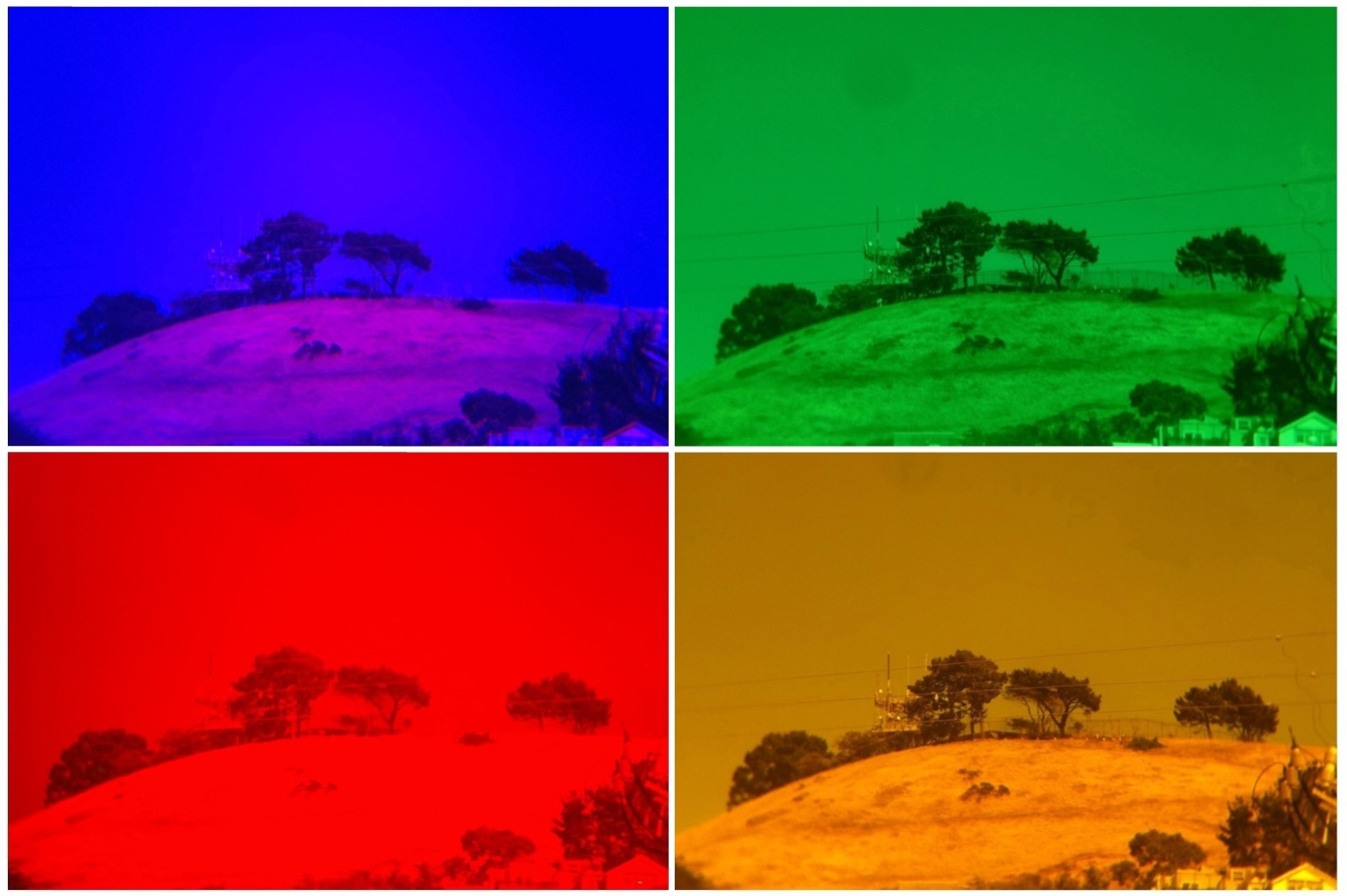
And I am rather impressed with my new iPhone zoom lens:
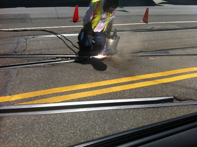
Welding the J-Church
I liked the lighting on this one.
Sutrifecta
Doctor Gage (via the esteemed SF Kid) brings us this epic shot of our fog-wrapped friend:
Using my advanced Sutrolocation powers, I’m guessing this was taken around 22nd-24th St? And maybe as far west as Valencia?
Orange! Yellow! Red!
Quite happy how this came out — blind shot, no enhancement:

Though it does kind of remind me of the early 1980s, specifically the epically awesome CBC exploding pizza logo
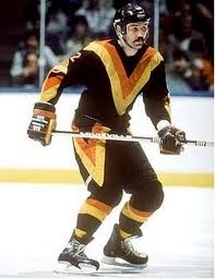
or the classically tragic Canucks flying V uniform:
Sutro Fog Wave
Yesterday, from 21st & SVN:

Mission In Space
Here we see a lovely view of clouds over the Pacific as seen from from the International Space Station:

Waaait a second — that’s no solar panel truss, it’s a fire escape!
Ahhh, it looks like I lost perspective. It’s actually a picture of yesterday’s sky over the Mission taken by @eviloars.
In other space perspective news, astronauts (and presumably cosmonauts) are building a Lego space station aboard the real space station.
And some real (and rather spectacular) pictures from the ISS.
Also, Telstar Logistics notes Sunday’s hypnotic video of Endeavour departing the ISS for the last time, with some spectacular shots over Oceana.
HSR, You Are My Density
Quick, what’s this?

I was going to be an ass and make you wait until tomorrow, but I’m in a good mood. If you guessed the relative lengths of high speed rail lines, you’d be correct. As for which is which, behold population density maps, to scale, of four parts of the world:
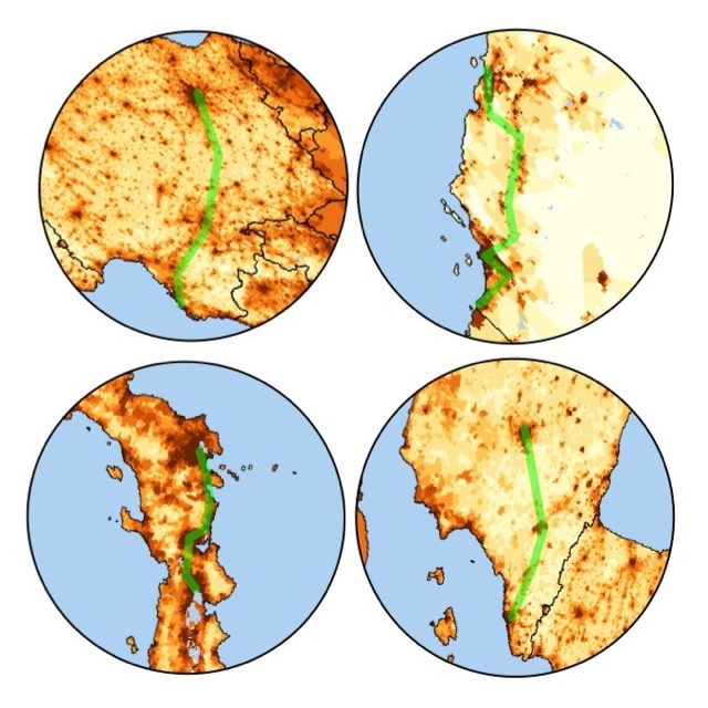
(Population density maps via the very nice Gridded Population of the World browser by SEDAC/Columbia University.)
I rotated them to align the routes, so you’re may to have to think about it a bit, but
Top left = France Sud-Est (Paris-Lyon-Marseille) / Top right = CAHSR (SF-LA-SD)
Bottom left = Tōkaidō Shinkansen (Tokyo-Osaka) / Bottom right = Ave (Madrid-Barcelona)
I decided to make this map after the rather ridiculous article in The Economist suggesting that only Japan has the population density to do HSR. My favorite part is where they laud California’s road network — they clearly haven’t driven on I-5 on a Sunday. And despite car ownership, I don’t know anyone who WANTS to drive to LA. (But let’s just say this isn’t the first stupid thing they’ve said — let’s remember that The Economist supported the invasion of Iraq.)
Anyway, Japan is so densely populated that it was obviously the best place to start with high speed rail. But it’s foolish to say it’s the only place that makes sense to keep doing it.
I also saw an interesting discussion in the comments a Washington DC blog that linked to me — one commenter claimed that since Paris has seven times the population density of LA, it can’t support HSR. But the French TGV is really a hub and spoke model. That being said, Lyon-Paris used to be one of the busiest flight corridors in Europe, but TGV pretty much took all that traffic. In fact, you can actually buy tickets on Orbitz that combine trains to Paris and flights out of Paris!
Once again, the best analogy to California is AVE in Spain between Madrid and Barcelona — two nodes of relatively the same size, with a few cities in between. Once again, it was one of the busiest flight corridors, but rail has picked up the majority of passengers. Not only to the Bay and LA have higher population bases than Madrid and Barcelona, but guess what’s another of the busiest flight corridors in the world? SF-LA.
While I’m at it, a few additions to California HSR are obviously necessary:
- Good food, both wine & cheese, along with the taco & beer. I’m thinking also a Fort Mason style Off The Grid car, no?
- No TSA bullshit. Despite legitimate terrorist threats, France and Spain have no security theater on trains. (I’m talking to you, Charles Schumer.)
- Why not have a couple of train cars that could carry electric cars? Roll your authorized Nissan Leaf / Chevy Volt style vehicle onto the train in SF and roll off in LA. And charge your car on the drive, no less.
I will meet you in the taco car, Big Daddy in hand.