280 Sunset, Sutro Dusk

Important Electoral News: Vote La Lengua!
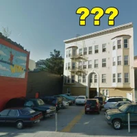
The LaLeVoElCo (La Lengua Voting and Electoral Commission) has learned that CurbedSF has gloriously included La Lengua in the Curbed Cup, the yearly neighborhood-off.
Our competition in the first round is the evilly compressed NoPa, aka Pandhandle. Do take the time to vote for our beloved wedge-shaped neighborhood.
UPDATE: Your efforts were successful! We narrowly defeated the NoPanditos, 51.4% to 48.6%! Russian Hill is next. If we get past them, and if Potrero succumbs to Bernal in the War of the Hill People, a battle royale will ensue in the lowlands.

As a refresher, please review these basic La Lenguan materials:
Curbed’s People’s Guide to La Lengua:

CBS 5 coverage of La Lengua:

(No, that’s not me in the hat.)
La Lengua as seen from Google Maps if not from space:

Just say No to NoPa! VIVA LA LENGUA LIBRE ¡VOTAR! ¡VOTAR! ¡VOTAR!
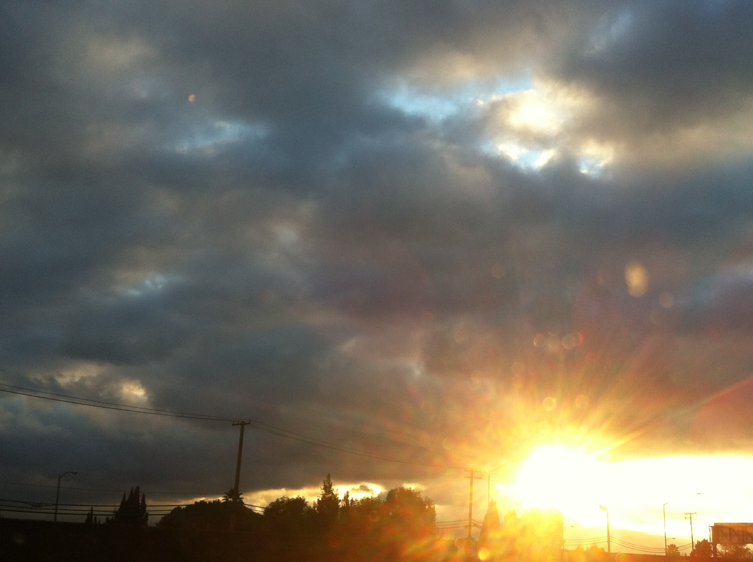
Eclipsing Sutro
I got up ridiculously early on a cold Saturday morning — 5:15 AM and 42ºF to be precise — and climbed Bernal. Why? To see the eclipse. The erstwhile @datapointed used SCIENCE AND MATH to determine that the masked moon would pass immediately behind Sutro as seen from Bernal. (Damn you science! Do you not realize how little coffee is available at 5:15AM?)
Anyway, here are a couple of quick shots before I start writing too much.


People watching the eclipse atop Bernal:

I was hoping to get a timelapse of the eclipsed moon settling behind Sutro but that was not meant to be — the software was willing but the hardware was weak. Here are a couple of my efforts, but @jobius did a much better job (from the comfort of his house, no less. Smart man.)
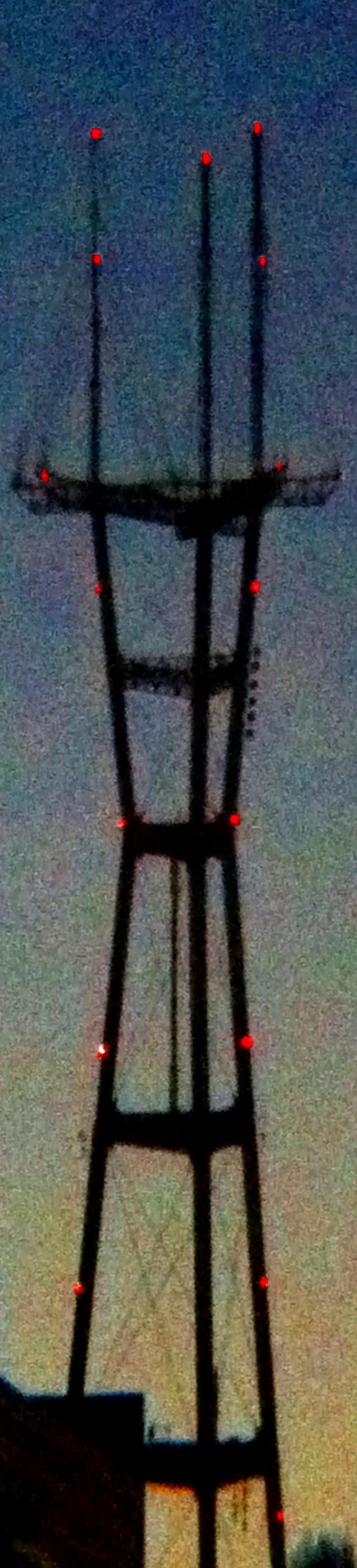
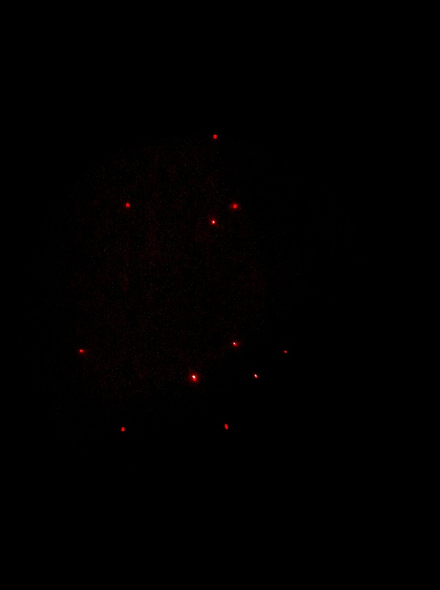
Thankfully I got some decent shots of the moon passing behind Sutro using 15 second exposures on my Lumix. Here’s a still:

The sun was starting to rise at this point, and the moon was battling not only more atmosphere, but a foggy haze and grew increasingly hard to see.
Here are 9 images turned into a movie (sorry for the crappy alignment but video editing software is my nemesis):
Here’s the Tumblr link in case Vimeo barfs, and of course an animated GIF:

Note that ancient peoples would find the bit depth extremely impressive.
And in a final bit of meta-photography, here is video of the eclipse from ABC 7’s camera FROM ATOP SUTRO TOWER.
That is all.
Sutroscope
I wear my Sutroglasses at night.
Spaceclaw for mayor!

Stamen has the best posters and stickers:

Lost Landscapes
Lost Landscapes of SF was awesome. Hooray, Prelingers! Go see it again on January 24.
Huge line, even at 6:30. Get there early or your view will look like this.

Luckily I brought my iPhone zoom lens and was able to bring you blurry photos from a distance. (Do note the quality of the footage was spectacular, much better than these crappy photos suggest.)
Lots of shots of SF during WWII.

Excellent quality outtake reels of driving around SF (basically what you would see behind two people talking in a car scene).

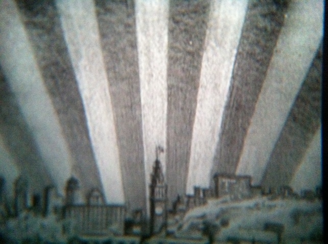
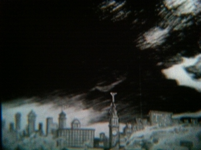
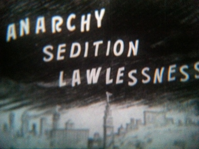
This film was a rather dramatic cry against anarchy:


Unsutrofied Twin Peaks:

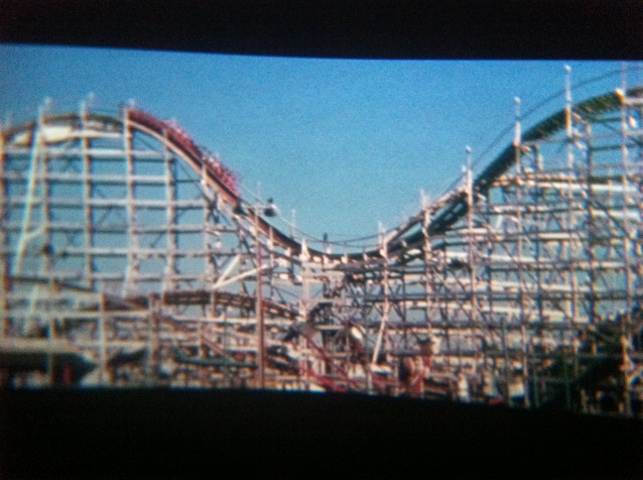
Also some nice shots of Playland:

The running commentary was awesome, both from these guys and the peanut gallery.

Anyway, highly recommended, cannot believe I haven’t done it until now! Another showing on January 24th, follow @footage for details. Previous editions of Lost Landscapes are available online, and I believe this one will be up soon.
PastMapper — bringing you yesterday, today!
PastMapper is undeniably awesome:

It’s things like this that make me ridiculously happy to live in this town.
Blue Sky, Red Bridge

Such a clear day.
SF and Sutro from the Dish Redux
So here’s a much better panorama from the Dish above Stanford taken with a real camera, stitched together with Hugin (a powerful but incredibly opaque application, yikes).
It’s a giant one, 32K pixels wide, that goes about 90 degrees from Sutro to 92. (Click to zoom, unless you happen to have a 32K wide monitor…)
![]()
Downtown SF (and a United widebody):

And of course, Sutro:

Below Sutro are the buildings by Oyster Point on 101.
SSF, “The Industrial City” (also known as “El Ciudad de La Tapatia“)

I was surprised to see the Golden Gate Bridge sneaking in beside the big hill by Candlestick / Bayview Park (does it have a name)?

That’s the north tower, and those are the streets of the south side of Bernal immediately below it. (The red part of Bernal merges into Candlestick hill. The north tower is blocked by Corona Heights, but I think you can just make out the tippy top of it.)
If this is making your brain hurt like mine, here’s the point of view from the GGB that may help:

And the view looking towards the GGB, over and between the hills (that’s Bernal just to the right of the yellow sightline).

And that’s this week in San Francisco at a distance.
Sutro from the Dish
10,000 pixel wide panorama from Sutro to downtown SF to TI, taken from the Dish, above Stanford. (iPhone + PhotoJojo lens, 7 shots, click to zoom):

Downtown:

Sutro’s pretty fuzzy (hey, from an iPhone, cut me some slack) but I took some better pictures from my Lumix which I’ll get up at some point. UPDATE: higher resolution 32,000 pixel-wide panorama here.

Airplane over Candlestick and Bernal!

UPDATE: higher resolution
Sutro Stripey Sunset Timelapse
Hey Patrick Gibson and Brad Ellis — this is REMARKABLE. SF sunset colors as a time stripe, Sutrofied.

Time running top/down, left/right, about an hours worth. Totally jealous and in awe, wish I’d though of it.

And the original shots in a time grid, a la NSKYC:

Nicely done, gentleman. I want to see the top one as a poster.