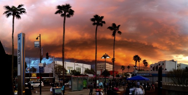
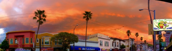
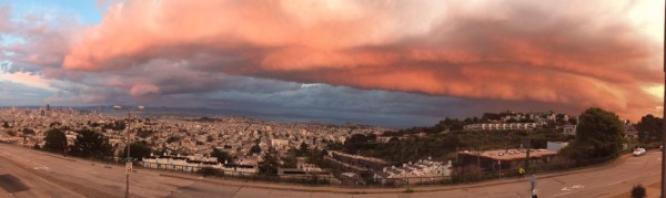
So Saturday the fire was in the sky. Some panoramas I made at 24th & Mission.
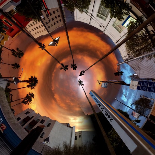
I liked how this rabbit hole picture turned out:
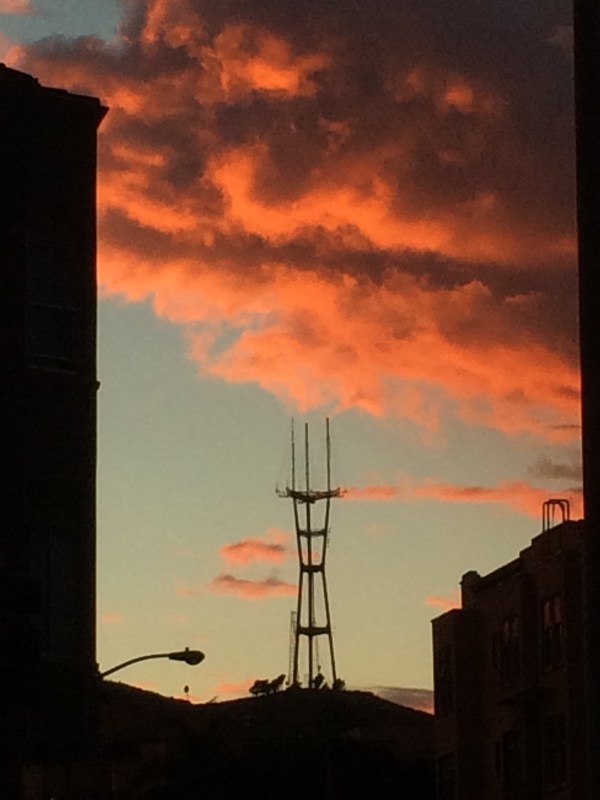
Hey Sutro:
A Burrito Justice agent atop Upper Market took this ominous looking shot:
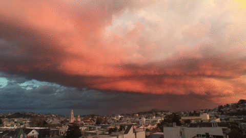
And of course the epic GIF of lightning by @mahlie via Mission Mission:
Here’s what the weather radar looked like as the storm passed through:

And of course the erstwhile Sutro Sunset Cam timelapse set up by the honorable @rrmutt:
(slow to load, as Flickr invariably is, but worth it)
The headline of this post is via @AndyKosinski.
UPDATE: Andy provides more details on the Cole experience:
The History of a Piece of Oakland
A year ago my now friend @brockwinstead wrote a fascinating series of blog posts digging into the people who used to own his house and the land on which it stands. He contacted BOOM: A Journal of California and it is now an article in the winter edition.
Brock had dug up lots of old and cool maps in his investigations. The awesome Jon Christensen at BOOM asked me if I’d be interested in making a digital mapping supplement to Brock’s article. Little did I know what I was getting into when I said “sure, that should be straightforward.”
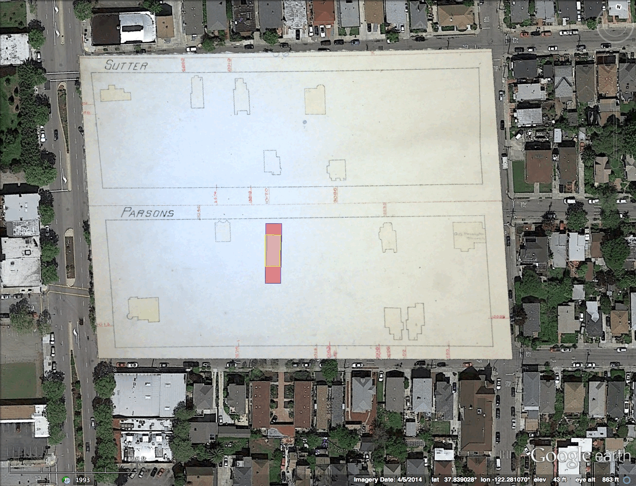
Much Javascript and CSS and GeoJSON later, behold the historical slippy map showing how a ridiculously large land grant got whittled down by regime change and sub-divided over time. Click on the years to travel through time and space, hover or click over red things for more information. While it is certainly viewable on mobile, it is even better on a desktop. (Click on the image because WordPress hates iframes.)
In the 1820s the Spanish government regularly granted good soldiers like Luis Peralta chunks of land larger than present-day San Francisco. In the 1850s, Americans forced them to sell most of it off. Seventy-five years after the grant, the Peraltas sold off their last piece of the grant.
Brock read his article and interviewed me on his BFF.fm show The Eastern Shore — we talked about the map and the people and what we learned making it (both historical and technical). Gracefully edited podcast version here:
http://tespodcast.com/e/the-eastern-shore-022-house-history-maps-and-burrito-justice/
What did I learn? While I would love to do this for more neighborhoods, it was a heavy, heavy lift. For those map and history nerds amongst you, the basic workflow was:
old maps —> NYPL Map Warper —(GeoTIFF)—> Google Earth —(KML)—> QGIS —(shp)—>

CartoDB —(GeoJSON)—> Leaflet —(JS/JQuery/CSS)—> dynamic slippy map
This is not a scalable workflow. I am pretty sure this needs to be an integrated product. I just need to figure out where I can work to make that happen.
NB: I have collected all the slippy maps onto http://maps.burritojustice.com for your viewing pleasure.
But before you think all the other websites get the good stuff, a Burrito Justice exclusive! Here’s a GIF of one of our first efforts to align actual Sanborn maps. (Click to zoom)
Song Frankongsko
Hong Kong, 1841

San Francisco, 1847

(Hong Kong 1841 via the Corinthian Column. SF 1847 via the Big Map Blog.)
Sutrocene
I have the best followers.
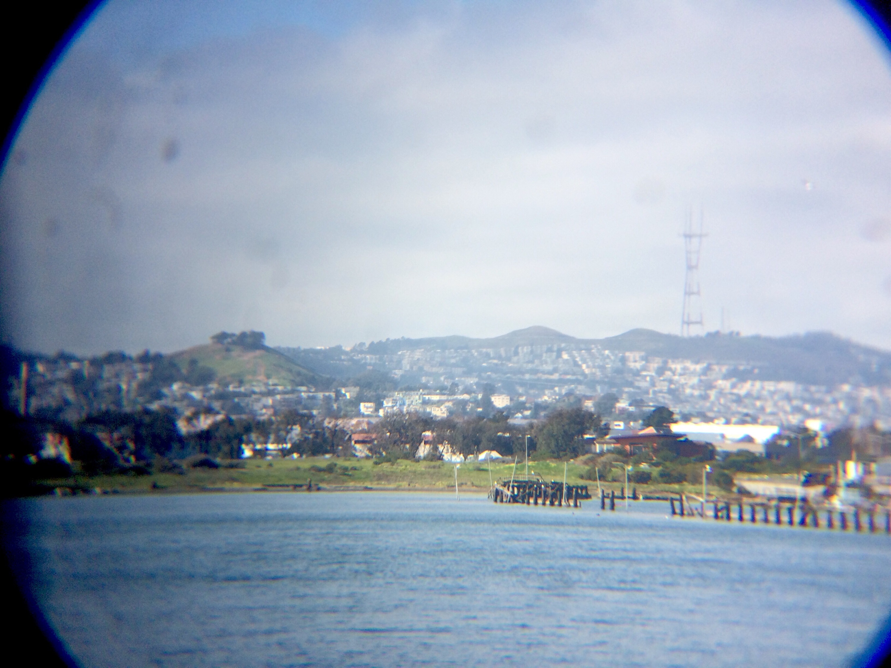
Heron’s Head Park
Such a nice spot. So much better than a Southern Crossing.
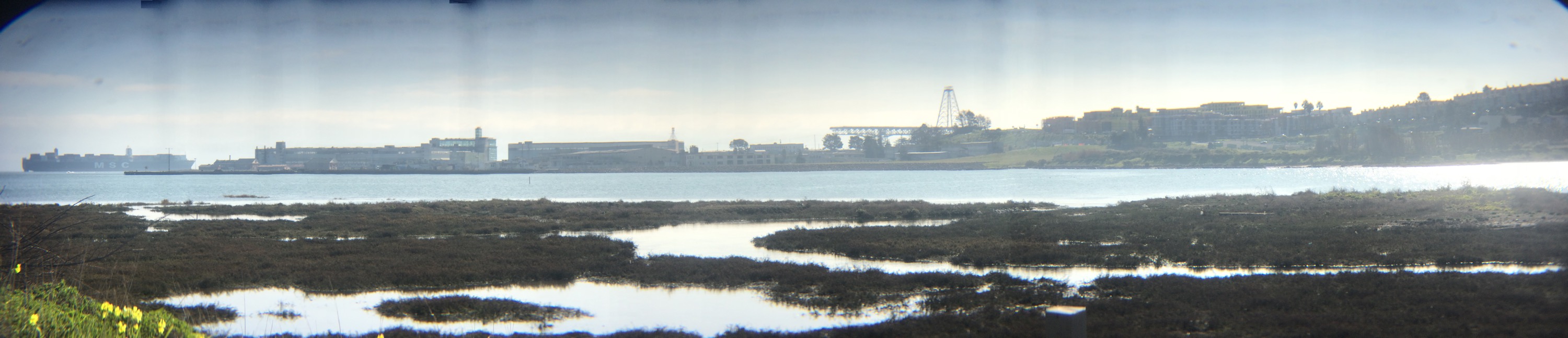
And what great view of the Burrito Railgun.
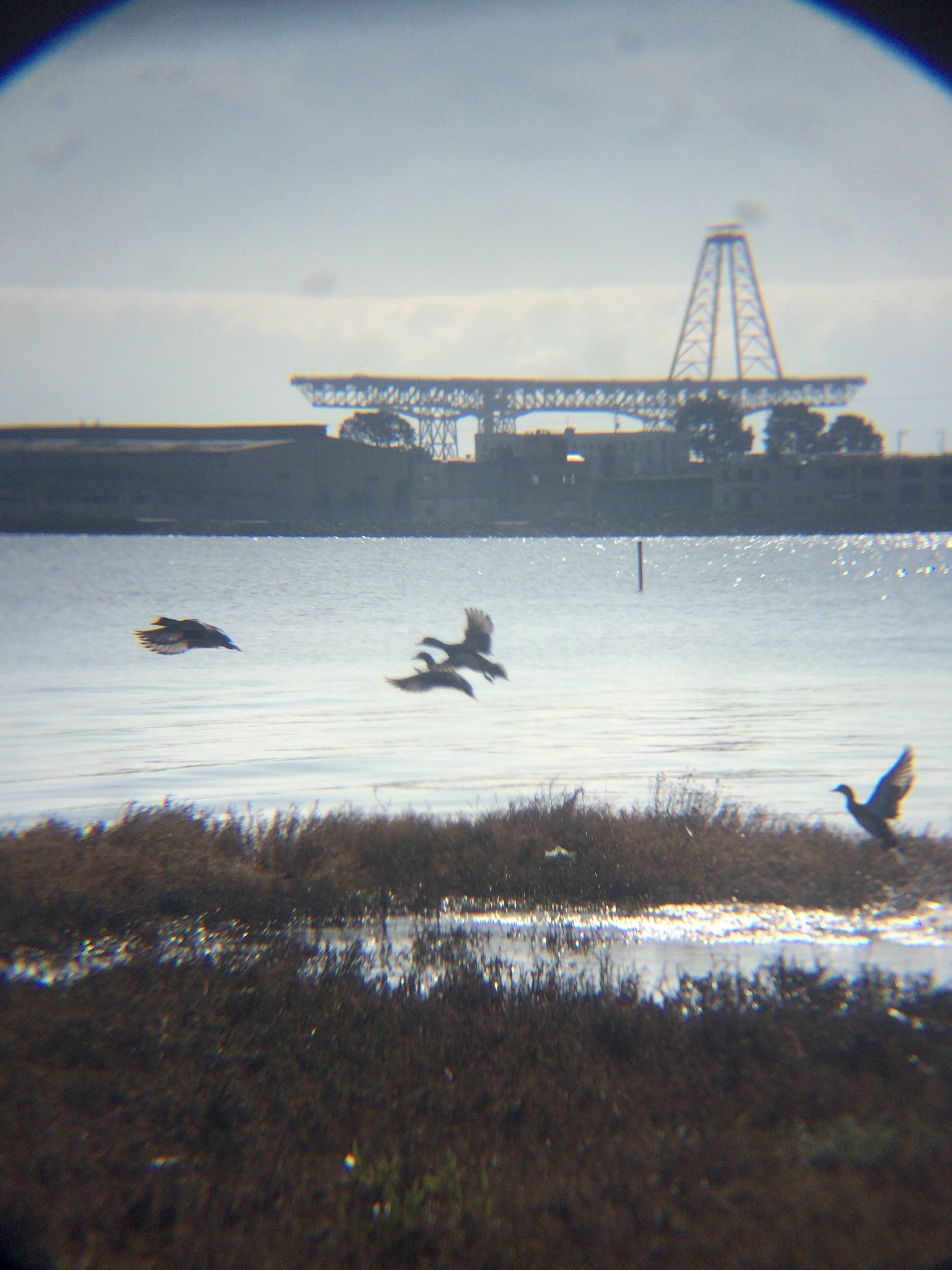
And Sutro and Bernal of course.
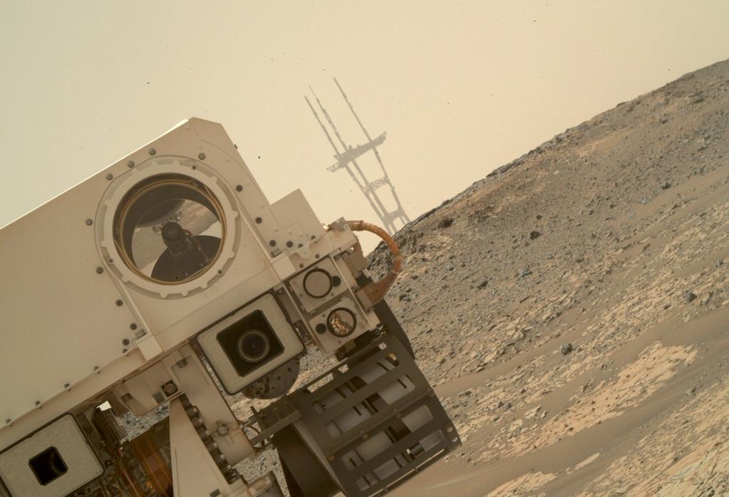
Mars*tro
Noticed something strange in the latest self-portrait by Curiosity.
Dinosaurs Winning the Internet
The esteemed Peter Hartlaub came across this ridiculously awesome nativity scene in his Oakland neighborhood.
The answer, of course, is this innocent shadow play tweeted last year:
All hail our dinosaur jesus overlords.
Not A Burrito, NYC Edition (part II)
Welcome back to America’s newest game show sensation, ¡¿IS. IT. A. BURRITO?!
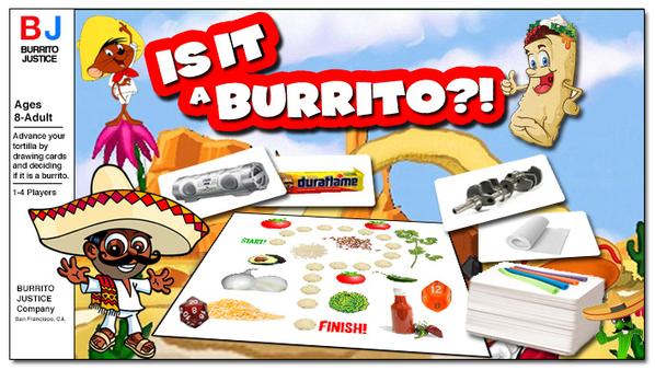
In tonight’s episode, we take the show on the road to NEW YORK CITY!
Our contestant is my friend @brittneyg, part of the SF Diaspora. She has two cats, a great boyfriend and just moved to the exciting borough of Queens. Brittney, are you ready to play?
https://twitter.com/brittneyg/status/537401417149857792
Alright Brittney, but let’s keep our expectations realistic! This is New York City after all, and we have seen some of their “burritos” during last season’s ¡¿IS. IT. A. BURRITO?!
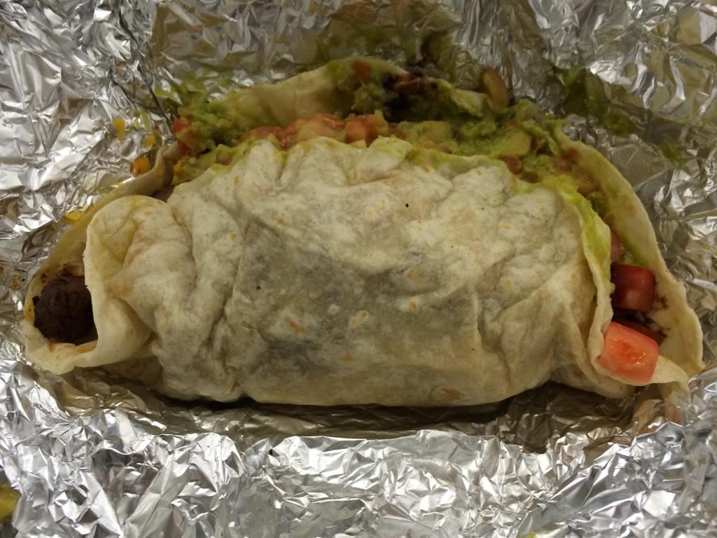
OK Brittney, you’ve chased down a taco truck in Queens. Please describe the “burrito” you have found.
https://twitter.com/brittneyg/status/537408470564503552
Oh dear, this is off to a bad start. But we here on ¡¿IS. IT. A. BURRITO?! don’t judge a book by its cover! (Or a burrito by its foil. Wait, actually we totally do judge that!) Anyway, please describe the structural integrity of the “burrito” in your possession.
https://twitter.com/brittneyg/status/537408833963192320
OH GOD NO. Brittney, there is still time to save yourself. Run! Run for your life!
https://twitter.com/brittneyg/status/537409139308494848
OH THE HUMANITY. Alright, let’s keep things together here. What about the tortilla chips, Brittney?
https://twitter.com/brittneyg/status/537410484509884416
Somehow this isn’t surprising. What about a picture, Brittney?
https://twitter.com/brittneyg/status/537412144711868416
Oh sweet jesus, Brittney, are there any witnesses to this debacle? Are you sure this isn’t a dream/nightmare?
https://twitter.com/brittneyg/status/537412548593983489
Great Scott, you’ve clearly succumbed to Stockholm syndrome and are overly sympathetic to your captors. Just put the “burrito” down, Brittney, and get to the nearest ABDF (Authorized Burrito Dispensing Facility). Here are instructions.
Well Brittney, thank you for playing ¡¿IS. IT. A. BURRITO?! Please let us know when your flight to SFO has taken off, because we have a special present for NYC!

That’s right! Thanks for playing, NYC! You win… a Burrito Railgun Delivery! We’ve disabled the humanitarian safeties, and within 9 minutes you will receive a fiery rain of al pastor, coming in hot at 29,000 mph! Expect a 20 mile blast radius of foil.
We had to destroy New York in order to save it.
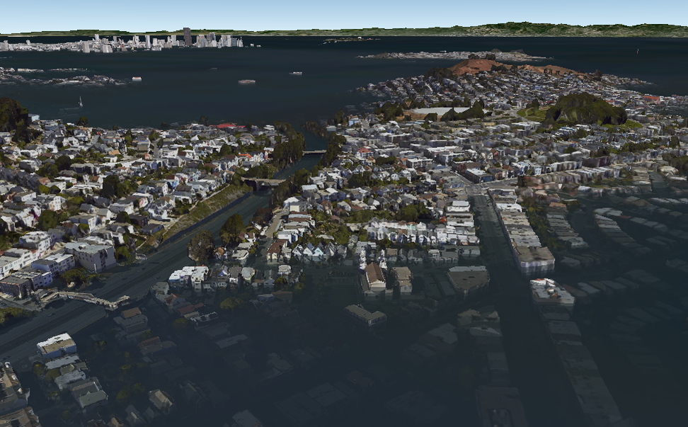
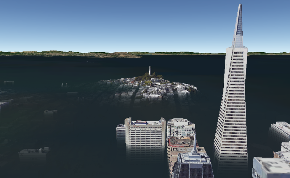
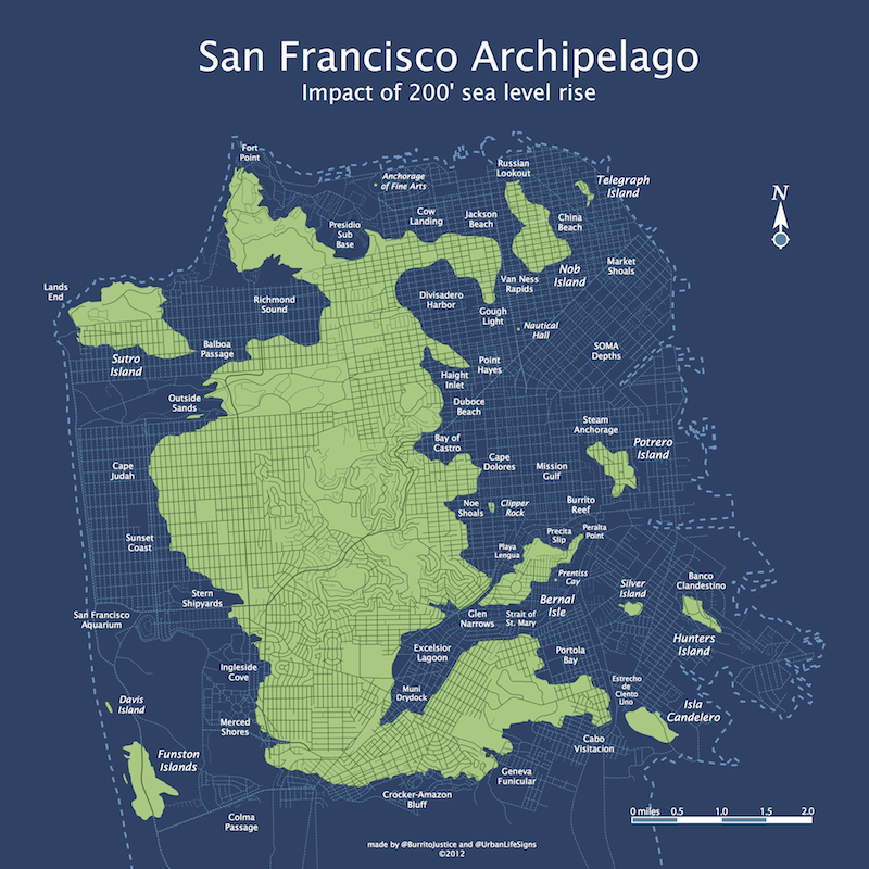
Here Comes The Flood
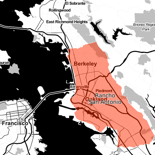
Reader @bncrain travelled forward in time to 2072 and took these shots of San Francisco adapting to 200 211 feet of sea level rise.
Glen Narrows is both a physical and emotional barrier to those on Bernal Isle as they overlook the taco boats of Mission Gulf. Noe Valley is a distant memory.
For the third time, Potrero Island rebels have destroyed the foundations of the bridge to Bernal. 134 year-old NorCal Gov Jerry Brown simply says “I’m in this for the long haul. Potrero Island is now officially under blockade — the NCSS Ed Lee will be joined by the second Sutro-class algae-fueled submarine, the NCSS Elbo Room.”
Coit Island overlooks the ruins of the Financial District and North Beach. Divers have recently retrieved menus from Tosca and have confirmed the integrity of the dome covering City Lights Bookstore.
Before traveling into the future, we here at the BJCPAME (Burrito Justice Center for Post-Apocalyptic Mapping Excellence) have maps available for purchase that will assist you in 2072 property assessment values.


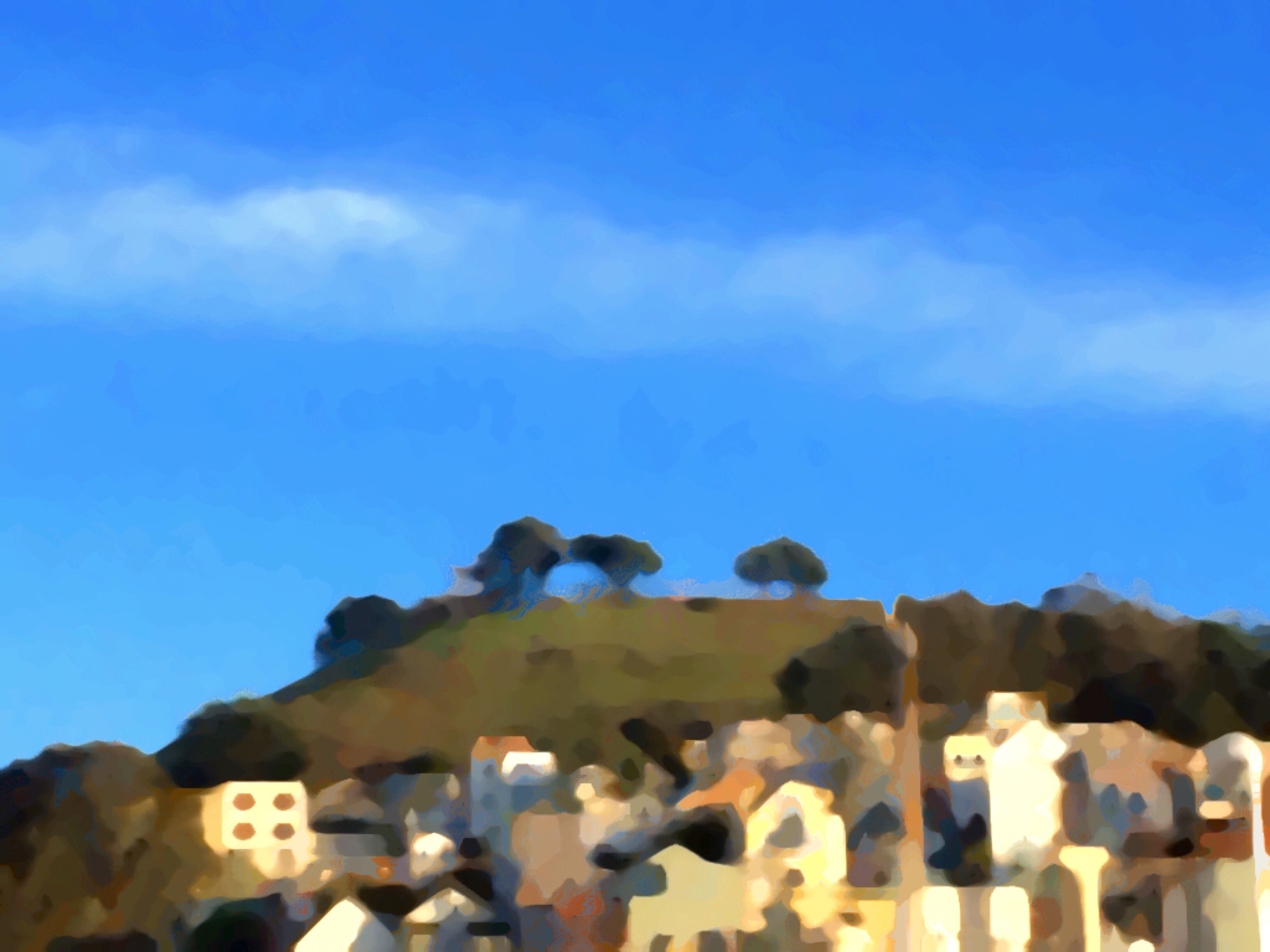
Green, Red and Blue
The Bernalian Hegemony looks so peaceful after a good rain.


