The History of a Piece of Oakland
A year ago my now friend @brockwinstead wrote a fascinating series of blog posts digging into the people who used to own his house and the land on which it stands. He contacted BOOM: A Journal of California and it is now an article in the winter edition.
Brock had dug up lots of old and cool maps in his investigations. The awesome Jon Christensen at BOOM asked me if I’d be interested in making a digital mapping supplement to Brock’s article. Little did I know what I was getting into when I said “sure, that should be straightforward.”
Much Javascript and CSS and GeoJSON later, behold the historical slippy map showing how a ridiculously large land grant got whittled down by regime change and sub-divided over time. Click on the years to travel through time and space, hover or click over red things for more information. While it is certainly viewable on mobile, it is even better on a desktop. (Click on the image because WordPress hates iframes.)
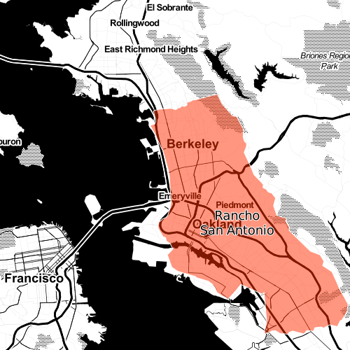
In the 1820s the Spanish government regularly granted good soldiers like Luis Peralta chunks of land larger than present-day San Francisco. In the 1850s, Americans forced them to sell most of it off. Seventy-five years after the grant, the Peraltas sold off their last piece of the grant.
Brock read his article and interviewed me on his BFF.fm show The Eastern Shore — we talked about the map and the people and what we learned making it (both historical and technical). Gracefully edited podcast version here:
http://tespodcast.com/e/the-eastern-shore-022-house-history-maps-and-burrito-justice/
What did I learn? While I would love to do this for more neighborhoods, it was a heavy, heavy lift. For those map and history nerds amongst you, the basic workflow was:
old maps —> NYPL Map Warper —(GeoTIFF)—> Google Earth —(KML)—> QGIS —(shp)—>

CartoDB —(GeoJSON)—> Leaflet —(JS/JQuery/CSS)—> dynamic slippy map
This is not a scalable workflow. I am pretty sure this needs to be an integrated product. I just need to figure out where I can work to make that happen.
NB: I have collected all the slippy maps onto http://maps.burritojustice.com for your viewing pleasure.
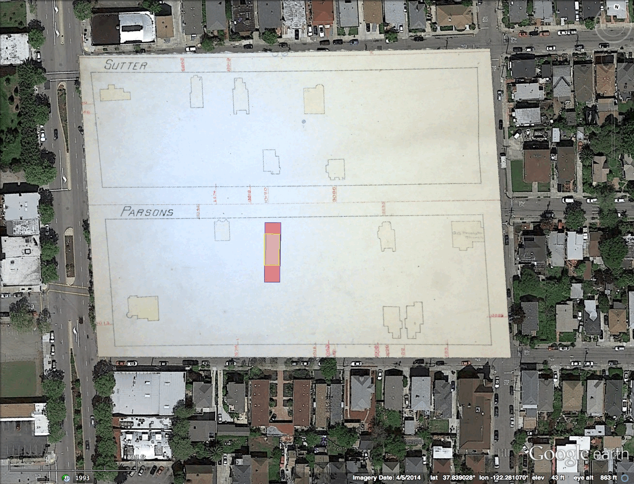
But before you think all the other websites get the good stuff, a Burrito Justice exclusive! Here’s a GIF of one of our first efforts to align actual Sanborn maps. (Click to zoom)


Hi….just FYI. We can open all the maps EXCEPT the burrito map. Tried at home on desktop, laptop, and ipad, as well as at work. Might there be a script error?
Thanks.
Sent from my iPad
>
Hmmm, not working for me now too. I must have broken something but didn’t see it because of browser cache.
Try this in the meantime.
http://a.tiles.mapbox.com/v3/burritojustice.burritoeater/page.html#12/37.7639/-122.4378
By any chance are you not in San Francisco? The link I put on the map page uses geolocation, and I only did tiles for SF, so if you are outside our fair borders there are no tiles to display…
“For many centuries, this place belonged to the Ohlone people—until the Spanish arrived and told them that it didn’t.”
What stopped the Anglos from returning the lands to the Ohlone people? The Spanish are frequently portrayed as the spawn of Satan, but other Europeans benefited and profited from what they did, while not making any amends whatsoever.
For many centuries, this place belonged to the Ohlone people – until the Spanish arrived and told them that it didn’t, but the subsequent wave of invaders didn’t restore the lands to the descendants of the Ohlone either.
The pages of that Hollywood/Cecil B. DeMille version of North American history has gotten dog-eared; time to fill in the missing truths.
Rumsey’s site has a nice new feature allowing you to geo-pin various old maps onto the modern topography. I recently pinned Bache’s 1859 Coast Guard map on David Rumsey’s site. You can see it here: http://rumsey.georeferencer.com/map/TN5kLkd5Rj6LhENRvU3rFT/201502042238-PvLmVP/visualize