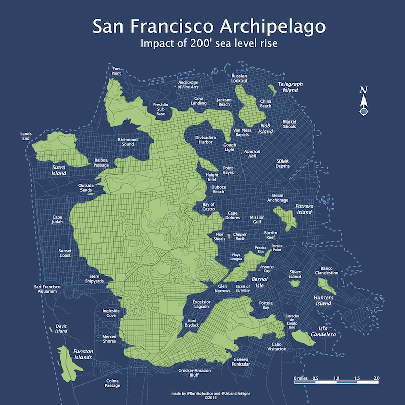
Here Comes The Flood
Reader @bncrain travelled forward in time to 2072 and took these shots of San Francisco adapting to 200 211 feet of sea level rise.
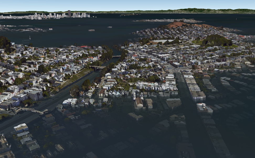
Glen Narrows is both a physical and emotional barrier to those on Bernal Isle as they overlook the taco boats of Mission Gulf. Noe Valley is a distant memory.
For the third time, Potrero Island rebels have destroyed the foundations of the bridge to Bernal. 134 year-old NorCal Gov Jerry Brown simply says “I’m in this for the long haul. Potrero Island is now officially under blockade — the NCSS Ed Lee will be joined by the second Sutro-class algae-fueled submarine, the NCSS Elbo Room.”
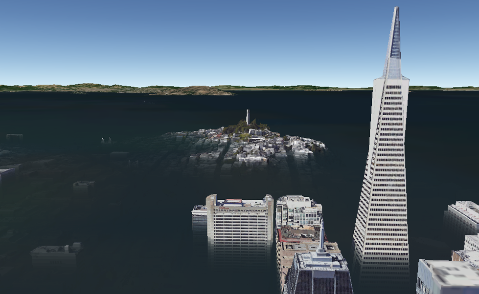
Coit Island overlooks the ruins of the Financial District and North Beach. Divers have recently retrieved menus from Tosca and have confirmed the integrity of the dome covering City Lights Bookstore.
Before traveling into the future, we here at the BJCPAME (Burrito Justice Center for Post-Apocalyptic Mapping Excellence) have maps available for purchase that will assist you in 2072 property assessment values.


Reblogged this on TayBan ICT.