Dirty Harry
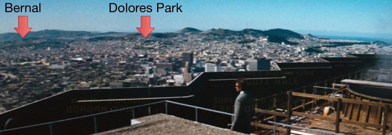
Harry the Dirty Dog Dirty Harry, the San Francisco classic, runs the intro credits with an epic 270° city-wide pan atop the newly constructed (at least in 1971) 555 California building, from the Presidio to North Beach.
Behold no Sutro Tower or Transamerica Pyramid! (What did bloggers write about then?)

Bernal and Dolores Park marked:
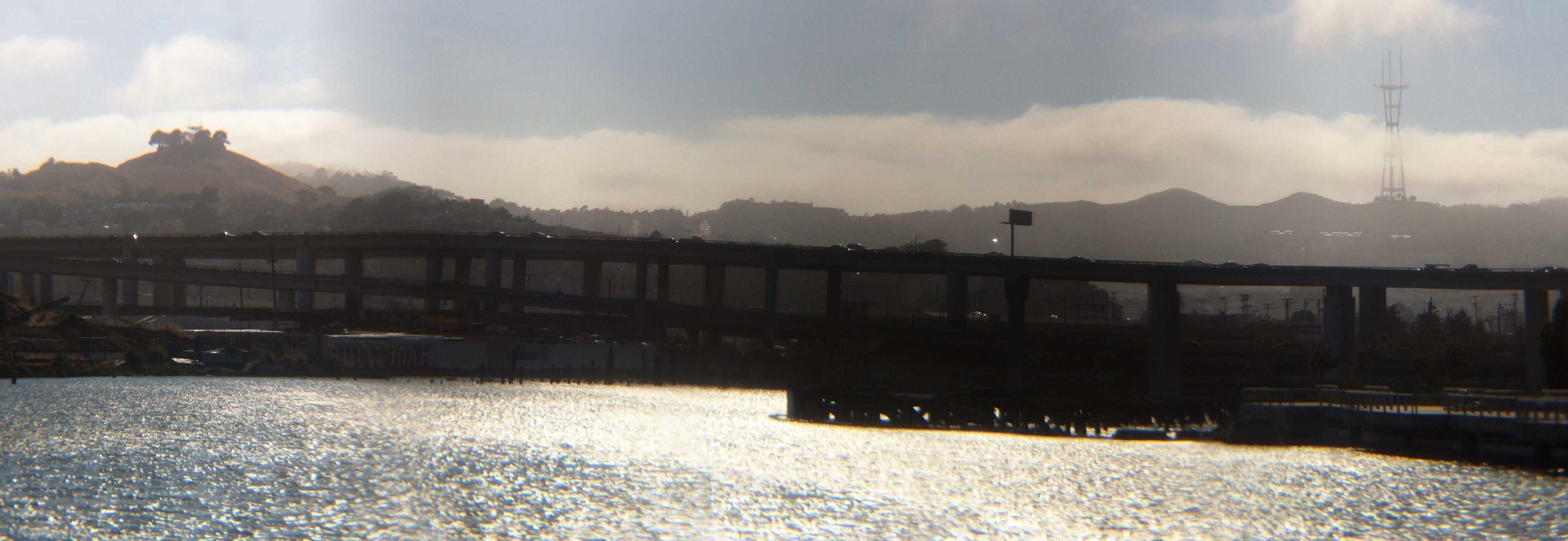
This is obviously begging to be panoramaficated, but one set of credits involving George Fargo and friends sat over right 101 / Potrero / Mission and was nearly impossible to remove, though it does add character (click to view 10,000 pixels wide):

My photo stitching software didn’t deal well with the gap and got a little wobbly:

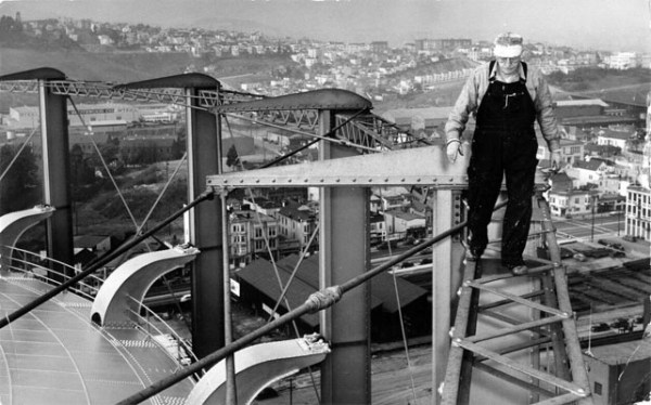
But behold the giant PG&E gas storage containers next to Potrero! That would have been comforting. Here’s what they looked like up close:

This guy had a funterrifying job:
And while we’re on the subject of PG&E in the 70s, here’s an ad for their mildly terrifying computers:

Tape *and* punchcards, impressive!
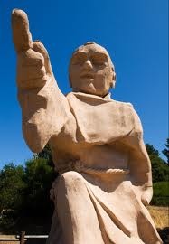
Google Maps hires Junipero Serra
@brentsleeper brings us the exciting news that Google Maps historic hiring program is in full swing!
http://twitter.com/brentsleeper/statuses/226046192734326784
Brought over from the ambitious but ultimately doomed Alta California Mission startup, Junipero is already at work on the FBP (freeway beatification program):

Junipero needs YOU to ride the El Camino Real:
Apparently, the California State Legislature went on a historical naming frenzy:
Section 635.
(b) State highway routes embracing portions of Routes 280, 82, 238, 101, 5, 72, 12, 37, 121, 87, 162, 185, 92, and 123 and connecting city streets and county roads thereto, and extending in a continuous route from Sonoma southerly to the international border and near the route historically known as El Camino Real shall be known and designated as “El Camino Real.”
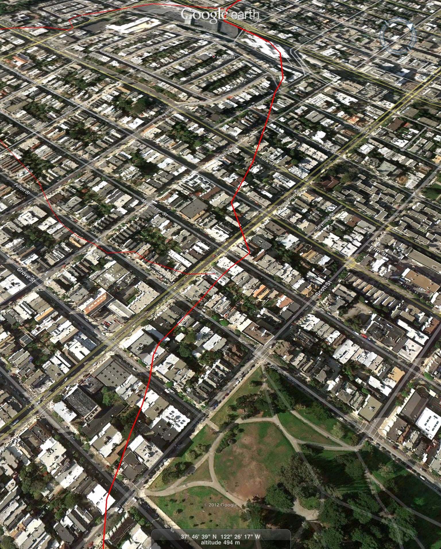
A little aggressive for my historical liking, given how many actual El Camino Reals one finds as streets in California. Here’s one of the better maps I know of showing the road at connected the Presidio, Mission Dolores and Santa Clara in 1852 as it passed through what would be come San Francisco, via David Rumsey:

One of the more obvious modern echoes of this is San Jose Avenue in La Lengua, which is clearly shown in the 1859 Coast Survey map as “The Road to San Jose”:

For the past few years, I’ve been noodling around with tracing the path from La Lengua to Mission Dolores, which is pretty straight forward. The path to the Presidio gets harder as the map stops at Geary, though I’ve made my best guess based on the wider-scale maps and topology:

KMZ file for your entertainment. Bonus material includes race courses other 1860s buildings which warrant their own posts.
A couple of interesting extracts:
The Road as it passes from San Jose to Dolores:

Through the Castro Safeway:

Across Lower Haight:

To the west of Alta Plaza Park:
And this concludes your briefing on 18th century road infrastructure.
Sutro Revolution
Look upon these works, ye might, and despair:

All hail our new Sutro GIF overloads, HYPNOSF. Stunning work, along with a bunch more SF rotational and swingback GIFs.
Do you have any idea how much work this was, both pre- and post-processing? I do — one street almost killed me.

Now all I need to is implement my SF-wide network of Sutro-ward webcams to make a live version of this (plus a fog detector).
Islais Landing, Sutro Rising
I love Islais Landing.
And Heron’s Head:
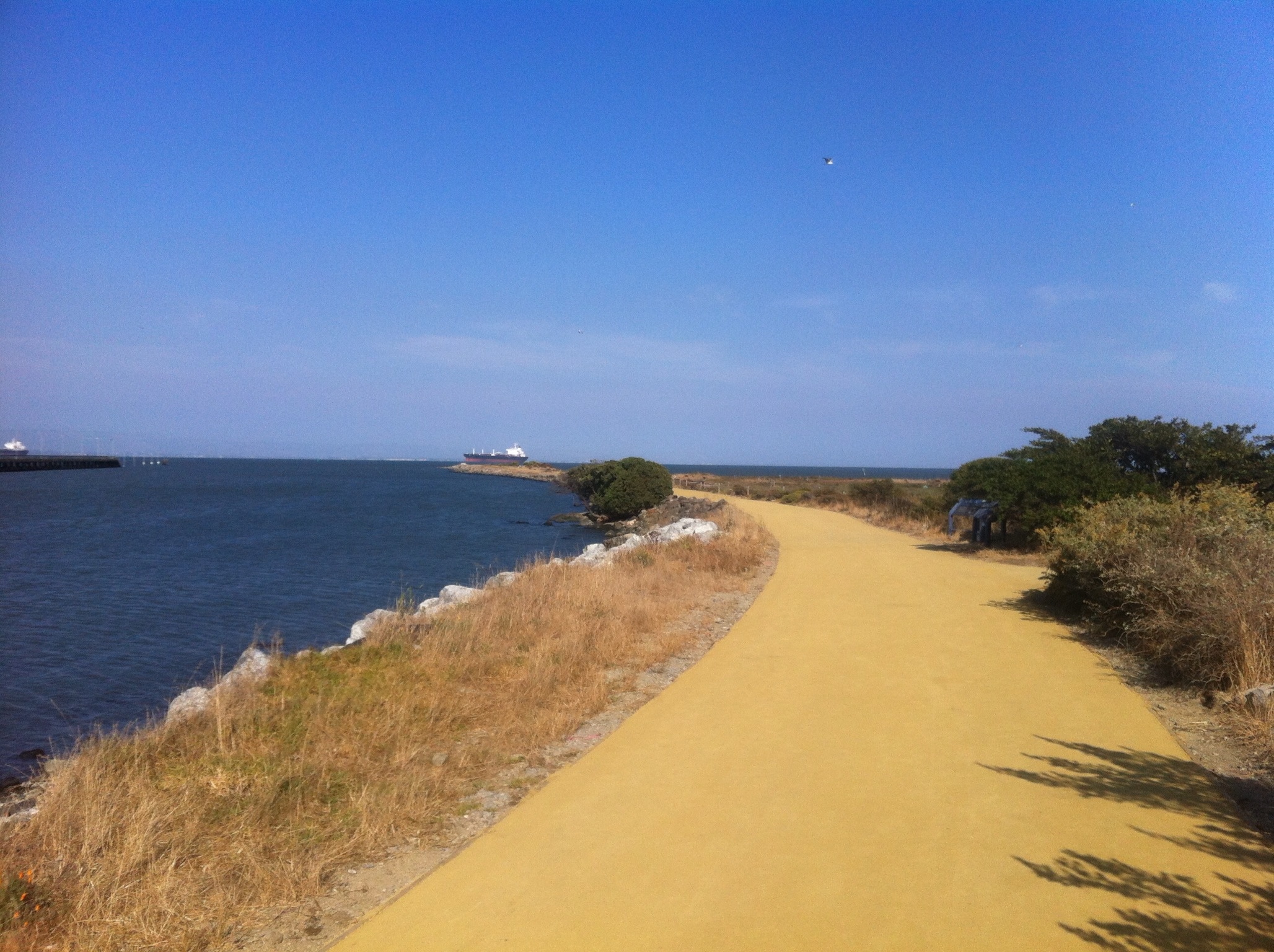
Hey, nice new hard-packed (decomposed granite?) path!

Now if only they’d finish the bike path along Cesar Chavez so I don’t die getting there.
Hey, gratuitous panorama of Hunter’s Point (click to enwiden):

North side panorama:

And downtown, through cranes:

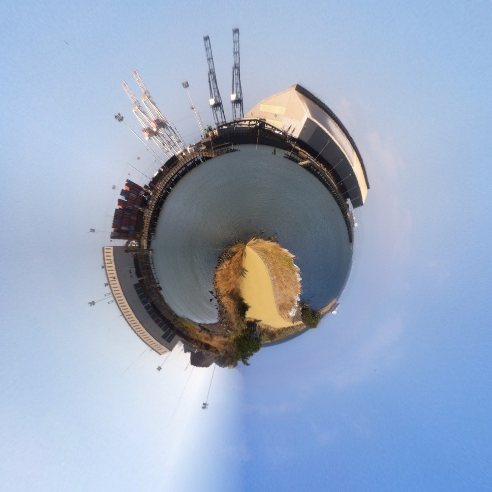
Me screwing around with polar projecting a 360 panorama at the tip (crest?) of Heron’s Head:

Welcome to Planet Crane:
And a somewhat mind bending tubularized map of Ocean Beach breaking over Hunters Point:

And am I the only one who thinks this would make an excellent Burrito Rail Gun?

We could even use the railgun to launch Larry Ellison’s X-301 (though it seems the Goa’uld cloaking device failed):
From Russia with (no) Love
Vladivostok! It’s apparently Soviet/Russia week here on Burrito Justice, and as you will see the news has given us interesting Vladivostokian material to discuss.
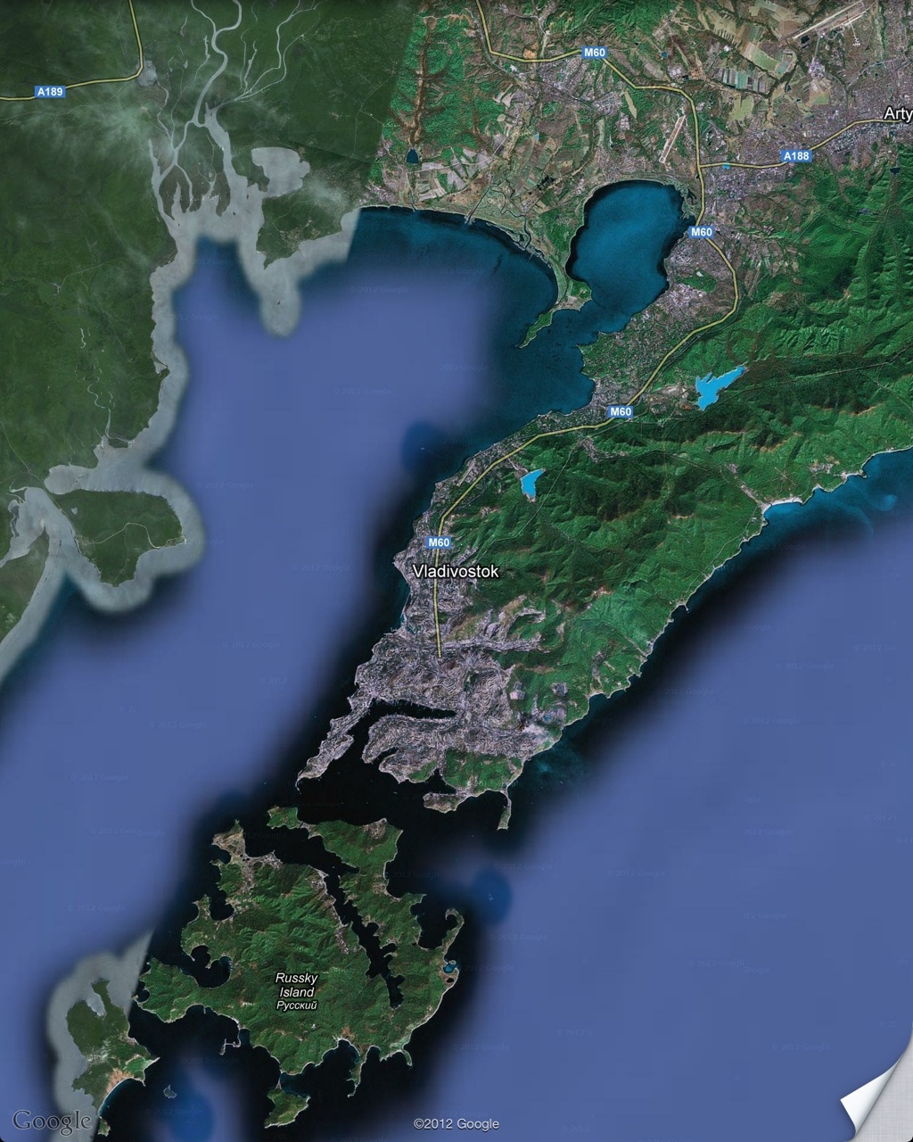
Has anyone been to Vladivostok? Noodling around on Google Maps, it is a city of hills situated on the tip of a peninsula on the Pacific, separated by a bay from the coast. Sound familiar?
The Tenderloin Geographic Society points out all we know of Vladivostok via the high-quality English Russia archives.
https://twitter.com/tendersociety/statuses/220042942356787200
To give you some perspective, I’ve aligned Google Maps on the same scale — I rotated the Vladivostok maps to better emphasize the rather similar peninsular alignment:

If you zoom in, you can see a bridge under construction at the Golden Gate analog (something they call the “Eastern Bosphorus”):

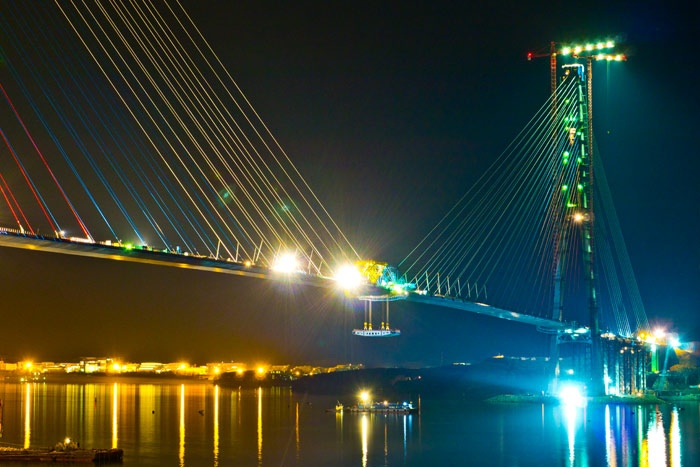
This is a billion dollar bridge connecting Vladivostok to Russky Island, a former military base that is being converted into a university and will be hosting the APEC summit there this autumn. It’s supposed to be the longest cable-stayed bridge in the world – the main span is 1104 meters. But the main span of the GGB is 1200 meters, so that takes care of that. Nice bridge though!
From the Rusmost website (site in English):


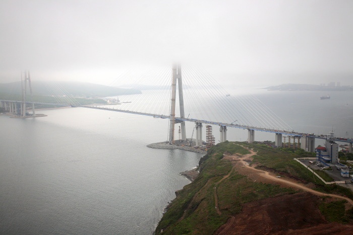

Those towers are taller than Sutro!
English Russia has some nice shots of the bridge nearing completion.
Like any big construction project, controversy and drama surrounds the bridge. These kids climbed up on top of it. Note the pylons are 330 meters, about 90 meters higher than the GGB!
Yikes. They apparently got fined $6.
While I don’t have the details, the Guardian notes:
It’s got rolling hills and a seaside view. Now, with a gigantic new cable bridge, the far eastern city of Vladivostok has come one step closer to realising the dream of becoming Russia’s San Francisco.
Never mind the ubiquitous construction cranes or gangland-style killings, accusations of corruption and shoddy work – for now the city is basking in the glory of being home to one of the world’s longest
suspensioncable-stayed bridges.
Russian Prime Minister Medvedev presided over the bridges opening ceremonies on Monday, and he transmitted a couple of choice comments:
“Everything was correct,” Medvedev said at the ceremony, according to RIA-Novosti news agency, commenting on the bridge’s Russian contractors. “Foreigners can’t be trusted to do things well. Perhaps unfortunately, we can’t build houses, but we can definitely build such structures.”
(I know the Soviets Russians were all apartment block-happy, but if anyone can explain the house comment I’d love to know.)
However, here is the REALLY controversial part:
“Vladivostok is probably better than San Francisco,” [Medvedev] said on Monday. “Nevertheless there are similarities that come to mind, because there is also an ocean, suspension bridges and the similar terrain.” In one last dig, he added: “Our people are definitely better.”
Time to rename Russian Hill! ENERGIZE THE BURRITO RAILGUN. I sure hope your precious bridge is carne asada-proof! ПРЕВЕД МЕДВЕД! (Or perhaps ПРЕВЕД БУРРИТО!)
(Though I must admit, all the Russian software developers I’ve worked with are awesome. Much less poopy that their hockey players.)
Obligatory Artsy Mission Sunday Streets Shot

(aka me desaturating and contrastifying HDR shots)
I liked the dancing Lucha Libre guy:

Hey, look, a guy on a bike with his iguana in a harness(with ‘Deep on his Trikeasaurus passing by):

I suggested to the SF Bulls that they hold a hockey clinic during the Aug 5th Mission Sunday Streets — if you a Canadian-San Franciscan or Northerly American, bug them on Twitter and get ready to play. Anyone have a net? BIIIIIIKE!
(I’ve imagined a Canadian entry in Carnaval — basically a bunch of people playing street hockey as the parade goes by. Who’s in?)
The Russians Are(n’t) Coming to С-Ф
Via the esteemed @footage, behold this Cold War era Soviet military map of San Francisco Bay Area:

Сан-Франциско, 1980 style. (Just don’t call it Фриско.)
This is by far the highest resolution version of this map I’ve ever seen — it was on an old UC Berkeley website, as well as various map resellers, but this one takes the cake.
The Soviets (good god, that sounds weird now) went to town mapping the world for their Cold War needs. This particular SF map is 200000:1, but they detailed some cities to 25000:1, and others down to 10000:1, highlighting tank-friendly roads and important buildings.
I’d love to find a Soviet map with 10000 or 25000:1 detail for С-Ф, though I’m not entirely sure it exists. It does seem the Soviets made maps for the whole world at 200000:1. Other resolutions seem to be for targets of interest. Most of the maps that made it to the public eye are of the former USSR and what would have been the Cold War hot spots: Europe, the Middle East, South East Asia. (One interesting note is that the maps of Africa are still some of the best around.)
From what I understand, as the Soviet state collapsed in 1991, huge quantities of these maps were abandoned as the Soviet Army fell apart. Some officers were running around trying to get them back, but this proved troublesome in the Baltics, and map dealers had a field day.
Some of the better map-based lookup indexes include loadmap.net and priceclub.ru.
The easiest site to download them from, presuming you have a map number (and that the map was scanned) is maps.vlasenko.net. There are five indexes, ranging from 1000000:1 down to 50000:1. Unfortunately there is little to nothing for North America on the 100000 and 50000:1 resolution maps.
For reference, our 200000:1 San Francisco map is J-10-XXII (or sometimes J-10-22).
The coordinate system is pretty simple – A is at the equator, U near the North Pole (the letter bumps up every 4 degrees, and the number every 6 degrees to the east, from the Internationaln Date Line.
Each map is subdivided, so XXII is one of 36 grids within J-10. This image should help:

Via afanas.ru — translated.
A roman numeral 200000:1 map can be subdivided into four 100000:1 maps, so our Bay Area map would also be J-10-079/080/091/092, if I’m reading it right.
J-10-079 can be further subdivided into four 50000:1 maps (А,Б,В,Г) , and those into four 25000:1 maps (1,2,3,4), so an SF neighborhood level map would be J-10-079-Б-3.
I tell you this so if you find yourself in a map store in Vilnius and have opportunity to find a map of the Mission, you will be ready to buy it and run before the former Soviet Army intelligence agents see you and catch you.
Lots more commentary on the maps in these well-written PDFs:
“Uncle Joe knew where you lived”: part 1, part 2
A legend to the map symbols can be found here and much more here. Half circles are natural gas tanks, and I think crosses are churches (Brotherhood Way seems to be the big one ). One interesting note: no sign of Sutro!
Let us know in the comments if you find anything interesting. ПРЕВЕД МЕДВЕД!
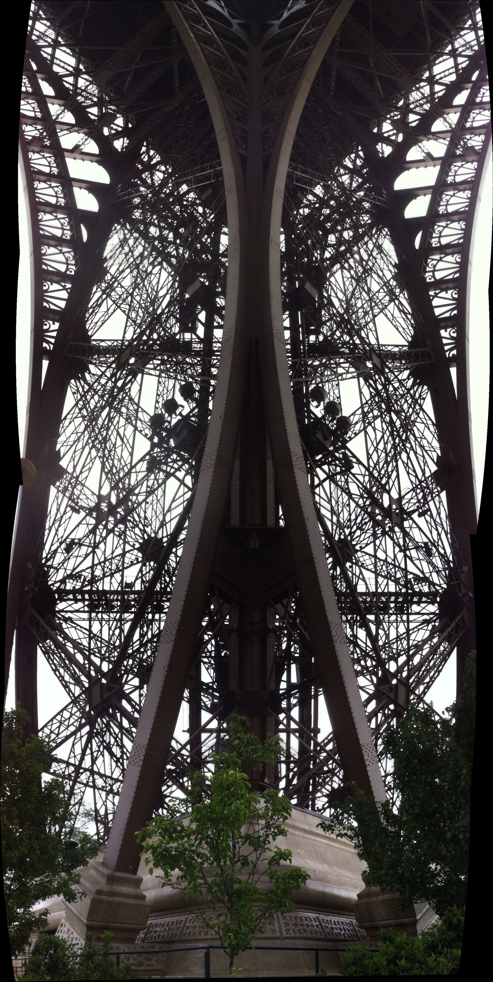
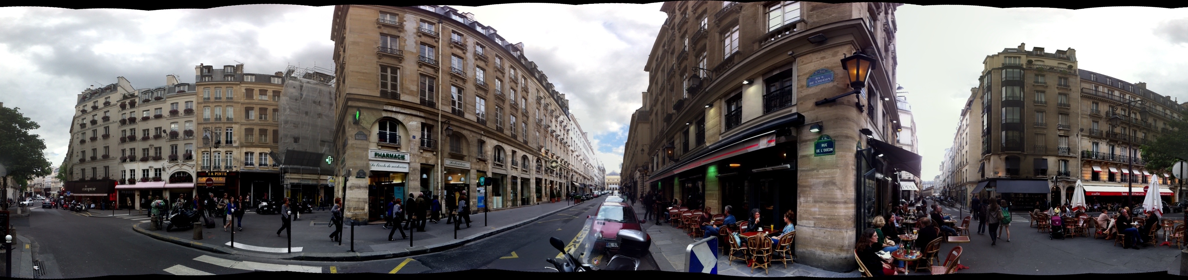
Eiffel Tower Panorama
18 iPhone shots, from the top. Sorry for all those I pushed out of the way but I think you’ll agree it was worth it.

3.8 year old Taquita Justice is big into the Eiffel Tower, since it’s “Sutro’s friend.” She walked up all seven hundred steps to the 2nd level. (I told her the 300 steps to the first level was like walking up Bernal.)
And here’s a pano from underneath:
Photosynth crazy wraparound polar pano from below:

Photosynth is an amazing pano app in its own right, and even moreso when you consider its by Microsoft. They have a spinny viewer but you need a Microsoft Live ID login, so that’s not happening soon. But do download the iPhone app.
Another Photosynth 360° of a corner brasserie when I drank 1664:
And a very necessary 1664 animated GIF.
See also: Parisian FedEx bike:

And 8-bit Space Invader tiles:


San Francisco Archipelago Posters
June 7, 2072 (AP), Northern California Association of City States:
Responding to coastal erosion due to the accelerated disintegration of the East Antarctic ice cap, the NCCS (Northern California Coast Survey) has released a higher resolution topographic map of the San Francisco Archipelago, showing the 200 foot sea level rise compared to the 2012 sea level datum.

This poster, designed by centenarians Brian Stokle and Burrito Justice, is available in three sizes (note: adjusted to 2012 dollars, and old-style American measurements – please double-blink to convert).
(Note: default shipping is via 12 hour pneumatic tube from Zazzle’s underwater Redwood City printing facility.)
Detail:

Note this should not be used for navigational, construction or underwater recovery purposes. Additionally, the hydrographic map has been delayed due to budget restrictions due to the construction of the new Norcal Capitol building on the Fresno shoreline. However, a small segment of the street map update is available for review.

The new street maps will be released by neighborhood over an indeterminate time frame.
This week’s headlines in SFCurbistGate:
- Noe Shoals residents vow to stop any port in their area bigger than a 40 boat small boat/fisherman fleet marina.
- Bernal Isle residents bemoan the design of the Cortland-Chernery street bridge, and worry that the influx of new visitors will threaten the “unique” character of the island.
- Debate over where to build new container port continues — Geneva/Muni Yards or Divisidero Harbor?
- Lawsuits continue over the ill-conceived levelling of San Bruno Mountain to 150′ in 2045.
- The Board of Supervisors agreed to extend Twitter’s tax break if they build their new 110 storey corporate headquarters on the disadvantaged Nob Island.
- Sea trials of the NCSS Ed Lee continue out of the Presidio Sub Base. The first of the Sutro-class algae-diesel attack subs is expected to contain the southern incursions of the Vancouver Island-Cascadia Alliance and neutralize the Orange County drone fleet to Port Fullerton.
- New legislation lifting restrictions on taco boats is expected to be approved by sailing season.
- The bond measure for a new multipurpose floating sports stadium anchored on Alcatraz is expected to fail in next week’s referendum. Meanwhile, the 49ers consider a move to Santa Cruz.
- A new study has revealed that the on-time statistics for Muni’s fleet of sea buses have been exaggerated since 2064 — average speed is 20 mph, not 20 knots.


