Sitting on the Dock of Bay and Taylor Street
March 10, 2015
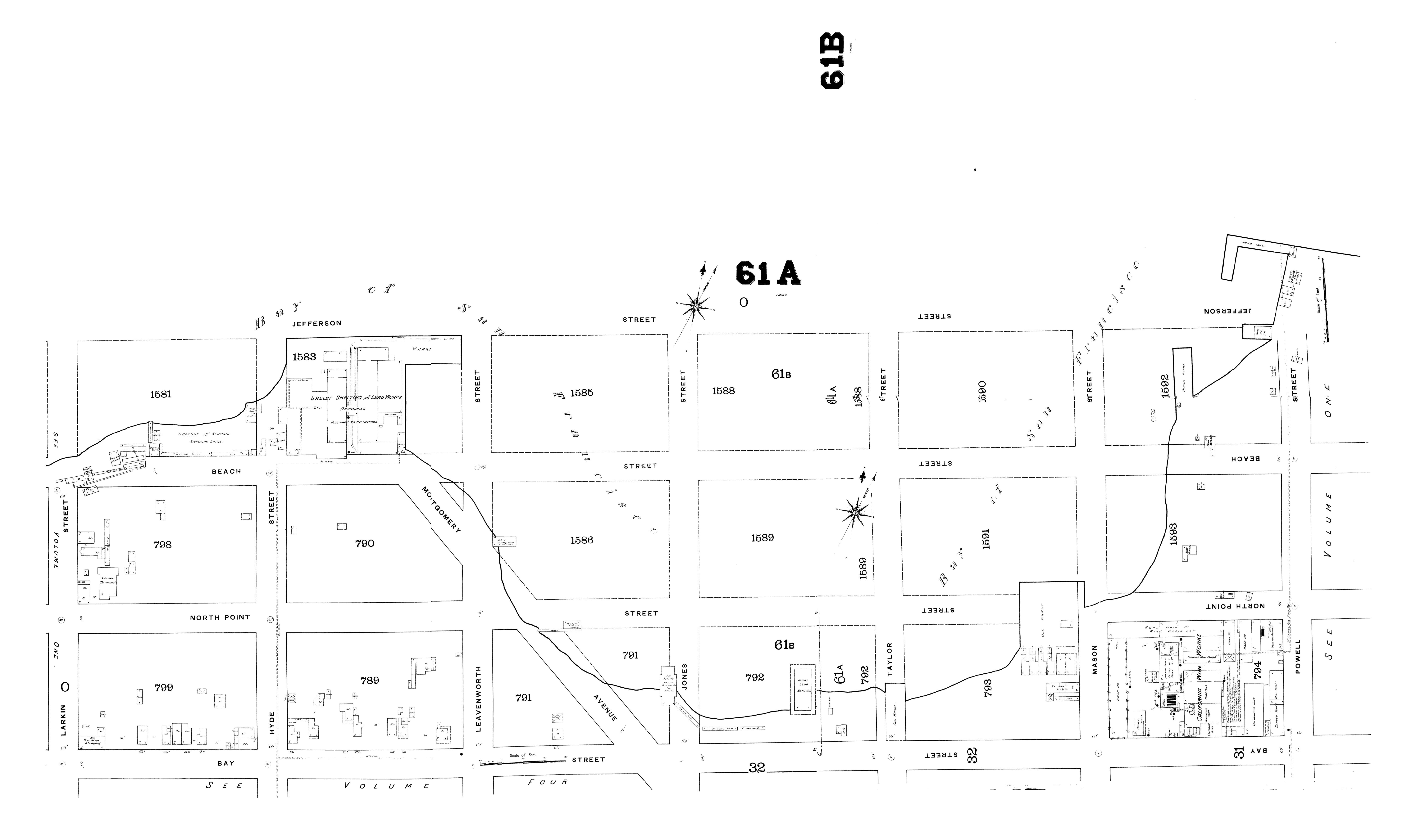
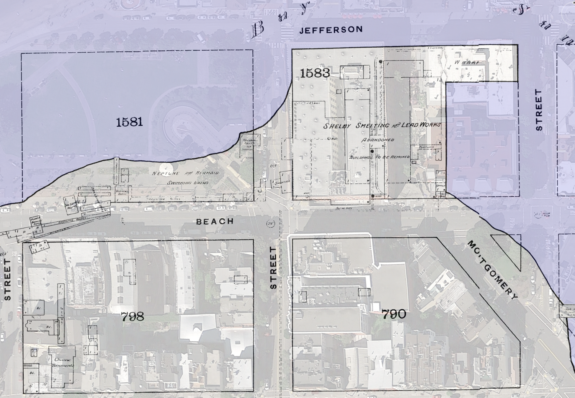
Just one of those maps that makes your brain hurt. The (near) original San Francisco coast via the 1886 Sanborn Maps, when Bay St ran next to San Francisco Bay, and Beach St was water lots. Montgomery is today’s Columbus. (Click to zoom).
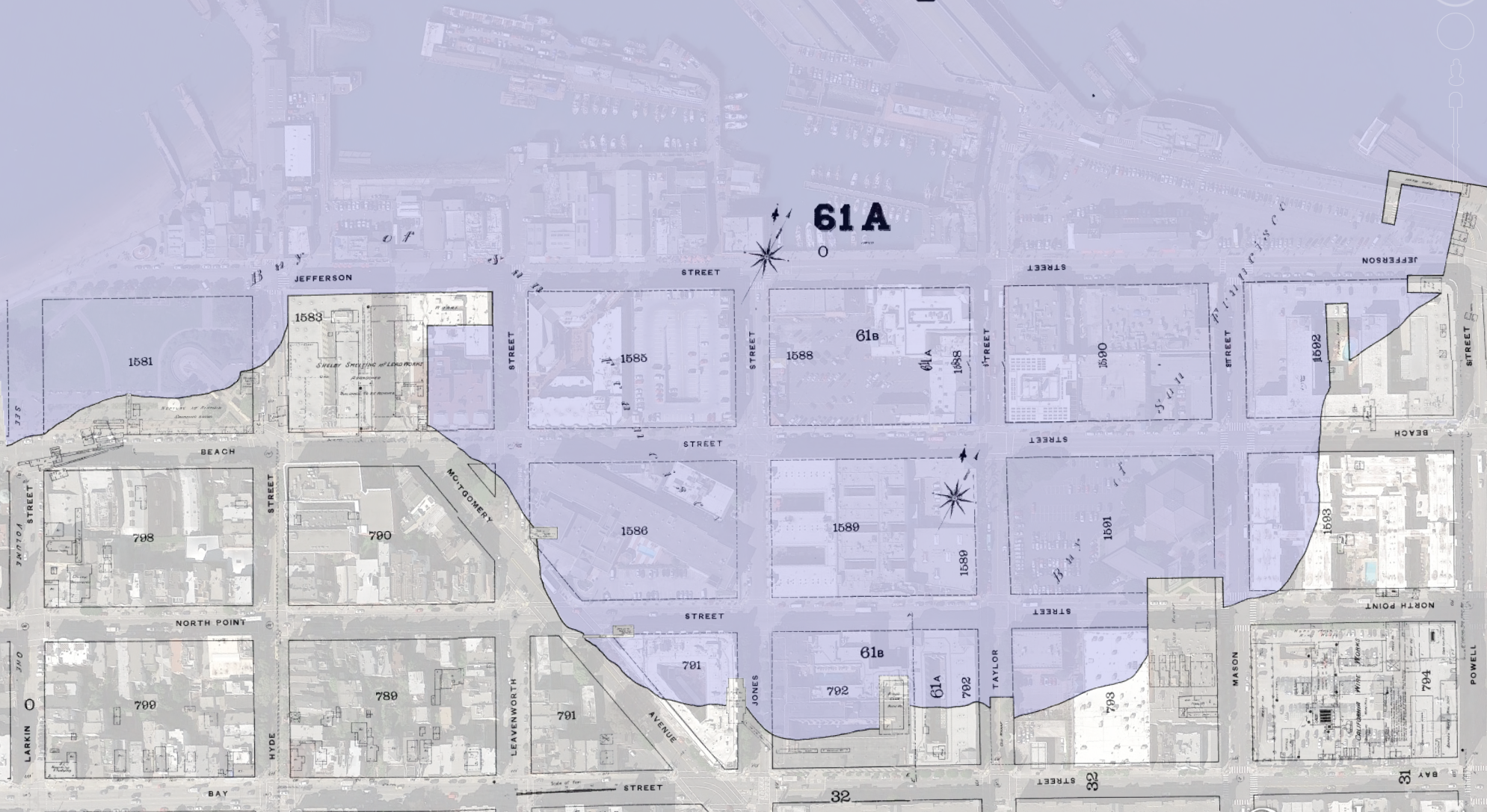
FINE FINE here it is in BurritoVision:
I found a saloon, right on the water! SALOON ZOOM:
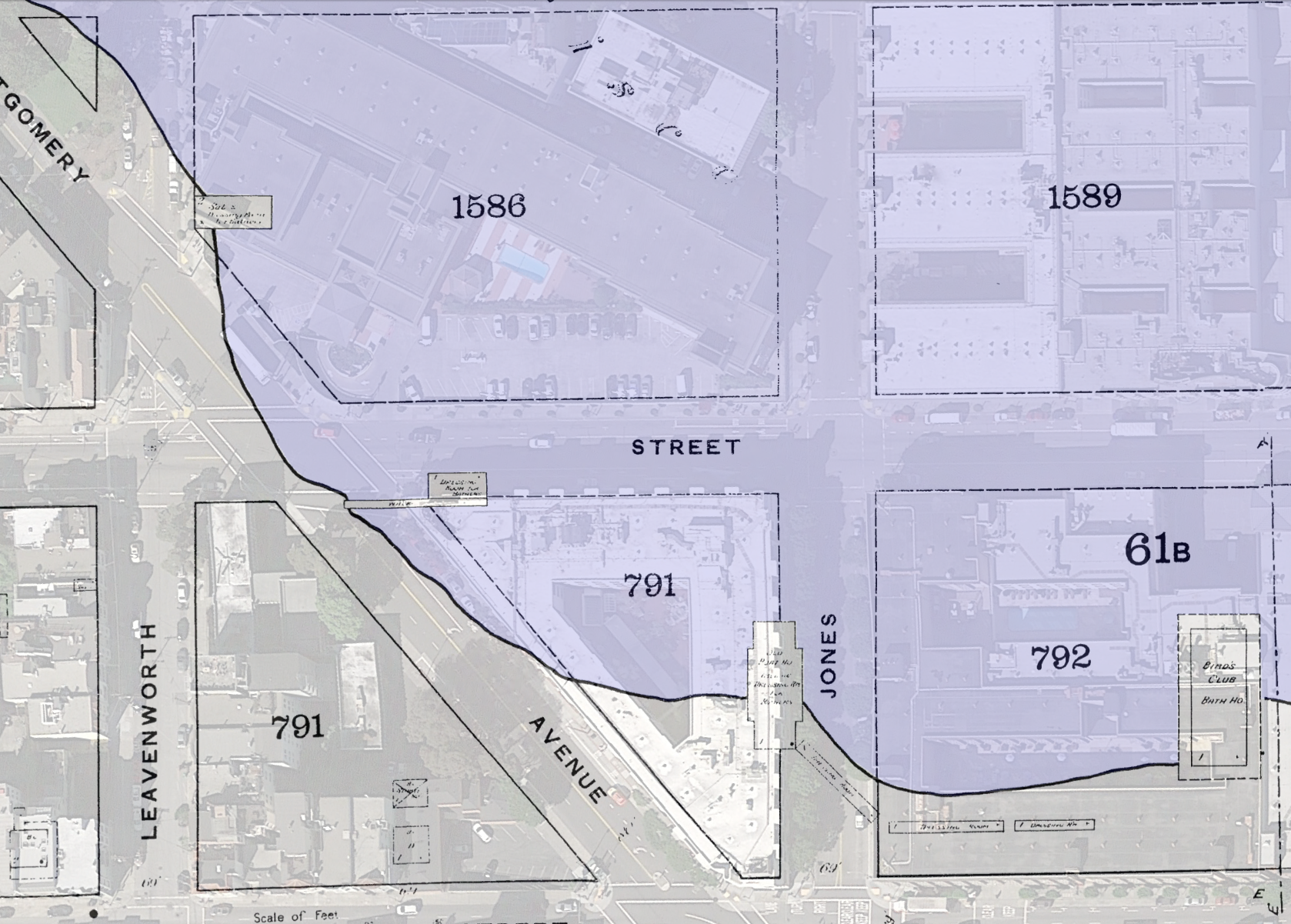
A saloon AND a dressing room for bathers no less. I suppose you would need a drink before plunging in next to the old lead smelter.
5 Comments
leave one →


molto interessante..
grazie
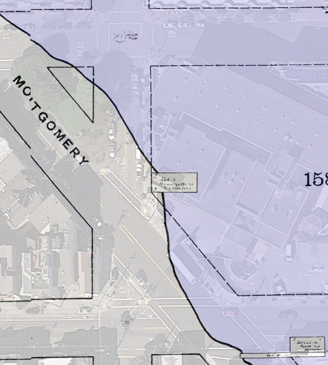
I’d heard that the Selby smelter was on the site of the future California Fruit Canners Association / Del Monte plant #1 site, and the map clinches it.
Note: searching for ‘bath house san francisco’ is a good way to quickly remind yourself what your safe search settings are.
This photo (which possibly contains an image of your saloon!) seems like it’s taken from the shore near the, uh, ‘Old Wharf’ (assuming I read that correctly) at Mason & North Point: http://sunsite.berkeley.edu/FindingAids/dynaweb/calher/graves/figures/I0012594A.jpg (parent page http://content.cdlib.org/ark:/13030/tf7c6009qg/).
The label on the photograph is wrong – Black Point, Larkin, and Polk are actually behind the visible hill (as is the future Aquatic Park). The Coast Survey backs up my Black Point statement (http://www.davidrumsey.com/luna/servlet/detail/RUMSEY~8~1~239951~5512086:San-Francisco-entrance,-California-). Many of the street maps in the Rumsey collection from this era are, shall we say, idealistic/artistic interpretations of a future waterfront, and I don’t have the time to unearth the names of the other buildings right now. :(
Stereoscopic images of the Selby works (I had to stand pretty far back from my display to get the effect because my stereoscope’s on loan): http://commons.wikimedia.org/wiki/File:Carleton_Watkins_%28American_-_View_of_Wharf_of_the_Selby_Lead_and_Silver_Smelting_Works,_San_Francisco,_Cal._-_Google_Art_Project.jpg http://commons.wikimedia.org/wiki/File:Interior_view_of_the_Selby_Lead_and_Silver_smelting_works,_San_Francisco,_Ca,_by_Watkins,_Carleton_E.,_1829-1916.png
Neptune and Mermaid swimming baths advert: https://www.flickr.com/photos/charmainezoe/5881695591/
This article on the history of Black Point is fun: http://urbanlifesigns.blogspot.com/2013/01/forgotten-hills-fort-masons-black-point.html
Wow! Thank you, this is excellent. Man that photo is remarkable.