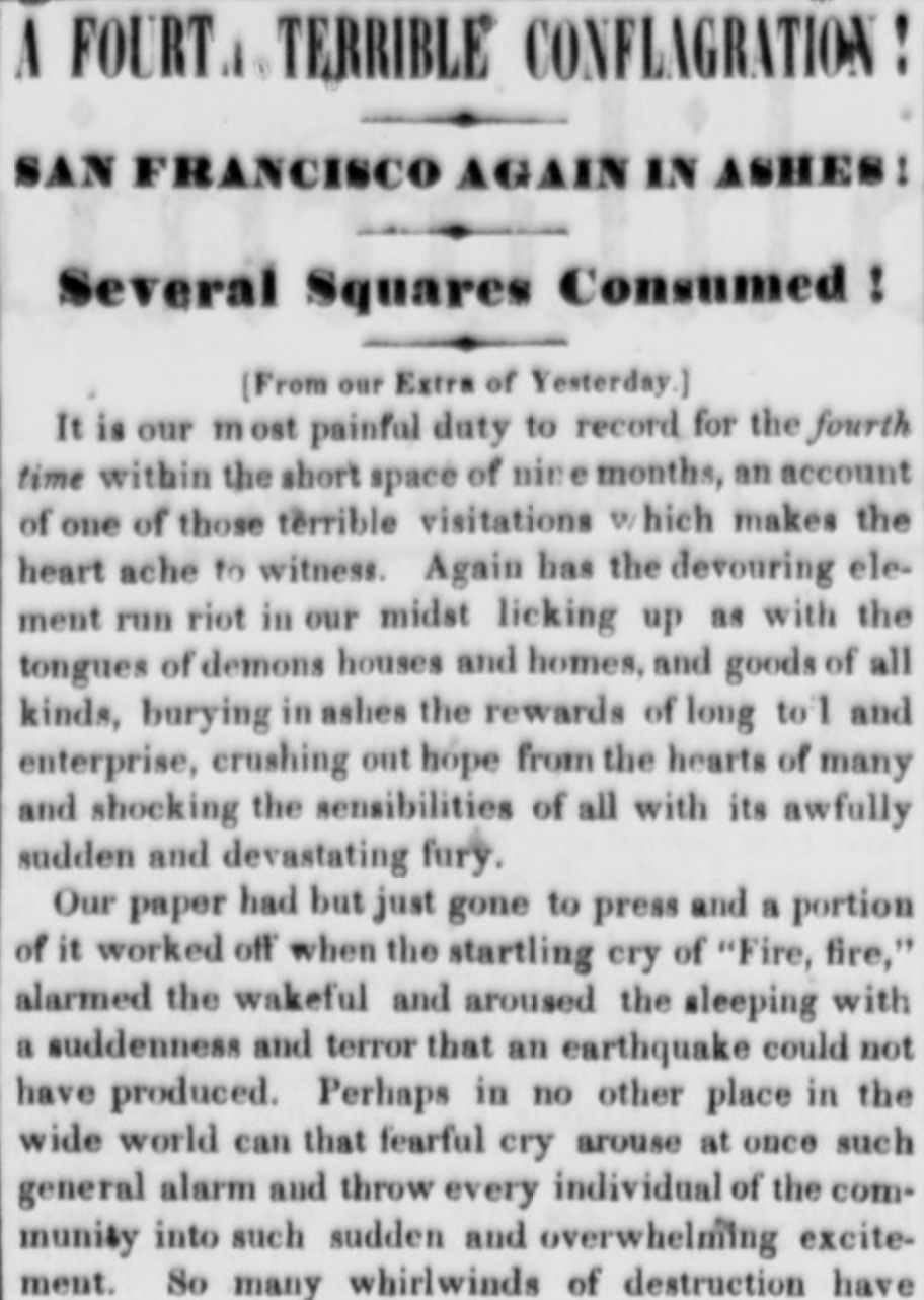
Fire the Fourth
Yesterday on BFF.fm, @brockwinstead and I spoke of many things, including the fire of September 17, 1850, one of the six fires that hit San Francisco in the space of a year and a half.
Side note: good news! You can now subscribe to Burrito Justice Radio via RSS!

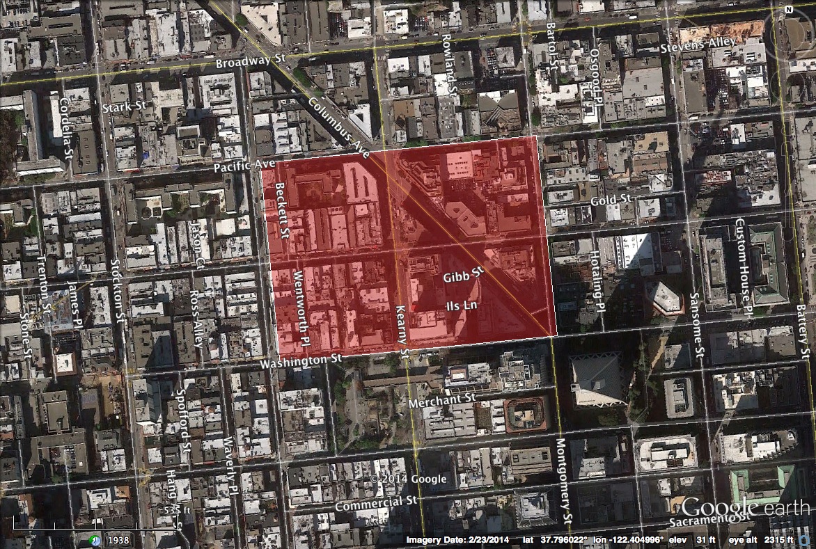
Here’s a rough map of the affected area today.
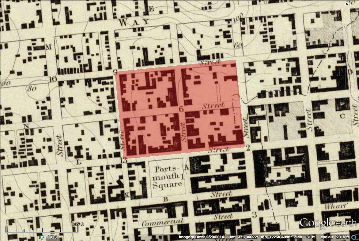
Here’s a GIF of the 1853 Survey Map (more on that over at Pastmapper) — caveat emptor, this was surveyed in 1851-1852, after another TWO fires had taken place..
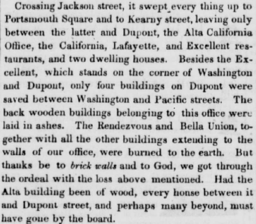
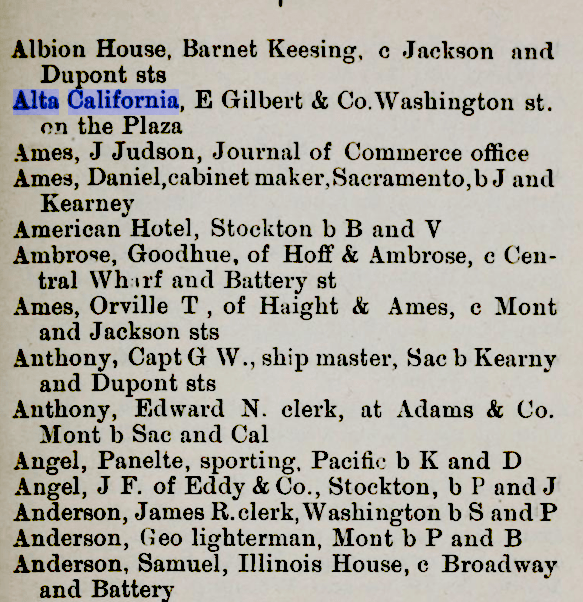
The fire burned up to the brick walls of the Daily Alta itself.
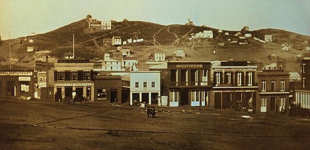
Here’s the famous shot from Portsmouth Square in 1851, looking across Washington St. at that survivor, the Daily Alta building.
I’ve started making a rough map of what burned over on Mapbox. Red is what burned, blue is what survived, and yellow is what got torn down.
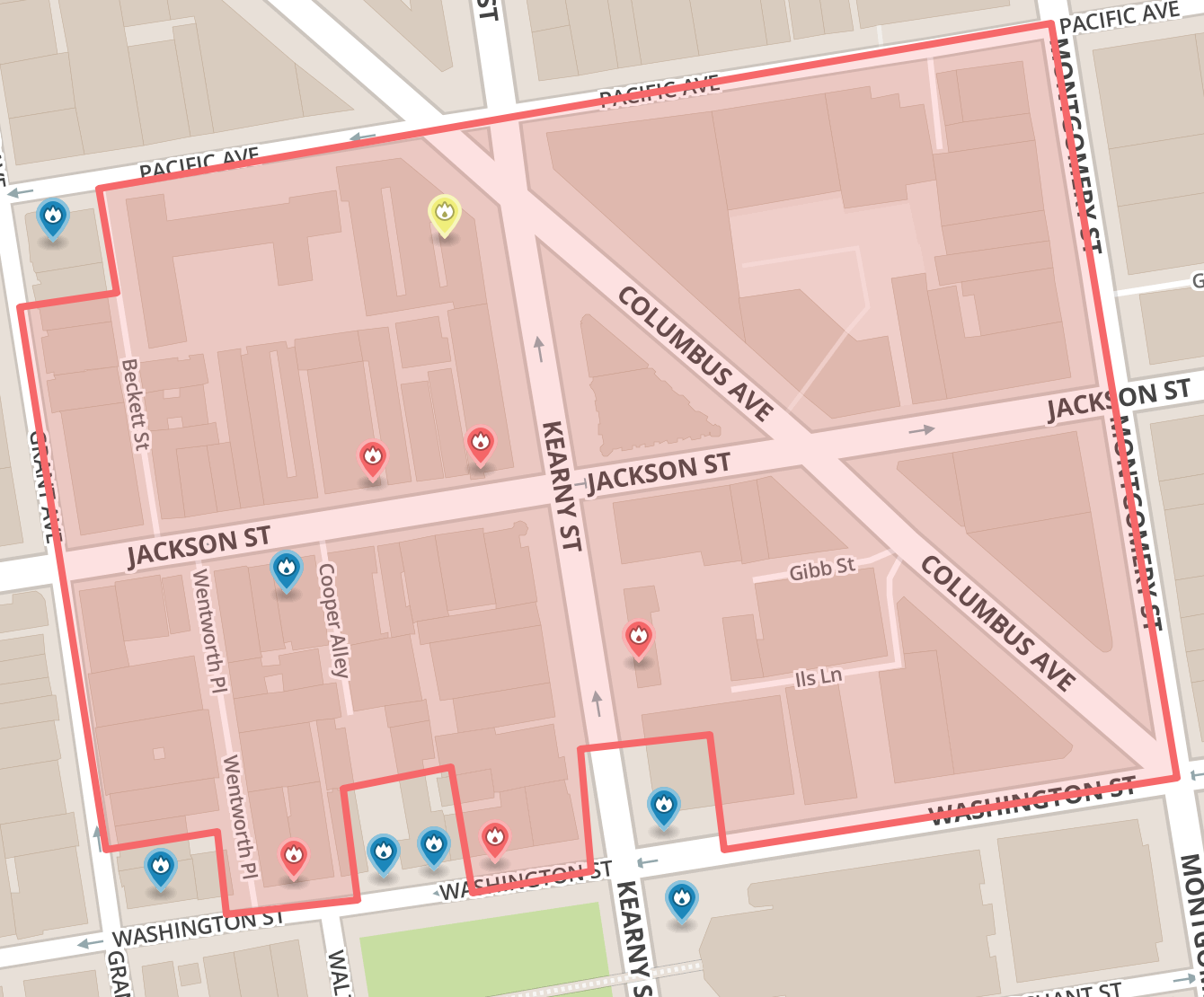
It’s a work in progress. The map doesn’t have the granularity or metadata I need to realistically keep track of what was where. Also, they didn’t exactly record the street address numbers with any great gusto. (I get the impression not all streets had actual numbered addresss at this point.)
Also, people are not exactly listed in alphabetic order within letters.
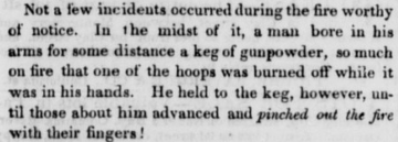
Anyway, during the fire some of these people were a little too focused on rescuing their goods, in this case gunpowder:
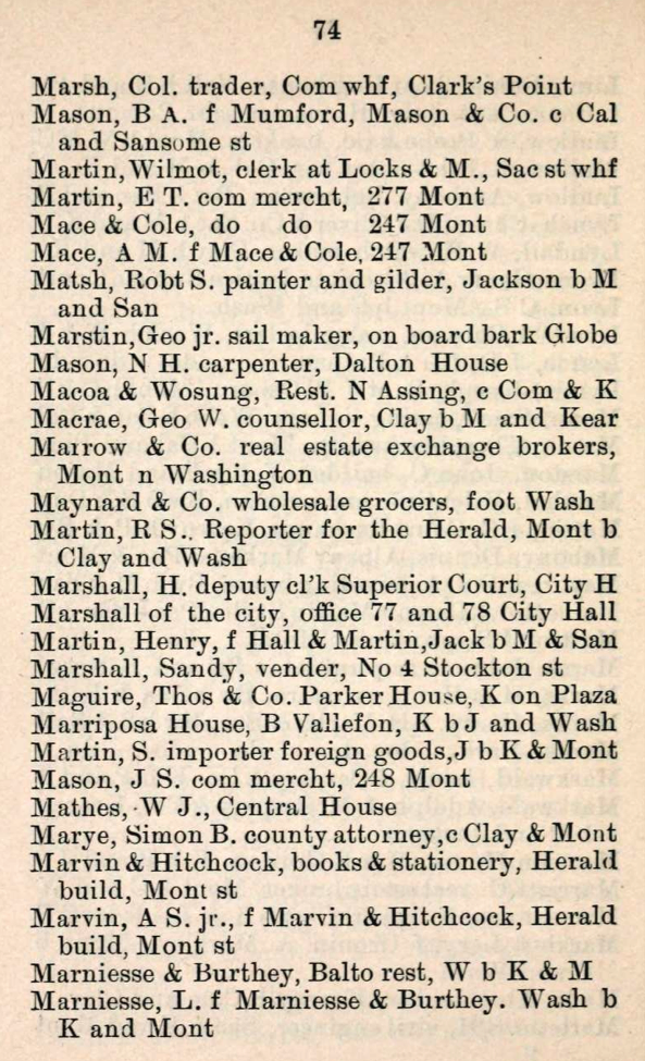
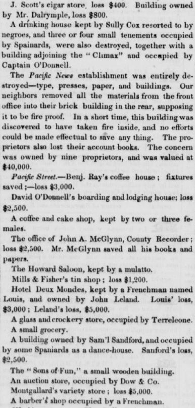
And in addition to the play by play of the fire’s path, the Daily Alta also published fascinating list of all the businesses lost. Here’s just a sample:
One of these days I’ll get this info embedded in a slippy map.
If this fourth fire was too much for you and you wanted to get out of San Francisco before it burned down twice more, here were some of your options:
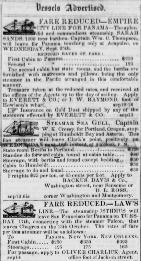
A first class fare to NYC, adjusted for inflation, was about $10,000. If you wanted to slum it in steerage, you’d only have to shell out $5,000. Getting to Portland would have run you $1200. More on ocean transportation of that era over here.


I like dis, Please send more.