I’m. Too sexy for this rope walk.
I have about 50 half written articles in my WordPress drafts folder. The good news about this procrastination is when someone beats me to an historic writeup, I have instant commentary! Such was the case today on Twitter when chatter erupted over the old Tubbs rope walk.
https://twitter.com/wroush/status/434779620135559168
Historic rope walk? You had me at “Sanborn map pasted over”…
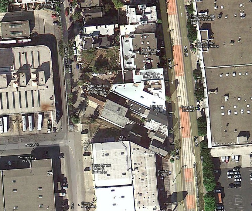
A few years ago, Wade Roush over at Xconomy dug deeply into those oddly angled buildings on Third Street between 22nd and 23rd.
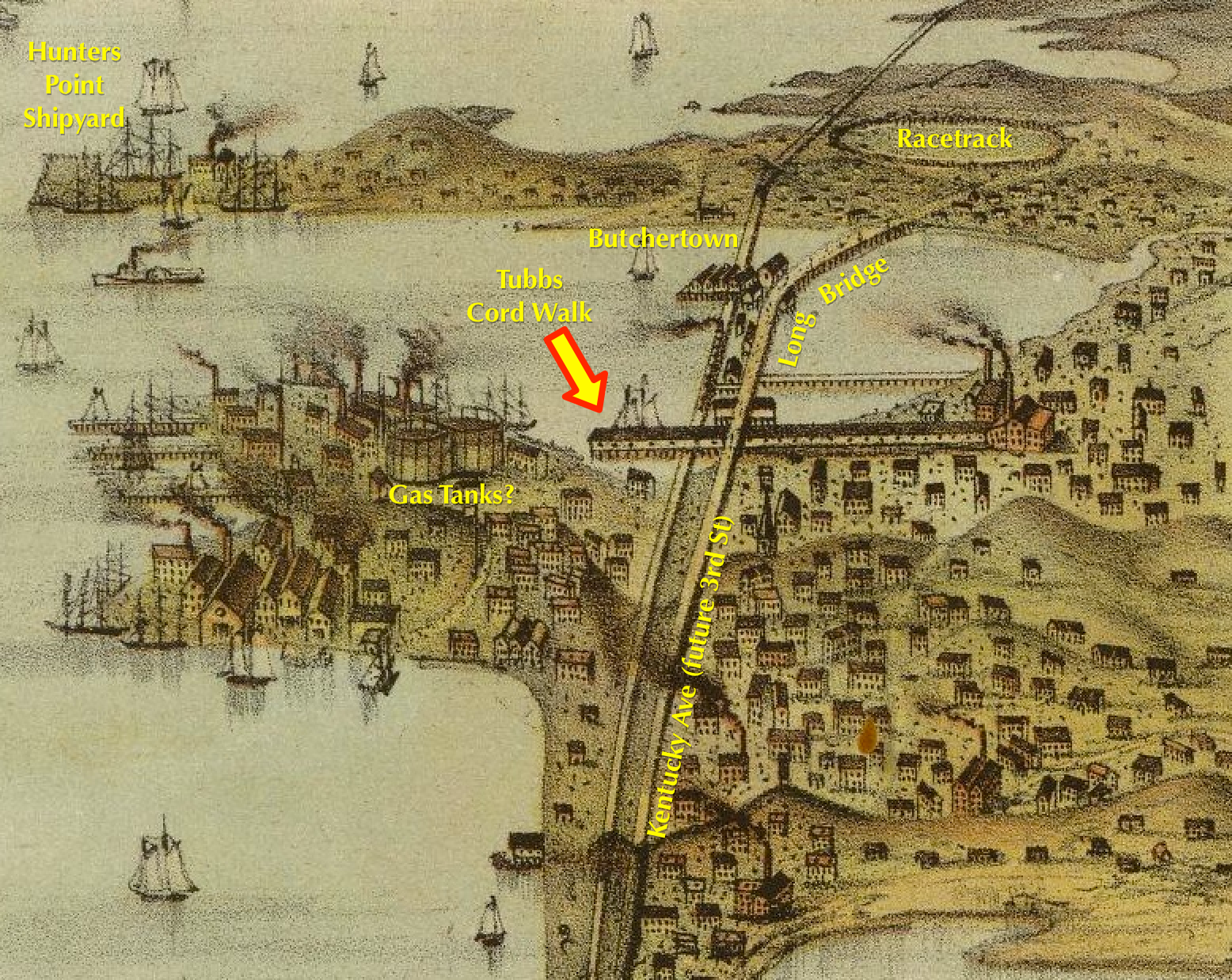
The ghosts of former industry in Dogpatch, Hunters Point and Butchertown could very well be its own blog. The short of it is as downtown SF developed in the 1850s and 1860s, the messy industries and ones that needed lots of space moved to SESF.
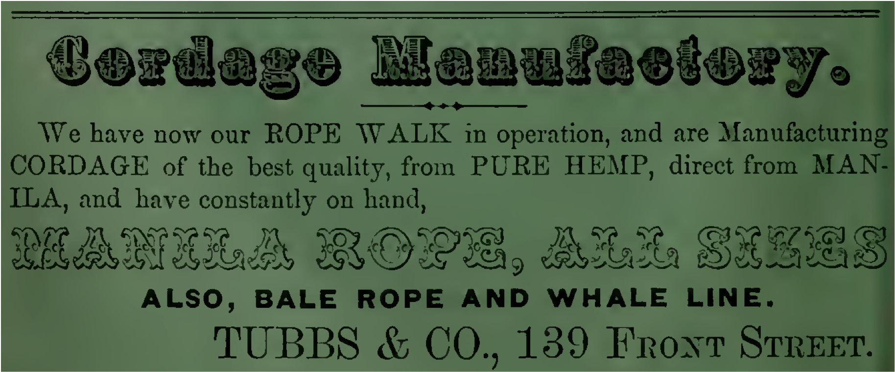
These particular buildings were once adjacent to the Tubbs Cordage Company’s “rope walk” factory that was built in 1856 and lasted until 1963. Today, one of them is the Hells Angels’ clubhouse, and Wad Roush disovered that in the 1980s, two of them were owned by none other than DAVID RUMSEY.
WHAT.
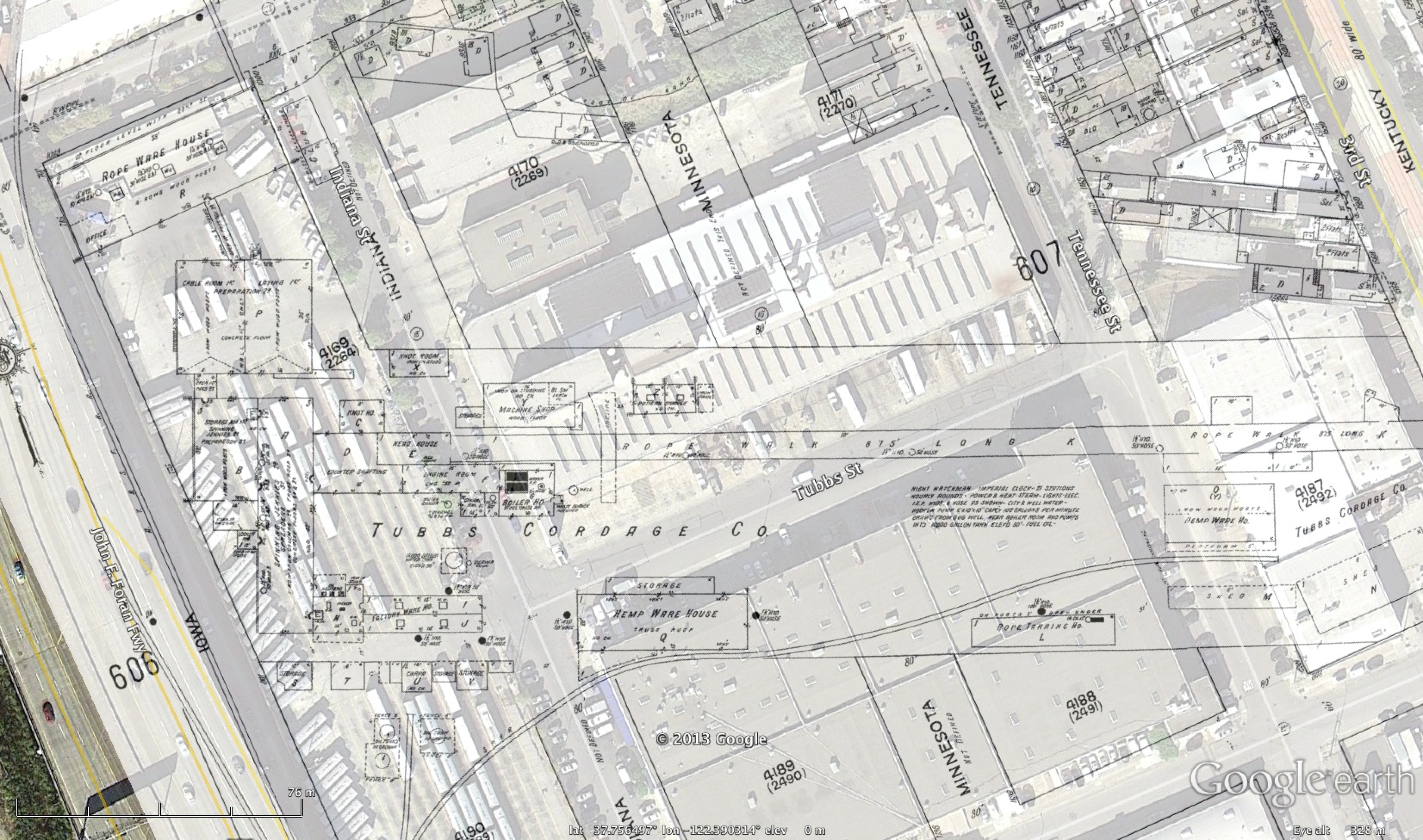
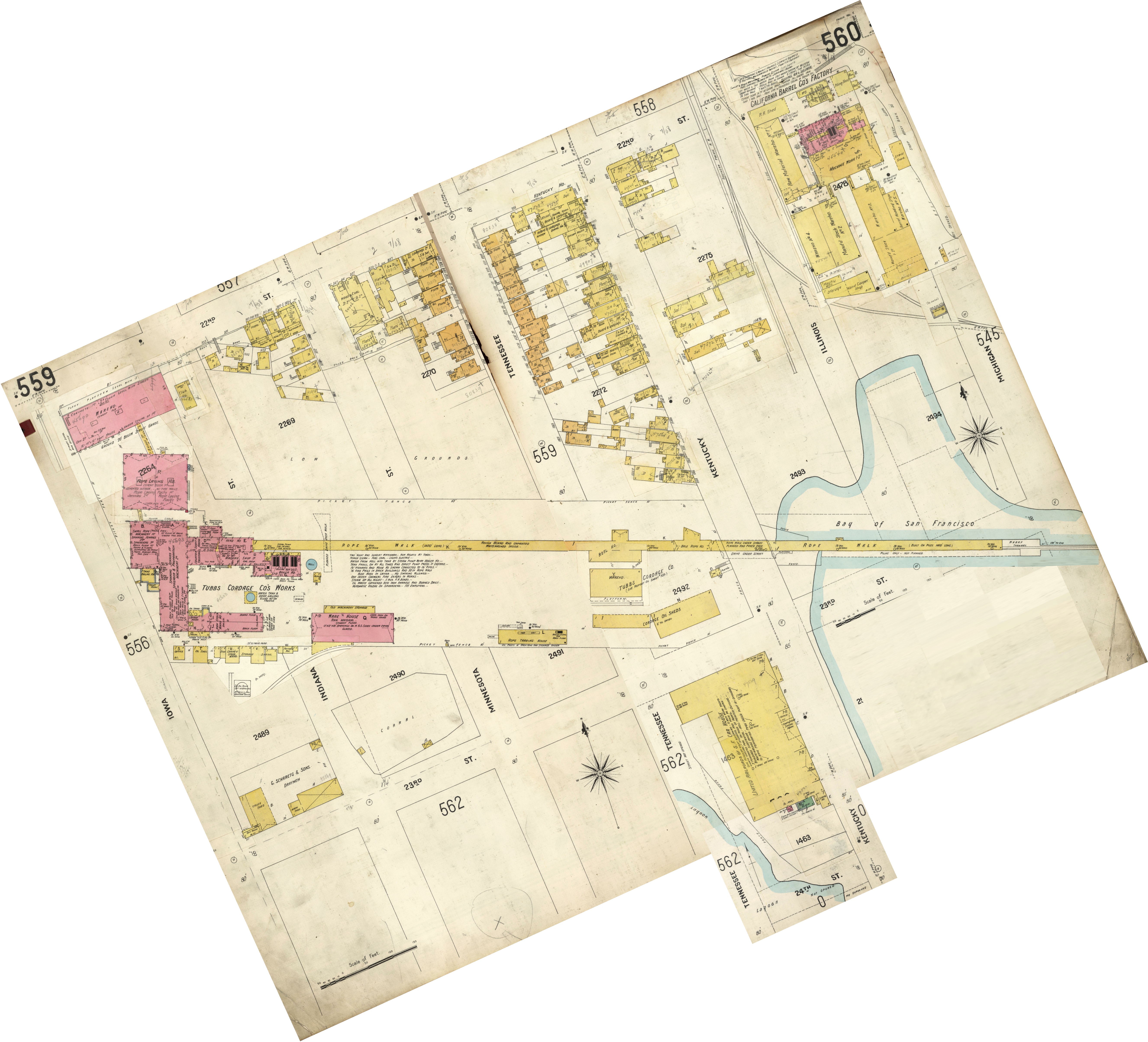
Anyway, here are their 1915 facilities presented in BurritoVision. Click to zoom.
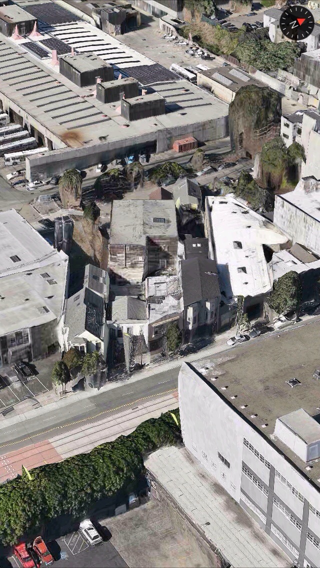
Close up of those angled buildings (1558,1560, 1562, 1564, 1566 and 1568 Kentucky), which match up pretty well:
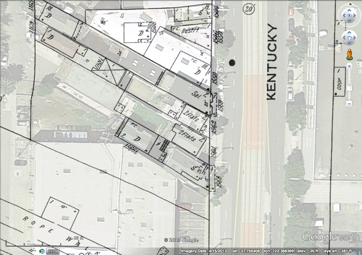
Overlaying the 1886 maps, the lots look the same, but the buildings, 46 aka 1564 and 45 aka 1562 Kentucky look different, and that saloon (which I can’t yet track down) isn’t there:
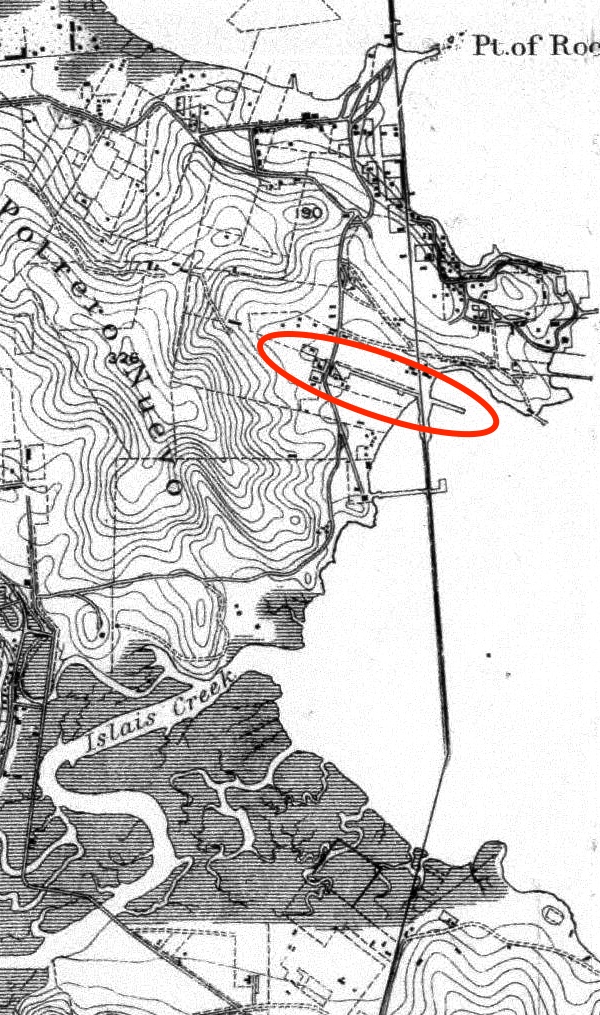
And here are the 1905 Sanborns, stitched and rotated to show the full length of the plant. IANARM, but apparently you needed an extremely long “rope walk” to make rope — at 1400′, it dodged under Kentucky/3rd Avenue and jutted into the Bay on piers (click to zoom):
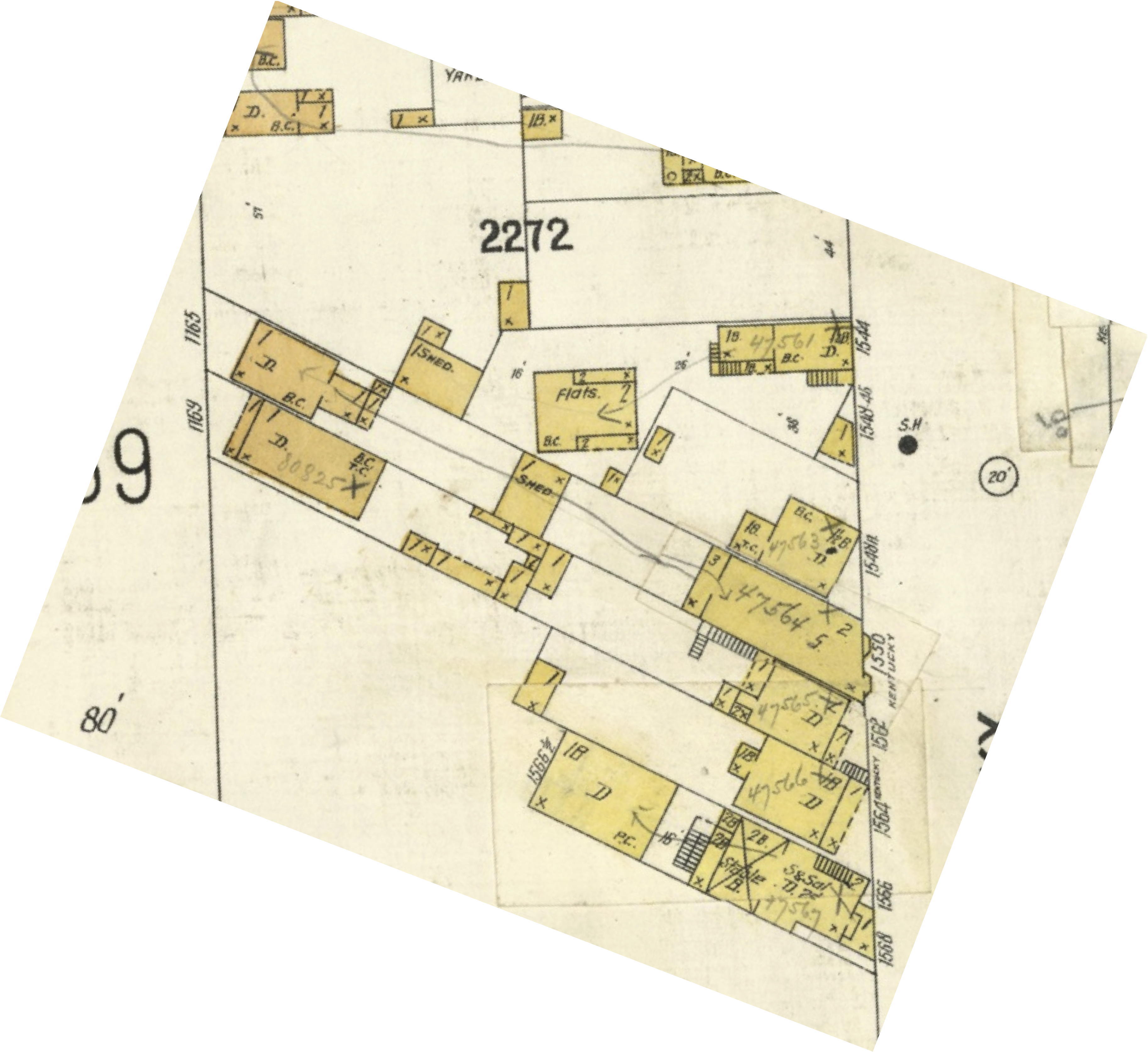
Zooming in on our angled buildings:
The National Parks Services gives us a glimpse into how Tubbs & Co got started:

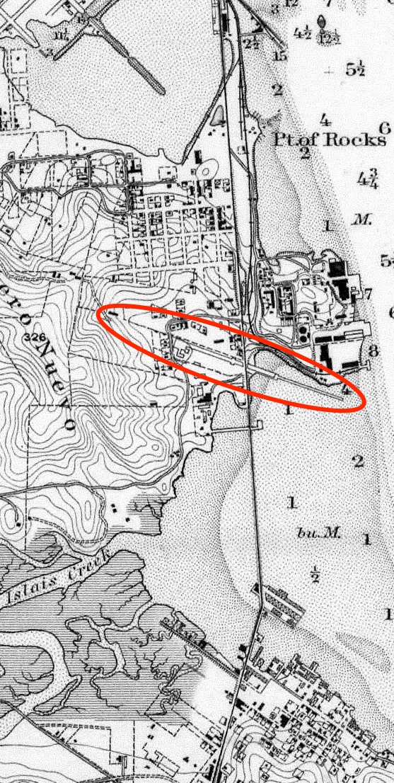
The 1886 Sanborns don’t show the extend of the rope walk, but it can be seen in this crop from the 1884 Coast Survey map, where it sticks a rather significant distance into the bay.
And this 1878 birds-eye drawing of San Francisco, looking from the north…
…along with this 1868 bird’s eye, looking from the west.

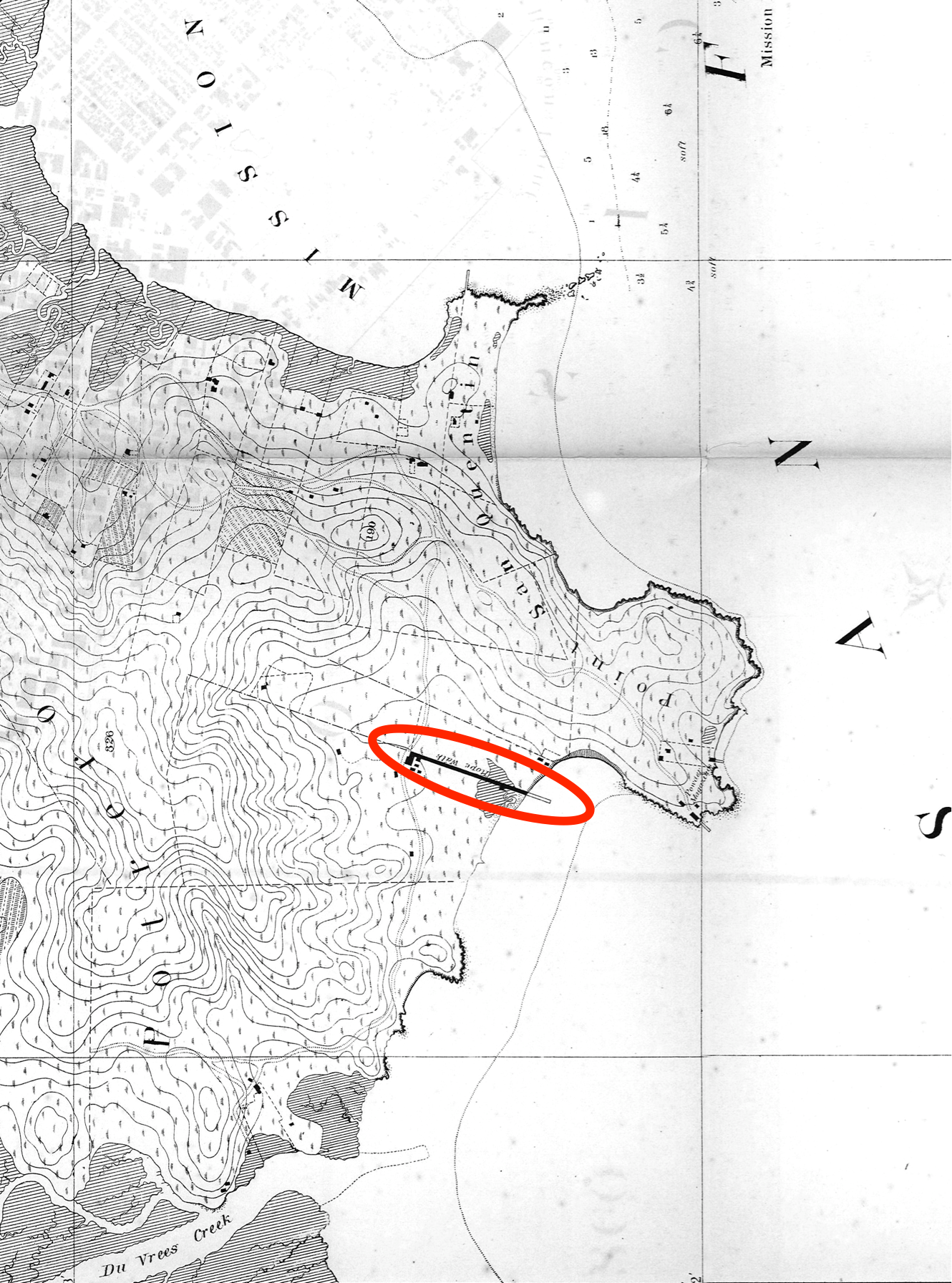
And the 1869 Coast Survey map:
And the 1859 Coast Survey map:
And just to give you an idea of how utterly isolated the area was while downtown SF boomed, here’s the rope walk sometime after 1857 (looking north, with the Bay on the right).

Zooming in on the 1859 Coast Survey map (which was actually surveyed in 1857, the same time as the photo), you can see some of the same buildings, as well as the fences (marked in green on the map). The red is my estimate of the field of view — I’m guessing the photographer was standing around 25th and Connecticut, looking to the northeast.
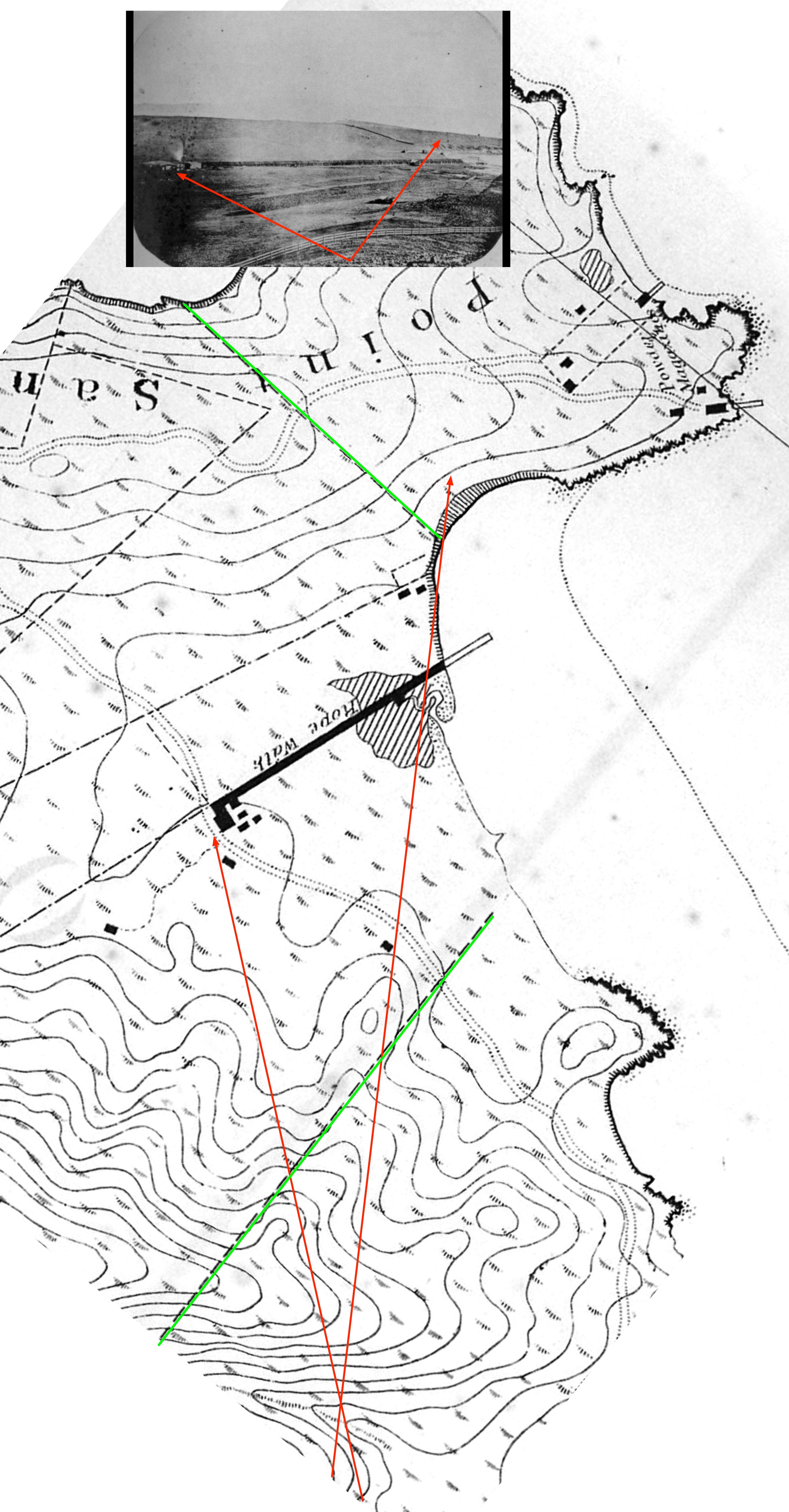
The rise is the lost Irish Hill (you can see the Oakland Hills in the very far distance). The powder magazine would be just to the right of this photo — in fact, that small building you see on the crest of the hill may be part of that complex.
An ad in the California Daily Alta from January 1857 (around the time that the photo above was taken) proclaims “the establishment of a very superior rope walk” — a bit defensive perhaps, but they must have been seriously pissing off the folks shipping rope from the East Coast in clipper ships around the horn.

July 1857: “No really, our rope is as good as what you can get out east.”

1858: But in case you want other people’s rope, we have Ratline! Spunyarn! Marline! Housline! Seizing!

1858 & 1859: “Not only do we excel in rope and cordage, but our choice of typeface cannot be beat.”

1860: prices reduced! Constantly manufacturing! Whatever you want! The rope walk NEVER SLEEPS!

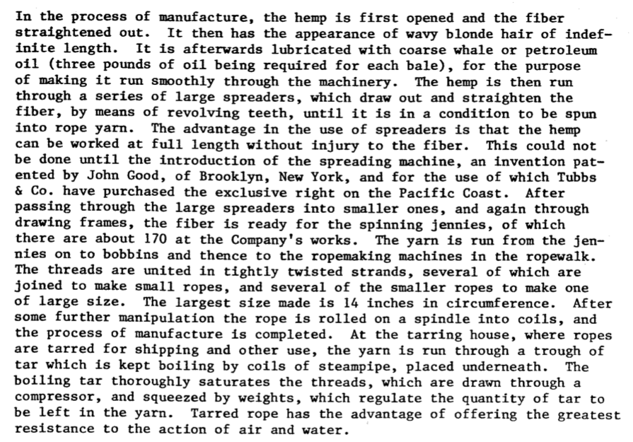
In case you were wondering how they made rope, the National Parks Service has your back with this short history:
1878: You want rope? We’ll make you rope. (But we’d prefer to make hay rope.)

1888: as they got bigger, the name of the company gets changed.

The Tubbs brothers passed away in 1896 and 1897, but the company kept going. The rope walk lasted for over 100 years until 1963.
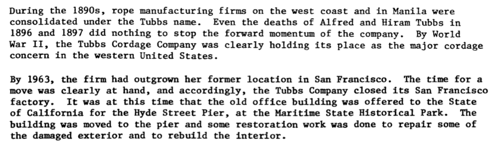
The old Tubbs office building on Front St was moved to the Hyde Street Pier where you can see it today.
.JPG)
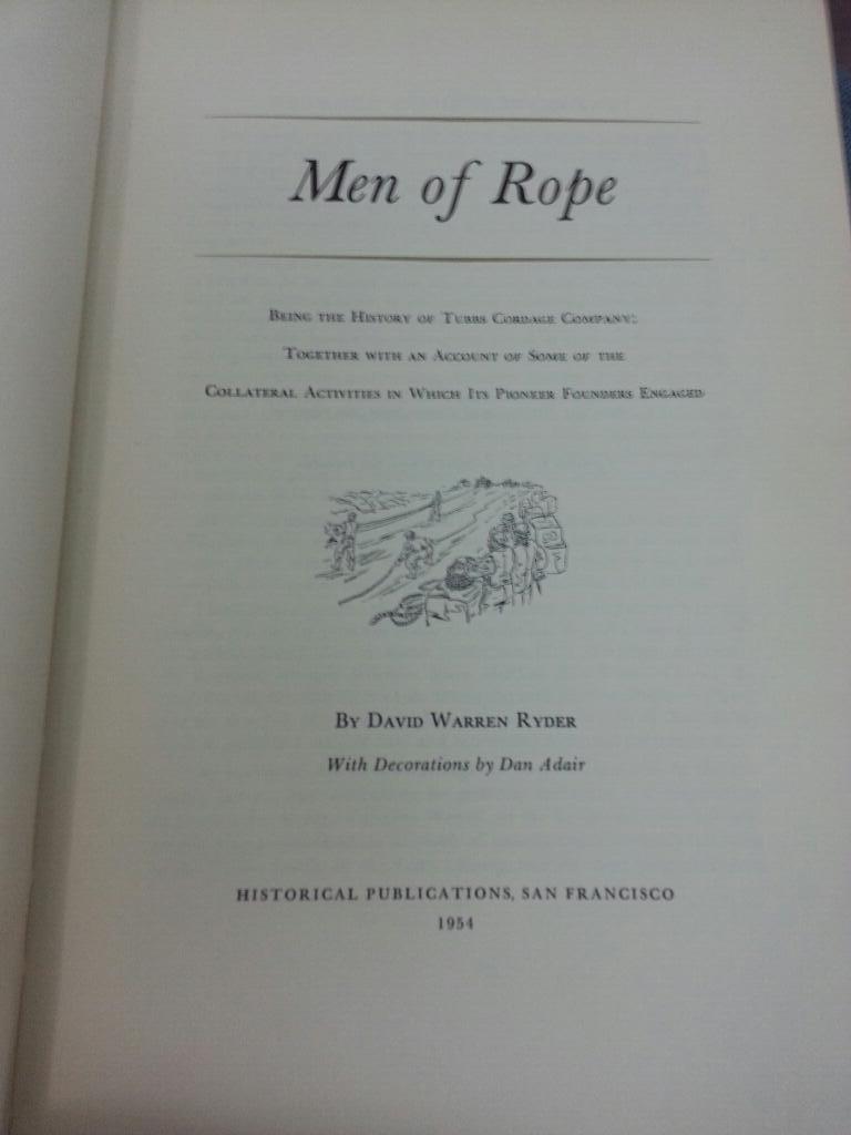
And I just learned from Wade Roush that there’s a book published in 1954 called “Men of Rope” which is now on my reading list.
https://twitter.com/wroush/status/434919657913335809


Great post! I had always thought those weirdly angled buildings were built on some long-forgotten railroad ROW. Thanks for setting the record straight. Looking forward to next week’s post.
Speaking of weird structures on old maps, have you ever heard of the “Potrero Flume”? There is something labeled that running down Potrero St. on the 1896 Rand McNally map of SF I have. Googling, however, reveals nothing… so I’m wondering if it was anything that actually existed, or just an artifact of that particular map.
Part of the water supply, but not sure if part of Spring Valley or another company… another item for the to-do list!
This is a minor point, but wasn’t 3rd Street previously Kentucky St, not Tennessee?
waaaait, are you saying Tennessee and Kentucky are in fact different states?
Arghh, but thanks, fixed the image.
This should be a very interesting set of posts Johnny. My father’s grandfather raised his Chinese family outside Chinatown in the late 1880’s in what is now Dogpatch. He worked as a janitor in Islais Creek Butchertown – nice job eh? He and his family lived in several places, though eventually were in two houses side by side on the east side of Minnesota St between 23rd and 25th, next to a vinegar factory, one of the houses having been a part of Tubbs Cordage property and moved to that site in a deal worked out by my father’s father and his brothers to take the house off the Tubb’s hands in exchange of getting it off their lands. Those houses are no longer around.
Fantastic work — it’s great to see I’m not the only weirdo interested in this kind of urban archaeology.
You know what would be amazing: finding an actual piece of rope made by Tubbs & Co.
Here’s another rabbit hole for you to go down: Are the giant gears now being used as outdoor art at Progress Park in the Dogpatch (near 23rd & Iowa) artifacts of the cordage, or of some other local “manufactory”? I heard they were dug up during construction of one of the new condo buildings on Indiana.
i found a copy of ‘men of rope’ at a bookstore in grass valley! not an entirely bad read. and fantastic now with this context. thanks!
Mr. Justice, if you’d like to borrow my copy of Men of Rope, you can feel free.
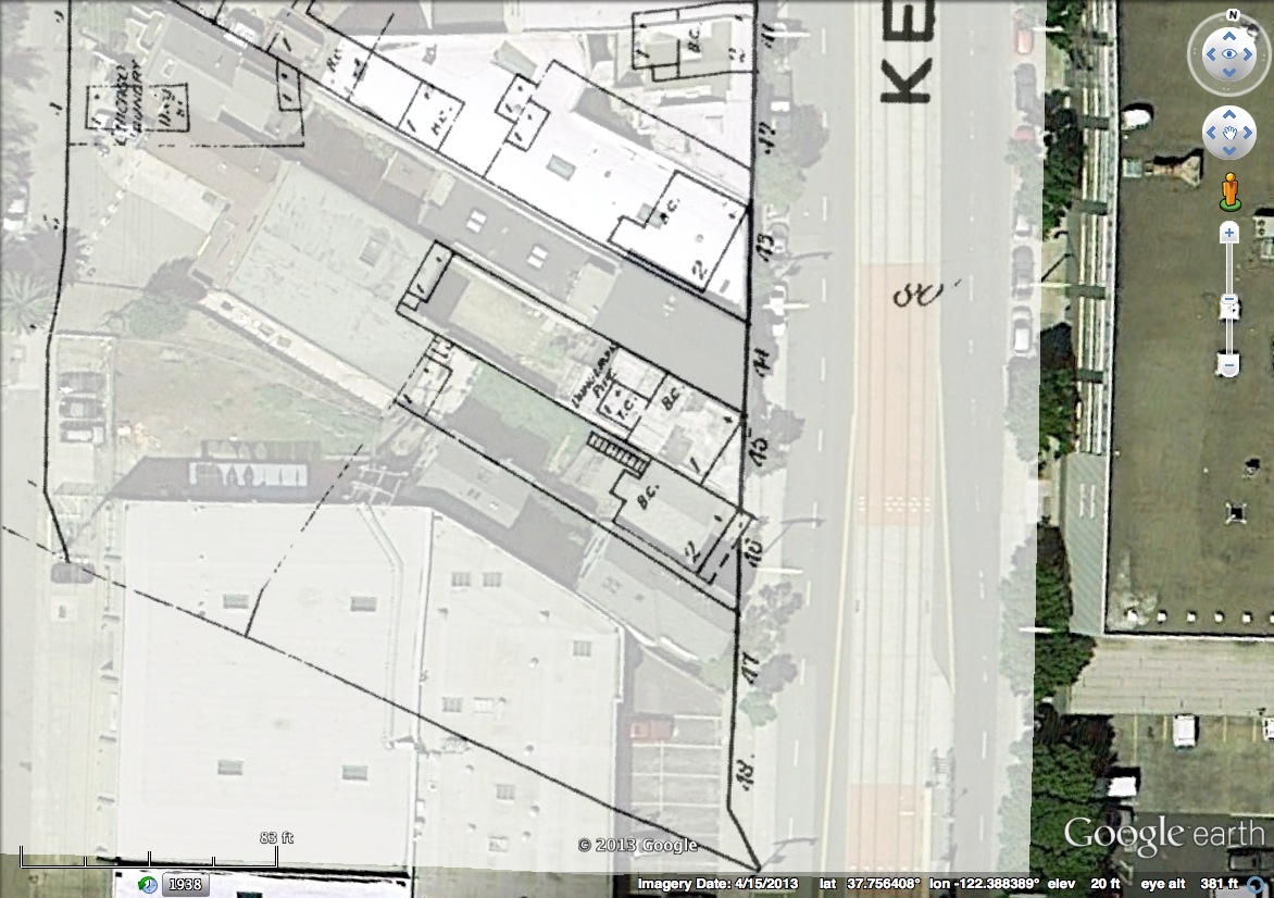
Google Earth’s historical imagery has an air photo from 1938 showing more angled structures south and west of the remaining angled buildings. .
This is outstanding work and near and dear to me as I used to live on that last block of Tennessee St., just across the street and a couple of doors up from the clubhouse. It’s a wonderfully peculiar and almost totally hidden corner of the city. A cul-de-sac, really, which is a real anomoly. And now the weirdness has a fully mapped explanation. Many thanks.
I believe Capt. Scammon. a whaler in Tubb’s employ was the Scammon for whom the Mexican lagoon was long named for, author of an early book on Pacific whales and seals and after leaving whaling became an officer in what is now the Coast Guard, worked on an underwater cable between Alaska and Siberia, and retired to what is now Sebastopol. California.
There is a picture on line of a horse drawn “dray wagon” with a very large coil of Tubbs rope on it.
Such interesting history. My great, great grandfather was bookkeeper and secretary for Tubbs Cordage for 56 plus years. He is mentioned multiple times in Men of Rope. Good read for San Francisco history.
Hi Cathy. I have been searching for various business records related to Tubb’s Cordage. I’ve read Men of Rooe and looked in the SF Maritime Museum library at their material as well as Tubbs material at the UC Berkeley Bancorft Library. My interest is that my great grandfather set up and raised his family 500′ south of the Rope Walk in 1880 through 1945. He was Chinese so this was very very unusual. Talliant Tubbs gifted my family a house in 1920 that they moved into when Minnesota Street was built between 23rd and 24th eradicating their earlier compound partially located in the middle of the then unbuilt street. So my guess is that my great grandfather Lim Lip Hong and his oldest son Lim Sing had employment/business relationships with the Tubbs factory over a long period of time. Does your family have any stories about Chinese contacts during that period of time? Glenn Lym
Hi Cathy, I’m working with a group of people on an Arcadia book on Dogpatch. Do you have more information, photos particularly, about your great grandfather? I direct the Potrero Hill Archives Project. all the very best, Peter Linenthal ppotrero@pacbell.net
Glenn, send me an email. artubbs@gmail.com
My grandfather arrived in SF in 1851 by way of ship around the Cape of S America from Brooklyn – he worked for SF Cordage then Tubbs – I’m coming to SF next week – are these buildings still standing?
None of the building survive above ground. The best remind to are the slanted property lines that still exist and thus have influenced the current building, as noted in this Burrito Justice article.
Does your family carry with it any stories about Chinese workers at Tubbs?