How Flickr Sees The Missn
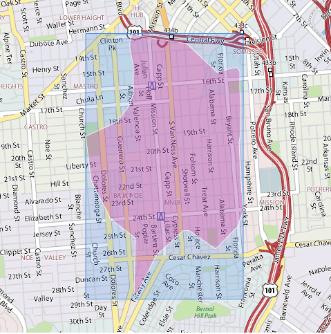
Flickr has taken geo-tagged photos and built maps of neighborhoods based on the geo-ids. Here’s the Mission:
Pretty accurate, all and all — the western edge is pretty interesting. But I’m glad to see some of the area south of Cesar Chavez recognized — sorry, no way that’s Bernal. I’d argue it’s The Mission all the way to 30th and back down San Jose/Guerrero. (SoCha? Not sure on that name though. I like “La Lengua” myself.)
I do like some of the borderland micro-hoods that Yahoo Maps names:
– Transmission (aka SoCha?)
– Baja Noe
– Mastro
– Somisspo?? (Um, OK…)
What else should be there? Two proposals:
– “El Corazón” — along 24th between Mission and Potrero, Cesar Chavez to 22nd
– “Hipster Valencia” — a block either side of Valencia (say San Jose/Linda to Bartlett/San Carlos?) between 24th and 17th
– “La Lengua” — Mission from Cesar Chavez to 30th, back down San Jose/Guerrero
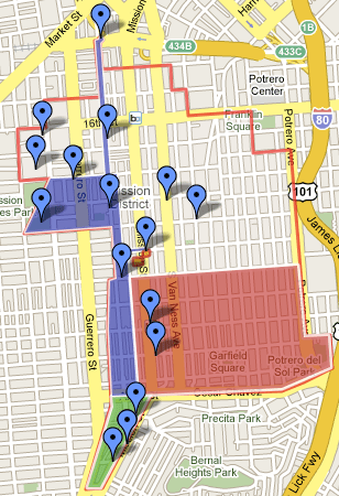
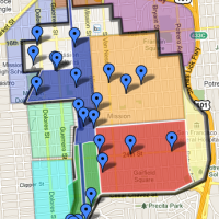
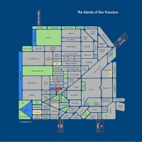
UPDATE — a completely arbitrary map of the Mission and the above microhoods. Importantly, this includes two areas that should *not* be in the Mission.




I used to live on 24th and York. My housemates and I came up with some micro-neighborhood names…St. Francis Square, Pops Valley, and Norteno Gulch.
I’ve heard MiSoPo instead of Somisspo, which is way funnier.
Somisspo? no way, it’s totally Somishtrero, everyone knows that.
Hahahaha, MiSoPo!!!
When I lived in Japan, I just about fell on my kotatsu when I saw this ad with James Brown for Misoppa:
http://www.youtube.com/watch?v=pzbSburmZY4
SOTO – South of Townsend.
The soulless area around the ballpark and the ucsf campus over there. I think “The palms” on 4th street has to be included even though it’s north.
“The Nission.” Area of 24th st. and surrounding streets in between Church and Guererro….
I like that.
Or how about the “The Notion”? (because “Noession” and “Nossion” look weird…)
I have heard what you call “Hipster Mission” called “The Valencia Corridor”; Of course, that was by real estate agents who were trying to increase the desirability (and price) of the places they were hawking by given them any designation other than “The Mission”. I think “Baja Noe” has a similar pedigree. Whatever you call it, there is a definitely a transition zone now between end of Noe (say Dolores St.) and the heart of the Mission (starting at Mission Street)
I was defining “Hipster Valencia” purely by bicycle density rather than real estate agents, but yup — they tried the same for “Valencia Triangle” where Valencia hits at Mission south of Cesar Chavez.
The overlap can get tricky. I’d like to figure out a way to have a “map poll” where you could select which neighborhoods you feel you are (and aren’t) in, then the magic of web 2.0 will generate a heat map. I think the “not-map” would be the most interesting.
I like La Lengua, but my coinage is TriBeCha (triangle below Chavez). It’s fun to say, *and* it makes fun of New York. What could be better?
My friends and I simply call the La Lengua/TriBeCha area SoCeCha (South of Cesar Chavez)