The Last Shuttle Slips Away
Last night around midnight, a Space Shuttle undocked from the International Space Station for the last time.
Here are a couple of screenshots from NASA TV:

And of course a couple of animated GIFs:
“Space Station, dead ahead!”

I *really* like how this one came out:

In a heartbreaking development, 2.9 year old Taquita Justice has become fascinated with the Space Shuttle. We were listening to the news on NPR in the car, and she yelled out “Daddy! The Space Shuttle! They’re talking about the Space Shuttle.” (At least I can show her the ISS the next time it passes over.)
It’s hard to believe, but I remember listening to one of the first launches of the Space Shuttle (the 3rd, I think), holding a transistor radio to my ear in my elementary schoolyard. And last week I watched the launch of the last shuttle on an iPad with my daughter sitting on my lap. Plus ça change.
I just hope she’ll have a cool space mission to show her kids.
Spin Your Sanborn Maps
A few weeks ago, I made a vague promise that I would hack together some sort of overview map of the rather lovely 1905 Sanborn maps of San Francisco, scanned by the all-powerful David Rumsey.
All 700 of them. Gulp.
Fortunately, Mike Migurski of Stamen Design took pity on me and they whipped up with a crowd-sourcing interface and database to place, scale and rotate the Sanborn maps!

More details on Mike’s blog.
It’s quite fun (not to mention theraputic), and is coming along quickly. Place some maps before we run out!
Thanks again to the guys at Stamen.
Burrito Trap
So I laid down a paper bag and baited it with salsa. Look what I caught!

In the name of burrito science, I inverted the colors.

Kind of looks like Chipotle. In a reactor. (While the chips are obviously emitting Cherenkov radiation, levels are within acceptable limits. The yellow salsa concerns me however.)
This of course was the subject of The Firm’s classic, Radioactive:
Well, I’m not uptight
Not unattractive
Turn me on tonight
‘Cause I’m radioactive
Additional analysis provided by KevMo.
Sutro Dog Experiments

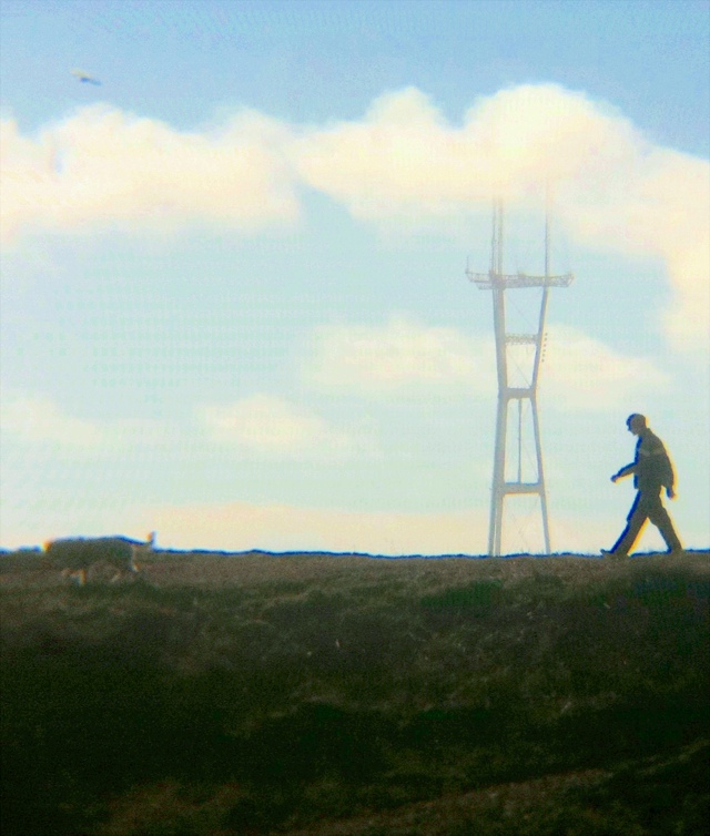
Sutro Fog Zoom Timelapse
More fun with the iPhone and 8x zoom lens and yesterday’s fog:
Check out the plane! I saw it coming and rushed to get the gorilla tripod set up, thus the jaunty angle.
My first pass at this was handheld, pretty much a disaster.
But I found a nice video stabilization app called Movie Stiller which did a pretty damn good job smoothing things out.
(Even with the tripod/clamp the wind was shaking the phone quite a bit, so the note that the very first video was also stabilized. You can see the original over at my experimental Tumblr page.)
I tried another pass with today’s higher fog but surprisingly the results were worse – the stabilzer had nothing to lock onto with full fog and it ended up looking like a dogfight from Battlestar Galactica.
(What I really want is to turn one of these onto an animated GIF loop where the fog clears to reveal Sutro, then closes in again. Rinse, lather, repeat.)
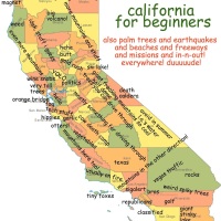
International La Lengua Conspiracy Theory
The good news: La Lengua has gained international recognition! We are now on the map, quite literally, in Japan, Korea and Russia. (I can just imagine the Google maps localization teams saying “You want me to type *what*?”)

All together now!
ラレングア!
ララララレングア!
Unsurprisingly, La Lengua was not translated into any of the Chinese or Arabic Google Maps. No Taco Spring. The revolution will not yet be Sinologized. (This is obviously due to the lack of Mexican food in China, and the clear and present threat posed to wraps and shwarma by burrito supremacy and weaponized tacos.)
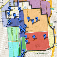
The bad news – and this is bad news – is that La Lengua seems to have disappeared from the most recent iteration of the English Google Maps. You may remember the heady glory days of the revolution when La Lengua was practically visible from space:
But as you might have noticed on the first frame of the top gif, La Lengua is missing.
Google giveth, and Google taketh away! The LaLeReCaCo (La Lengua Revolutionary Cartography Council) is maintaining active watch (i.e. hitting refresh and hiding tears) on this disconcerting development.
But regardless of the naming whims of our mapping overlords, La Lengua will live forever as long as taquerias roam free. ¡Viva La Lengua Libre! ¡Continuar La Lucha!
Adjustment Bureau, Sanborn Unit
While watching the Adjustment Bureau, I noticed them using Sanborn maps:

I leave it to New York readers to determine the location.


(But seriously, A.B., you have those kick-ass displys in your Moleskins but aren’t using the color Sanborn maps?)
A Space Station in my Backyard
A rather glorious and stately pass of the International Space Station this evening. View from my yard.

(Note the Big Dipper.)
This pass is about as good as it gets. It was so bright, I could even pick it up on my iPhone camera:

Can’t wait for those Earth-facing HD cameras to be mounted onboard.
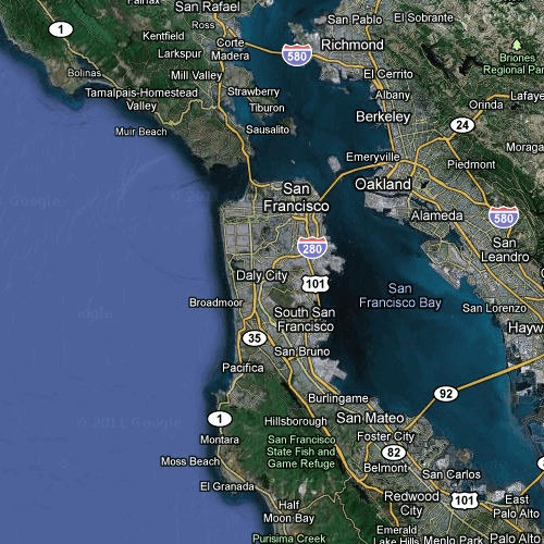
The Last Great American Highway
280 > 101

(This is actually a panorama, 3 shots.)
Golden State:
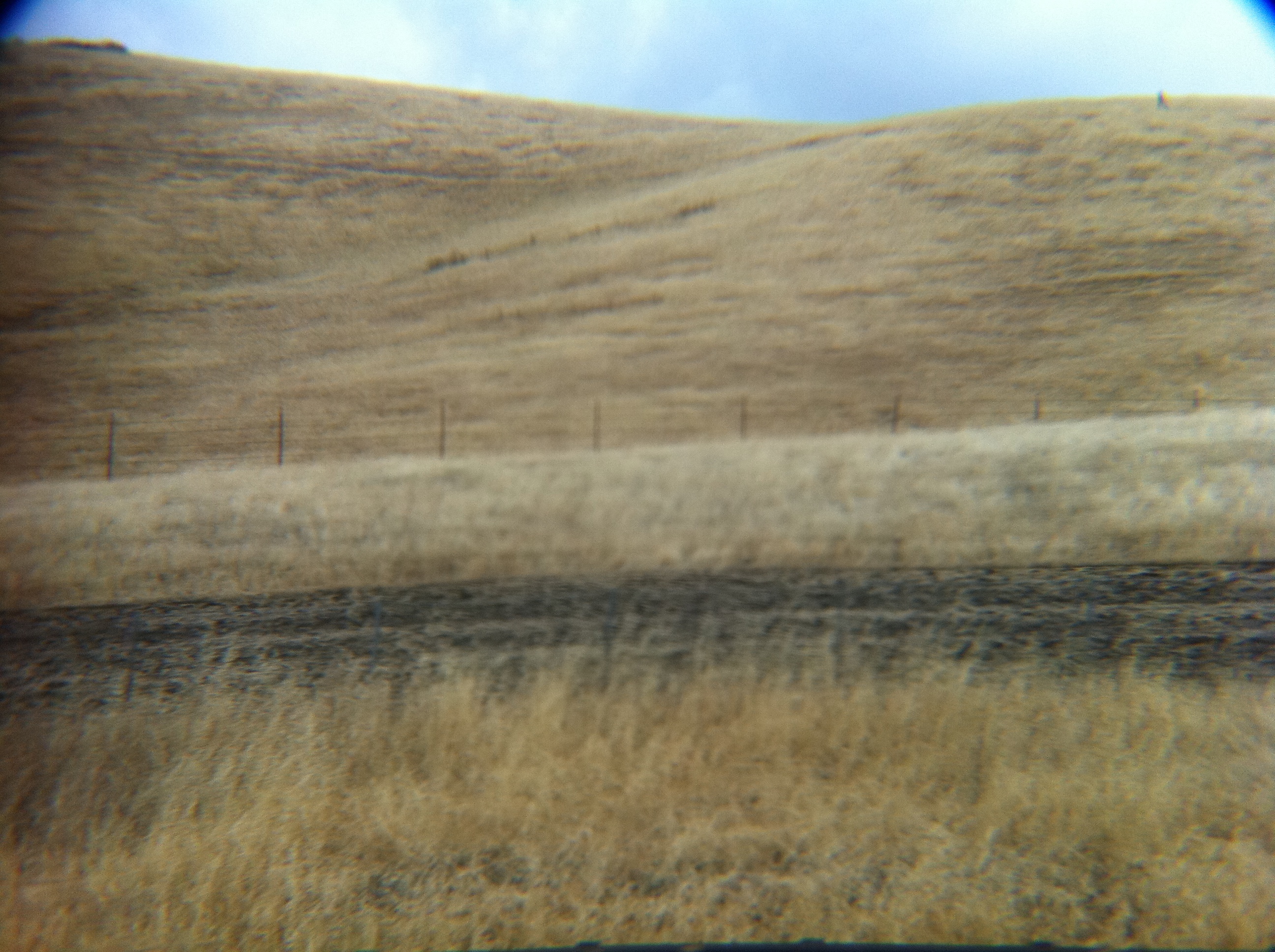
(But no cows, dammit.)
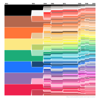
1905 SF Sanborn Maps, Now in Color
Big historical map news — David Rumsey has scanned the Sanborn fire insurance maps for 1905 San Francisco.
The black and white images you often see here in the Burrito Justice Time Machine are merely scans of microfilm versions of the color originals. Mr Rumsey worked with the 6th Floor of the San Francisco Public Library to get the originals digitized, and the results are rather wonderful.
Oh, the irony of these volumes being damaged by fire in 1906.
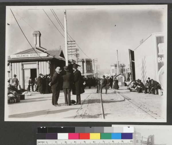
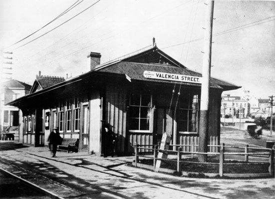
I’ll obviously be digging into these a lot more over the next few weeks/months/years/rest of my life, but just for flavor, here’s the old Southern Pacific train station at Valencia and 25th.

Here’s the station itself:
1906, looking towards the city (well, northeast, actually). via Calisphere
Looking in the opposite direction (south):
(This and more in a nice collection of shots along the old SPRR line in this unfortunately stagnant blog.)
There’s another picture of policemen at the station waiting for President McKinley but I can’t find it right now. UPDATE: found it, but it doesn’t show the station — I think that’s looking north across the triangular yard towards the building across 25th St – 299 San Jose to be precise. You can see the funky bay window on the full map. Nice turret! (That would make a great place to put a webcam! If, um, well you know what I mean.)

Oh, and for those concerned that there was only one saloon on this block (hi TK!) fret not as there was one just north of the station, and a ton up by 24th & Valencia, including a billiard-saloon combo! (Right next to a church.)

Anyway, here are the index files for our side of the city. Once your figure out the map number your block is on, it’s easiest to search for “[map number] Sanborn 1905” in the search box. (At some point I will make a mapesque clickable HTML grid — today is not that day however.)
Volume 6: La Lengua, Noe Valley, Glen Park, Castro (basically east of Douglass, south of 17th, west of Mission) along with a little bit of the Sunset and Ingleside, Oceanview and Portola):

Volume 5: Mission, Bernal, Potrero, Dogpatch, Hunters Point (basically south of 16th, east of Mission):

Have fun. I apologize in advance for the massive drop in productivity in the Mission, La Lengua and Bernal this week.
UPDATE: To avoid hue and cry and accusations of Mission/ La Lengua favoritism, here are the index files to the other volumes:
Volume 1: Above Market , to Van Ness (North Beach, Downtown, Russian Hill, Nob Hill, Civic Center)
Volume 2: South of Market, north of 16th, SE of market
Volume 3: Western Addition, Van Ness to Broderick, Market to the bay (Pac Heights, Cow Hollow, Marina-to-be, Duboce, Lower Haight)
Volume 4: Broderick to the beach (Upper Haight, and what will become The Richmond & Presidio Heights)
p.s. So it looks like the Luna viewer isn’t very (read: at all) iPad friendly. Anyone know of an iPad/iPhone MrSID viewer? Or better yet something in HTML5? (Though I would totally buy a David Rumsey iPad app. Hint hint, @DavidRumseyMaps.)
And as an added bonus for those of you who read this entire article, here is that map of the block of Valencia / San Jose / 25th / 26th in BurritoVision:

One day I dream of cropping, merging and converting this entire Sanborn map set into seamless Google Earth tiles. Imagine an iPhone app where you could stand on a corner and pull up the Sanborn map to see what was there. You turn around, and the map rotates with you. Awesome, no?