Year of the Bay, California Historical Society
There are many reasons to like the California Historical Society on Mission between Third & Annie. They have an awesome building that is painted International Orange.

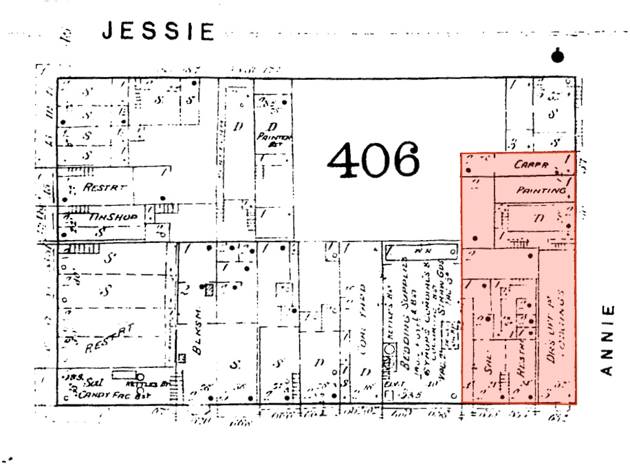
Also, part of it once housed a saloon in 1887:
As for now, it’s full of historical records. It’s currently focused on the Year of the Bay, a project that aims to collect photos, videos, and stories from everyone to tell a better story of the history of the Bay Area.
The exhibit is perfect for your lunch hour or a weekend stop.

Lots of maps, naturally:
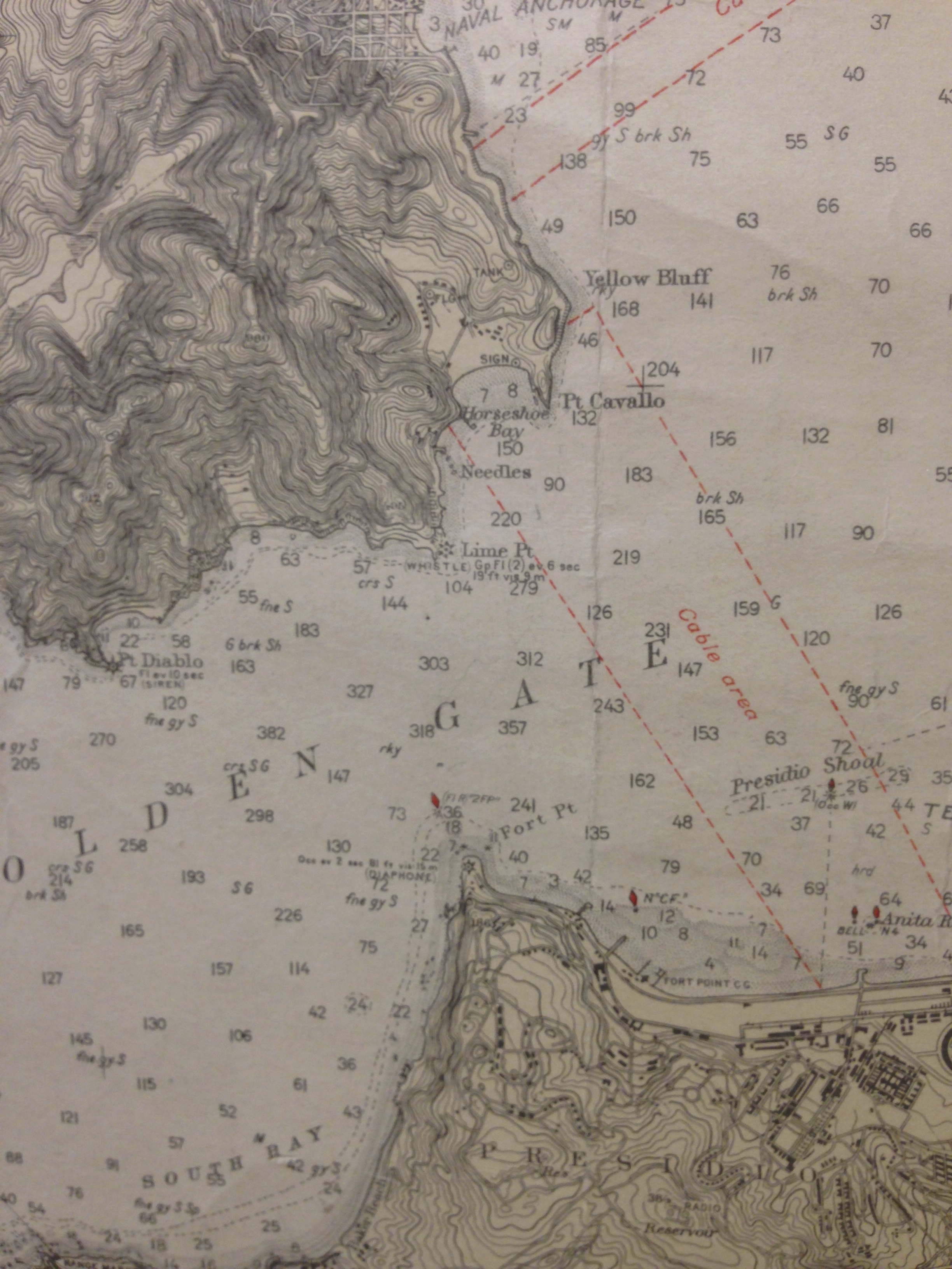
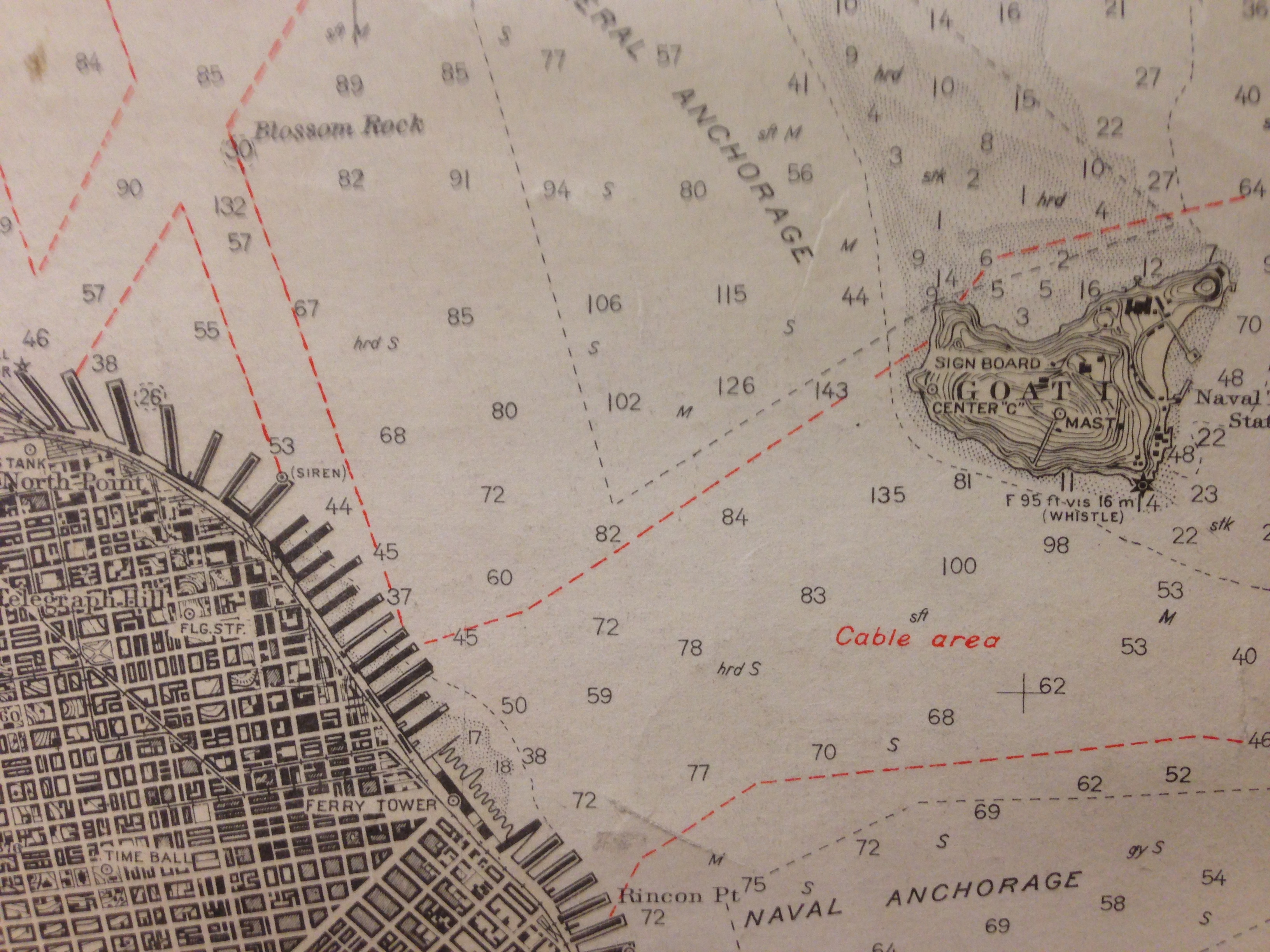
Some detail from the 1927 Coast Survey map (no bridges):
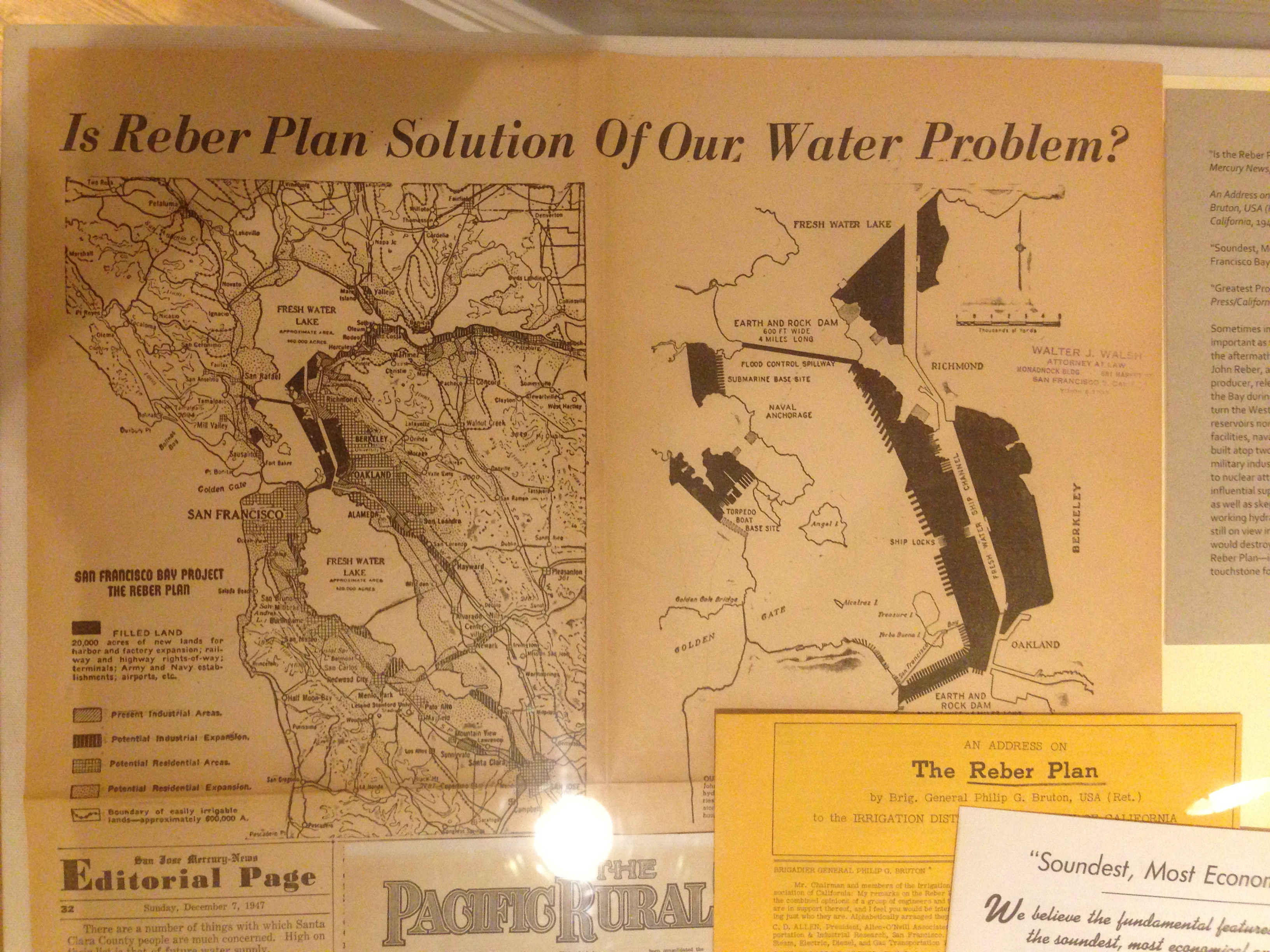
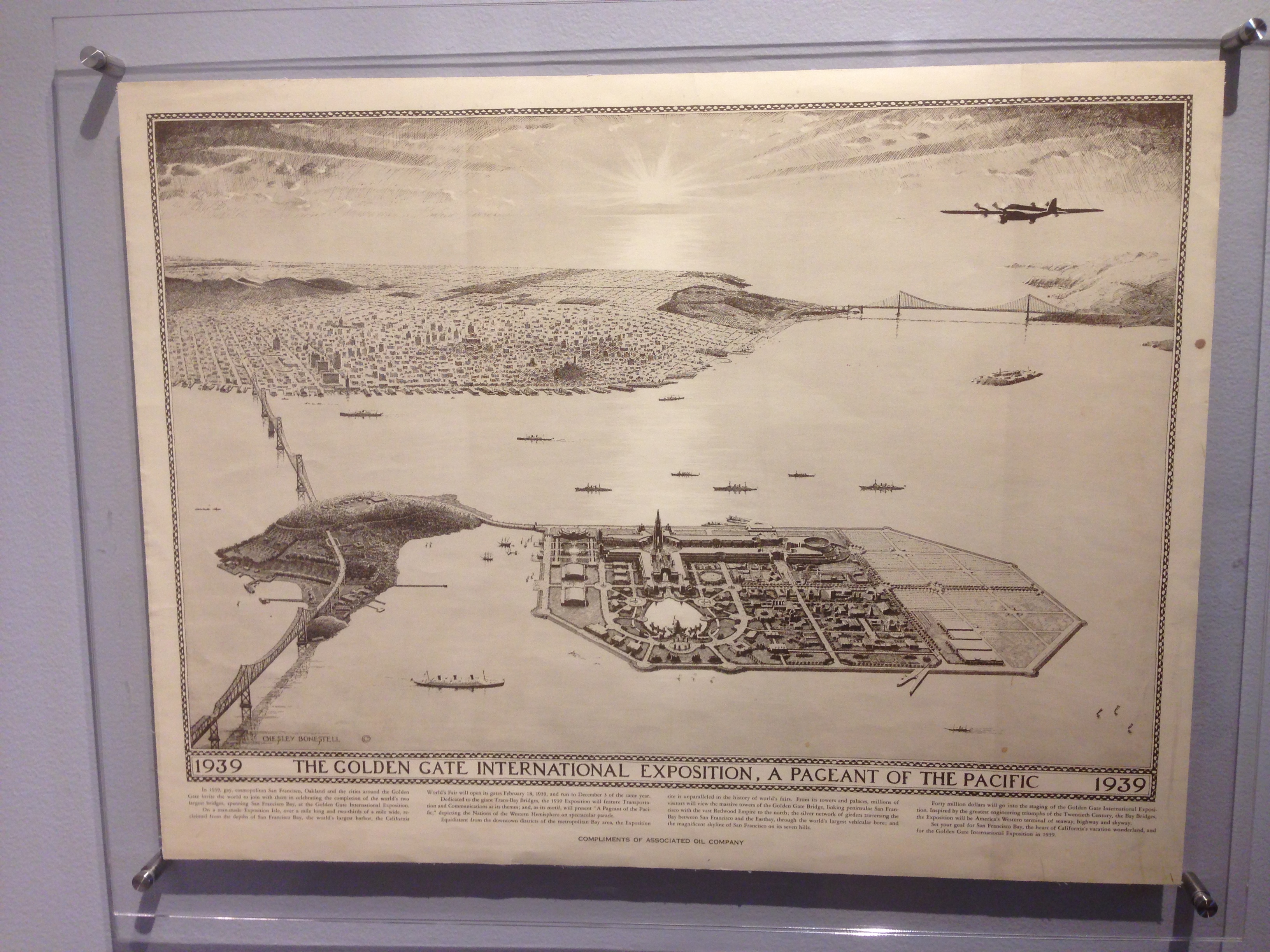
The absolutely insane Reber Plan to dam the Golden Gate:
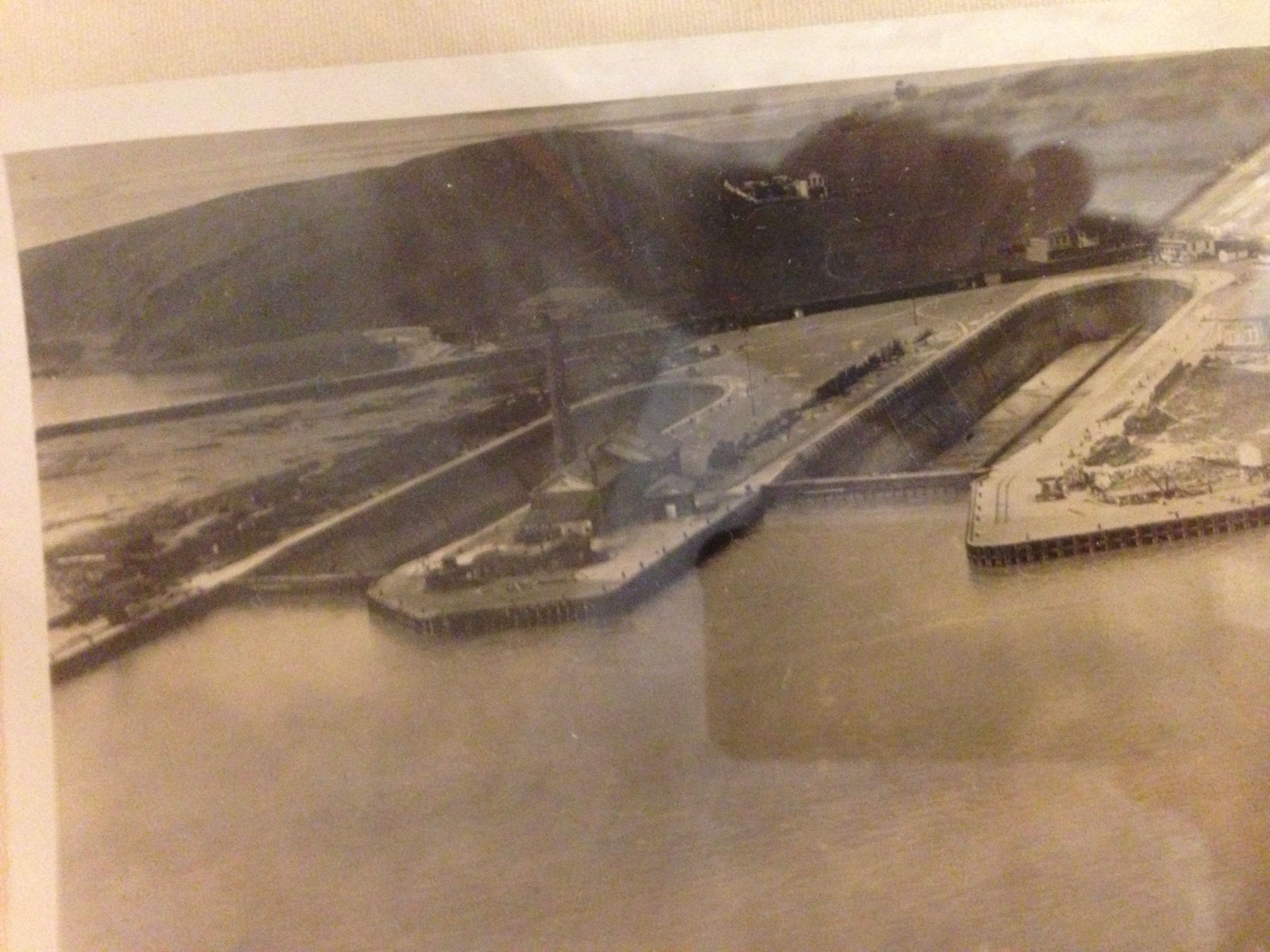
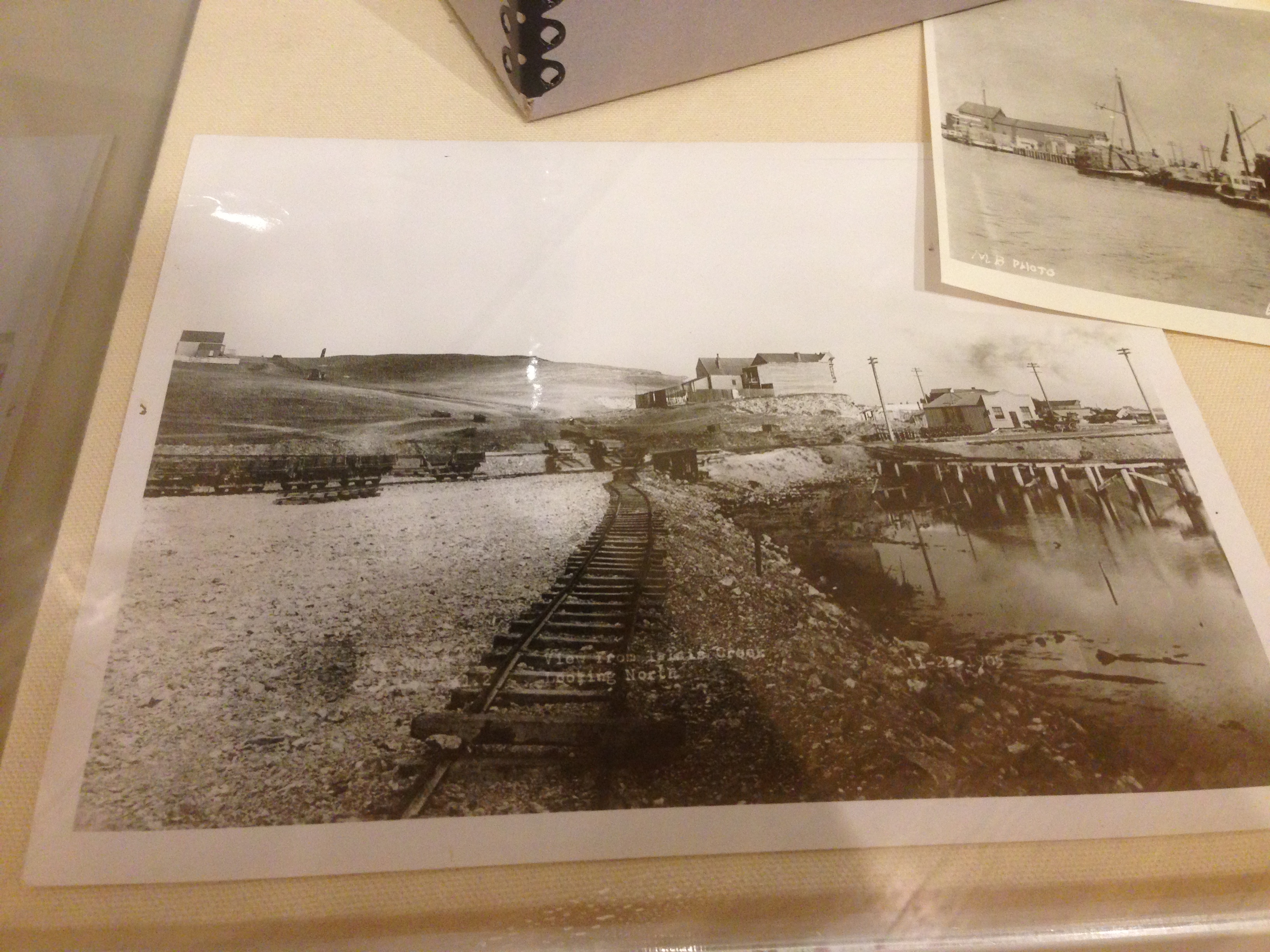
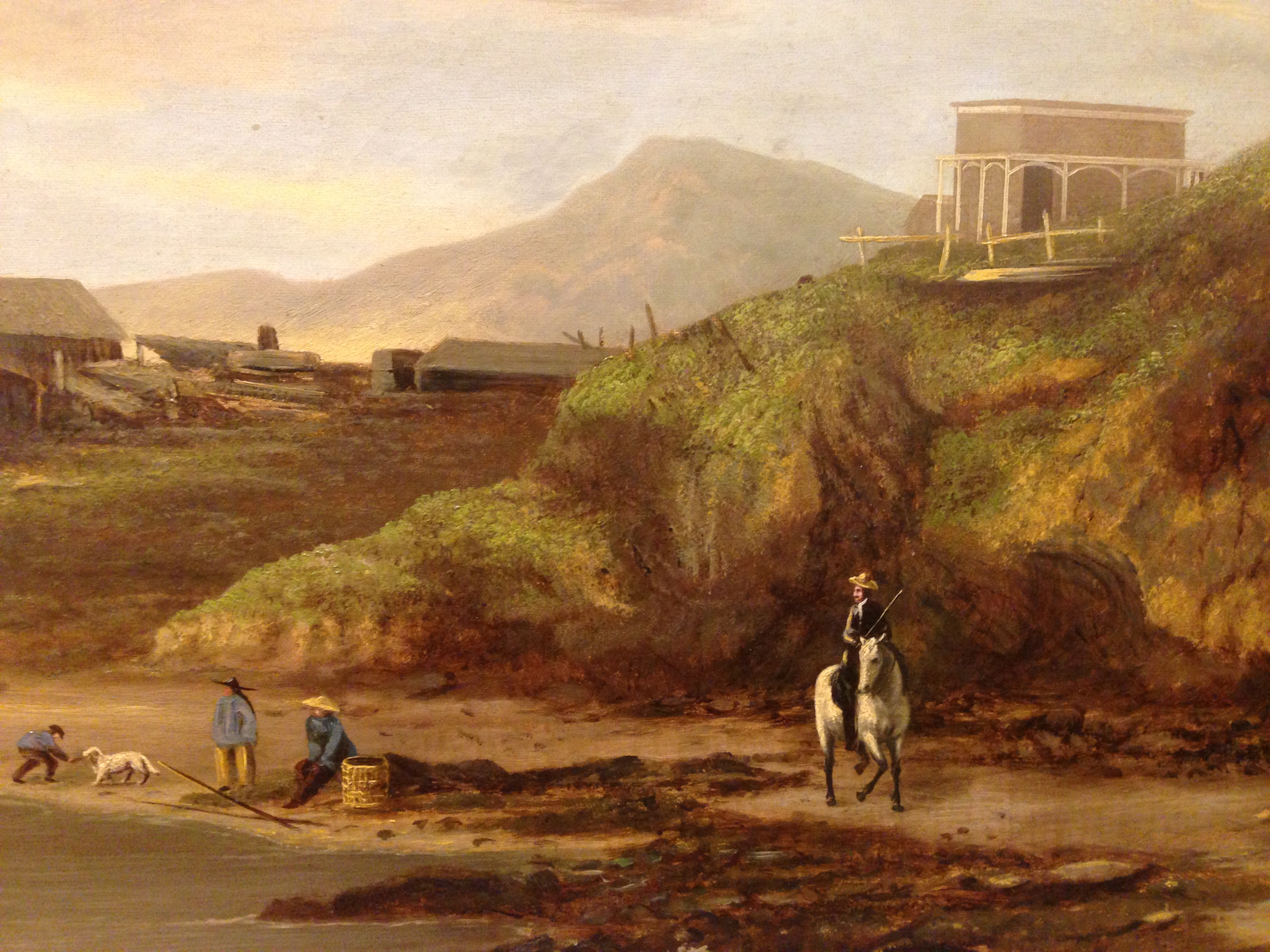
Lots of historical photos of, including Hunters Point and Islais Creek in the mid to late 1800s:
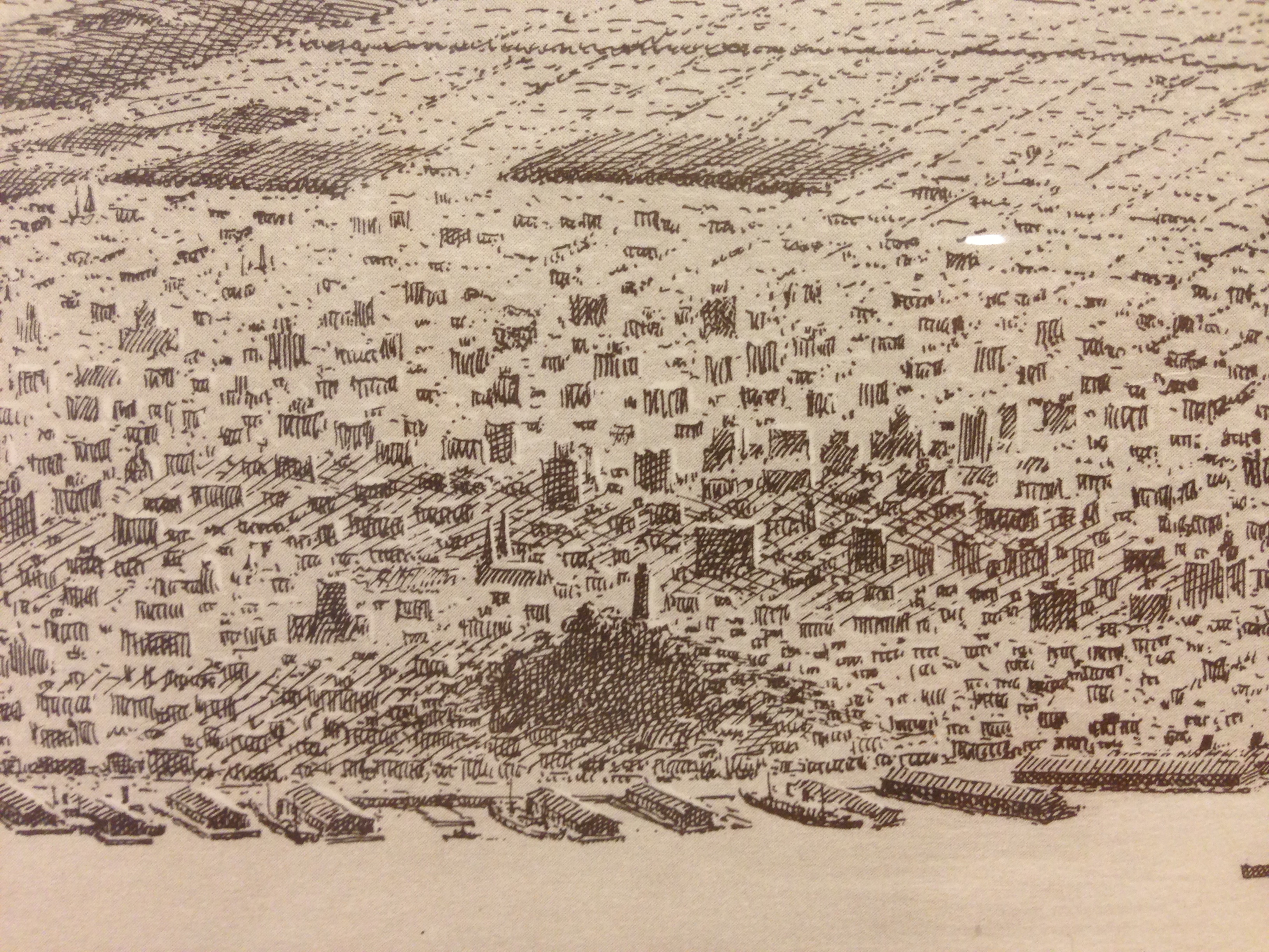
I was most surprised by the sketches and paintings. The crosshatching in this aerial view of SF is amazing:
Incredible detail in this drawing of the Lombard, North Point and Greenwich docks:
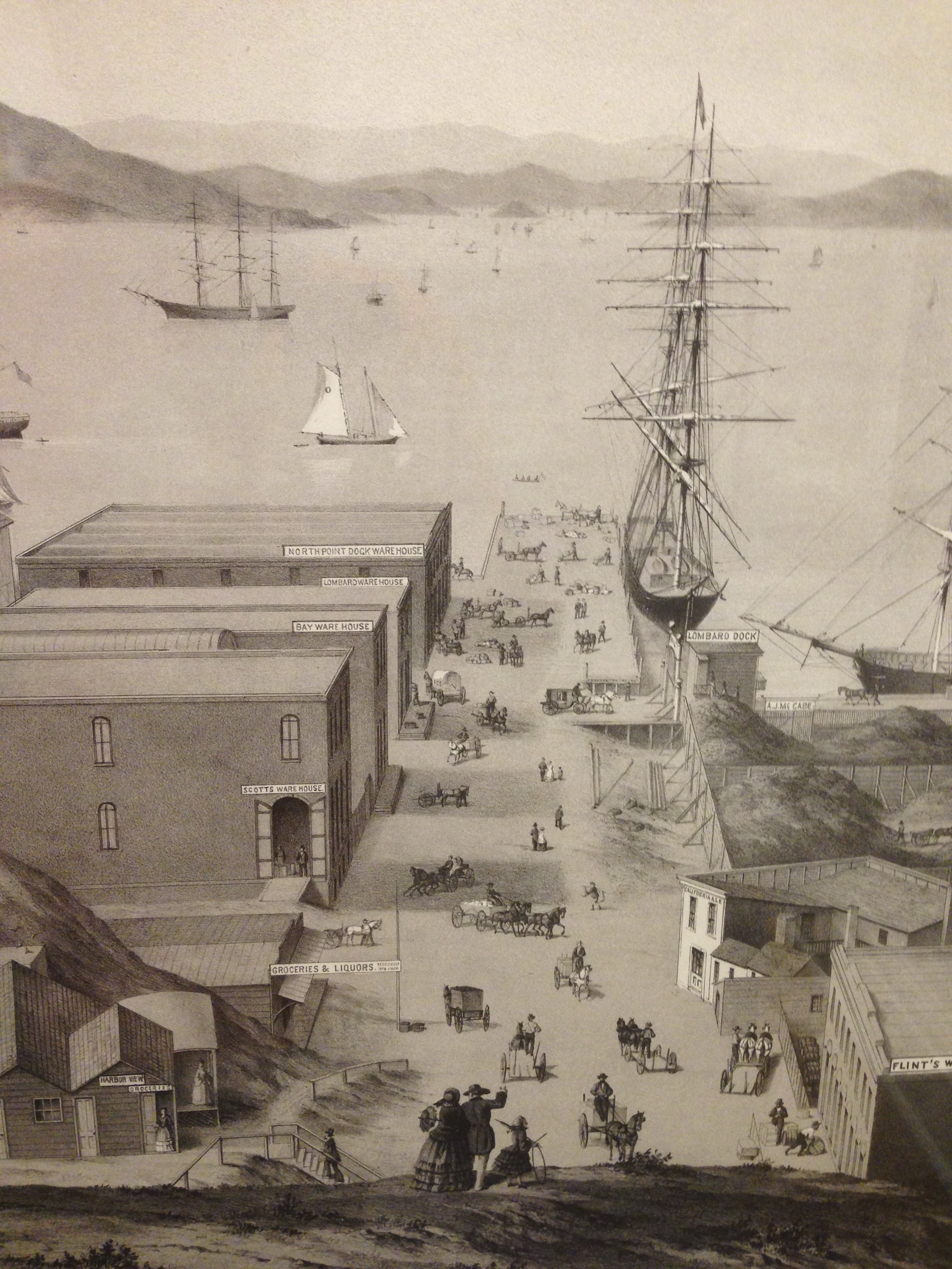
Ladies shopping.

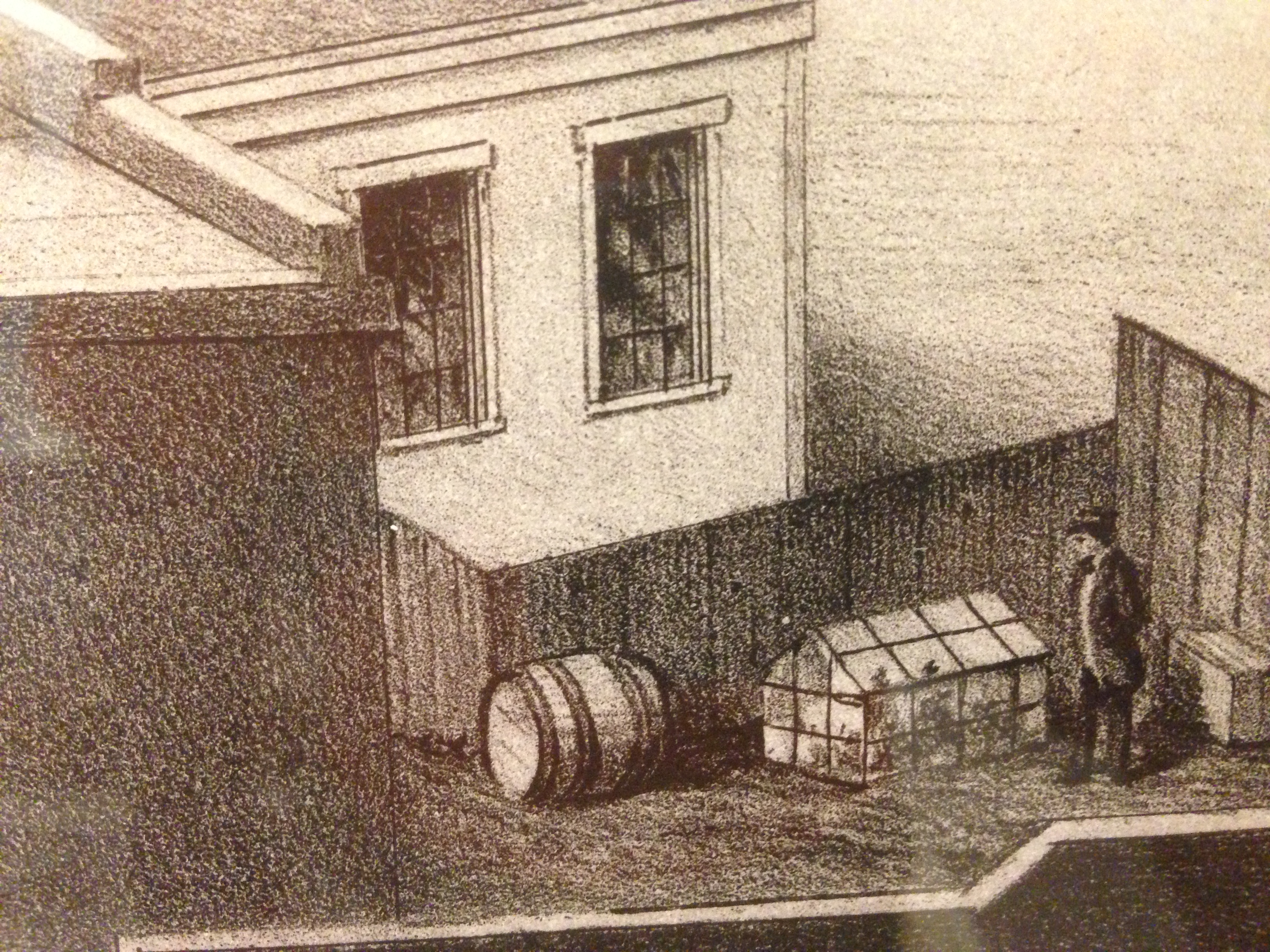
Not entirely sure what this guy is doing. Probably a grow-op.
California Ale!

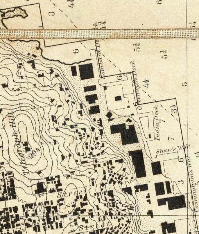
You can see the Greenwich and Lombard docks at the foot of Telegraph Hill in the 1859 Coast Survey map:
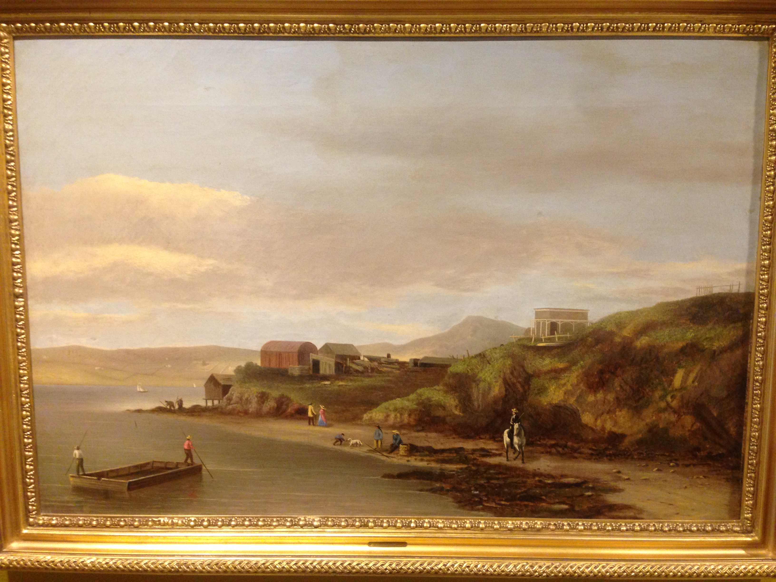
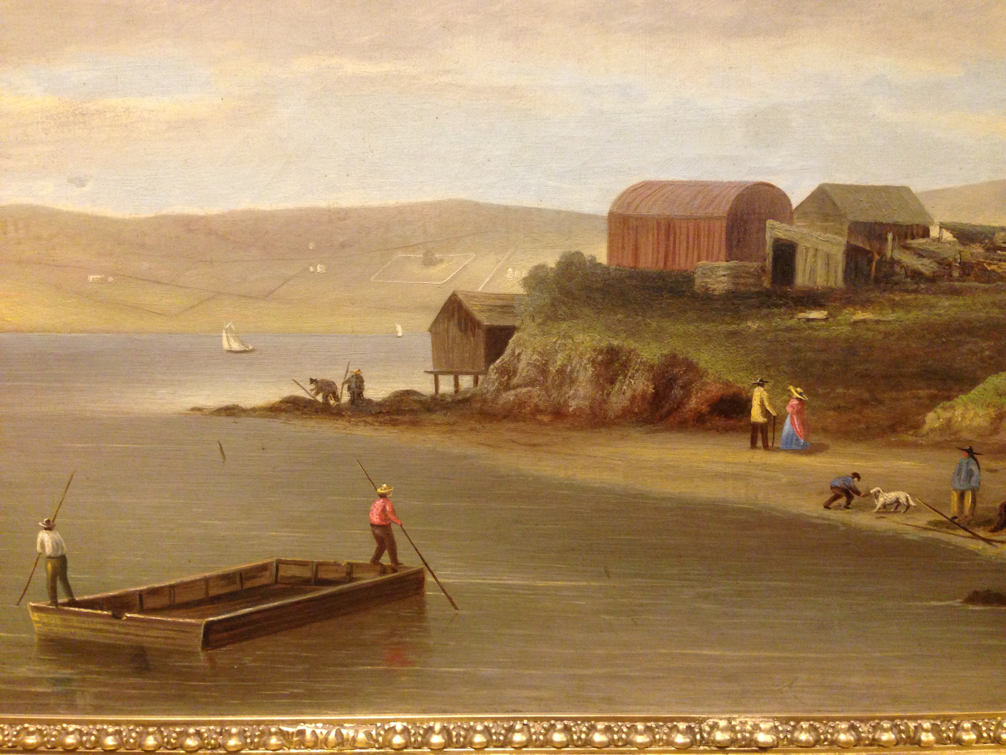
Then come things that take you to another time and place. This painting of Hunters Point in 1859 is a little surreal, showing a very different world:

Anyway, the California Historical Society exhibit is well worth your time, as is the Year of the Bay / HistoryPin website.


Very cool. I love that place.
Awesome! Thank you! I’m totally going to go there today!
GG: I’d totally glom on to your plan today if I didn’t have a lunch date already. Boo! Last time I was there was for the Drake’s Bay oyster exhibit…
Also, 1927 Coast Survey maps: Blossom Rock? OK. Yerba Buena = GOAT? This I like…
Help me tell the story of the explosives industry from Glen Park to the Panhandle to Santa Cruz to Hercules, Berkeley and Pinole.
!!!
Step 1, start explodingthebay on WordPress.
I just went and read the Wikipedia on the Reber Plan and, of course, the SF Chronicle endorsed it at the time. Good lord. That is truly a frightening institution.