I’ll Meet you at Valencia and Falcon
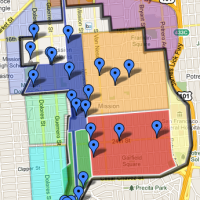
Mission Mission points us to the most excellent 1861 Langley map of San Francisco, with great detail around the Mission.
It shows the planned street grid with many proposed names that didn’t quite make it when they extended the numbered street grid past Market (or they never made the street at all). Though I really like “Falcon” between 17th/18th and “Eagle” between 18th and 19th!
South is up to make the street names easier to read.

And it looks that was Mr. Treat’s place right by Precita Creek (north is up):

Notice Mr. Bernal’s house in the bottom left corner. I guess the trick to getting something named after you is to live there before anyone else (or make the map yourself…)
I hereby rename Army/Cesar Chavez “Burrito Justice Avenue!!” And we have to starting calling Mission St “Mission Mission.” Any other suggestions?
Also another big creek along Cesar Chavez/Army (though south of Valencia it the road was named “Serpentine Avenue” until they straightened it out in the 1880s):
This branch of Islais Creek left it at a point where what is now Evans Avenue intersects Army Street and proceeded in a winding westerly, southerly and northwesterly course crossing Army Street three times between Vermont and Utah Streets, its channel being in what is now Army Street from Potrero Avenue to San Jose Avenue. Though the channel itself was not very wide after crossing Potrero Avenue, the marshes, according to William J. Lewis, to whom we shall refer in a subsequent chapter, were from six hundred to eight hundred feet wide. From Potrero Avenue southwesterly to San Jose Avenue it was paralleled on the north by what was known as Serpentine Avenue and on the south by Precita Avenue, the latter, however, extending to Mission Street. The creek was probably fresh water from San Jose Avenue for some distance easterly.
The legislature in 1878 authorized the board of supervisors to construct a sewer in the channel of the creek and to abandon all of Serpentine Avenue. Pursuant to this, Army Street was extended westerly over the former channel of the creek, the course of which is indicated by Army Street as it now exists.
I think Cesar Chavez would be far more entertaining if it had all those crazy-ass turns (basically like Precita is now). You can see the last of Serpentine Ave where Capp makes that bizarre intersection with Mission and Cesar Chavez, right by the Palace Steak House.

Orange is Serpentine Ave, blue is the creek, red is the Pioneer Race Track:

Lots more interesting creek and water related history on the SF Museum site. It is pretty astounding what they filled in and paved over.


And just look at what Chavez/Army & Mission looked like before it was widened from 40′ to 100′ (until the freeway revolt happened when the City got to Guerrero):
http://3400cesarchavez.net/en/history/armyandcesarchaveztoday
For the record, Eagle does exist today west of Kite Hill. Although today’s Eagle is between 18th & 19th, not 19th & 20th, I’d guess its name did come from this set.
Whoa. Makes sense. Not sure what year that bit of street grid was laid out, but Eagle is in the 1900-1905 Sanborns. http://maptcha.org/image.php?id=637
Ah, and there’s Falcon, under today’s Market.