Soviets map America
August 12, 2013
Following up on our previous discussion of Soviet Red Army maps of San Francisco, please study this 1979 Soviet map of the US economy and land use via @vrubareads.

Калифорния!

While I can piece together Cyrillic letters, I do not read Russian. However, @afiler was able to put together a handy Southern Californian pronunciation guide:
Looks like this was on Reddit a few days ago. Here is the key:
 and the land use:
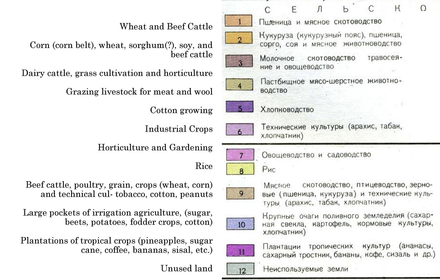
and agricultural symbols:

2 Comments
leave one →


Most entertaining translation-related item I’ve encountered in weeks!
Nuclear power plants at San Onofre (north of San Diego) and Rancho Seco (near Sacramento) are prominently indicated with black and white lightning bolts — but Rancho Seco (ранчо секо) is shown as being north-west of Sacramento, when it’s actually south-east: http://bit.ly/19ApdbL. How did they get that so wrong? Also the hydro dams at оровилл (Oroville) and хувер (Hoover)