Look Upon My (Geotagged) Works, Ye Mighty, and Despair!
May 19, 2010
Eric Fischer, yet again delivering awesome. Armed with nothing but the Flickr and Picassa APIs, OpenStreetMap, Perl and Ghostscript, he has recreated the world (or at least the vectors of photographers in 20 50 important cities).
As previously noted:
- Motion recorded by geotagging photographers.
- Taking all timestamps and location stamps at face value.
- Black is walking (less than 7mph)
- Red is bicycling or equivalent speed (less than 19mph)
- Blue is motor vehicles on normal roads (less than 43mph)
- Green is freeways or rapid transit.
(Update: Eric just added 30 more cities!)
Click any map for near magical 1024 x 1024 and 6137 x 6137 pixel views.
I am just glad Eric uses his powers for good and not for evil.
1) New York
2) London
3) Paris
5) Berlin
6) Barcelona
7) Boston
9) Rome
10) Toronto
11) Chicago
12) Vancouver
13) Hong Kong
14) Amsterdam
15) Madrid
16) Prague
17) Las Vegas
18) Venice
19) Stockholm
20) Tokyo
11 Comments
leave one →




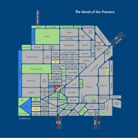

these are awesome!! i love how boats show up on the map and play into the whole idea of mapping routes (even off the roads – really obvious to me on the SF one)!
Thanks! I was surprised too how well it worked for the ferry routes.
Yes. These are pretty amazing.
Yet again Eric Fischer kicks geospatial and urbanism ass and has his robotic assistant take names. I am curious about how this was done — is it just pairs of photos from the same source that are then strung together in a linestring and colored by distance between points divided by time apart they were taken? That is extremely elegant and clever. Do these photo site api’s let you query huge areas or do you have to do it in pieces?
Also agree that the representations of bodies of water are particularly cool, especially the Thames at its most trafficked part.
Thanks! It was done pretty much as you say — the pictures are all sorted by photographer and then by time, and for any two sequential pictures taken by the same person within 10 minutes and 3 miles of each other, there is a line drawn between the locations, with speed calculated from the distance and time deltas.
The API querying gets a little complicated because of the limits on the number of results you can receive at one time. With Flickr you can ask for a list for the whole world as long as you ask for a sufficiently short time range. Picasa does not let you limit queries by time, so you have to query for small areas to get any older results.
This post will help the internet users for building up new web site or
even a weblog from start to end.