De-Elevating The Mission Freeway
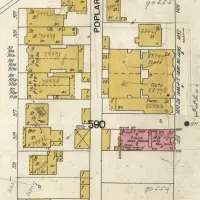
Fellow mapologist Eric Fischer took the time to alert me to diagrams from the SF 1948 Transportation Plan for the never-built Mission Freeway that we discussed a few months back.
Prior to the Great Freeway Revolt, traffic planners wanted the highway immediately to the east of Mission St — basically a continuation of the 280/San Jose exit now. It was to run
- along the foot of Bernal, between Mission and Coleridge
- from CC/Army to 24th, between Mission and Capp
- slice diagonally between 24th to 20th
- between Capp and Van Ness from 20th to 14th
I sliced together the two sections of the map for viewing convenience, click to zoom. (South is up)
The Mission would have been cut in two. Think a huge trough like Geary by Fillmore.
The highway was to be at or below grade from 26th to 14th. 15th, 17th, 19th, 23rd, 25th and 26th would have been cut off. The Bernal section looks to at grade, and Bernal would have been completely cut off from Mission / La Lengua except for Coleman (and Army). No Zante’s, Baby Blues, La Taqueria, El Faralito, Benders…
High resolution scans are available on his Flickr page including the Mission Section and Bernal Section.
UPDATE: Eric’s Flickr stream also contains this dramatic rendition of the Mission Highway, looking NE, between Mission and Coleridge, with Cortland coming down Bernal on the right:
Be sure to check out the many great maps on Eric’s website and his Flickr feed.






That light rail station looks sweet though. Can’t say it would been worth putting a freeway through the Mission.
That’s not a light rail (i.e. not Muin streetcars)… That’s BART.
It might have been repurposed for BART later, but BART didn’t even exist organizationally yet in 1948. According to the report, it would have been operated with PCC-type cars (like the F Market).
It went through my house. It went through the century-old softwood floor I am sitting on right now with my cat on my lap. My home would not exist. My neighbors would not be living all around me; their kids would not be my kids’ best friends. My jacaranda tree, my terrace, my bedroom, would be a freeway.
Holy cow.
Yeah, the light rail does look sweet. (As does the nearly empty freeway — funny how they never show them packed with cars.)
Kind of wondering how folks would actually *get* to the station. Walking under that highway would have been so fun and safe.
Holy crap. So in short, they planned to do to the Mission what New York City (via the august personage of Robert Moses) did to the South Bronx: fuck it completely, relentlessly, and for all time.
As much as the civic gridlock in San Francisco occasionally frustrates me, the fact that this monstrosity did not get built, for whatever reason, is a victory for the ages.
after the war, highways were really seen as a way to break with the past and make things “modern” but they never really realized at first just how damaging they could be in dense urban areas.
the national highway system under Eisenhower did a great job of connecting the USA, but within cities, was often quite damaging…they wanted to put a freeway or 2 in the park, with the 7th avenue freeway (Which would have been just doors down from my place in the Inner Sunset) blasting through….yikes!!
Maps of the two GGP highways, the Richmond Freeway and the Sunset Freeway that were connected to the Panhandle Freeway.
San Francisco (and Vancouver) were pretty much the only cities to avoid getting sliced and diced by freeways, and both are better cities because of it. Seattle is a good example of how *not* to have highways cut towns in twain.
Thanks for the publicity! I went ahead and also posted maps of the Crosstown Freeway and the Western Freeway in case anybody is also interested in the destruction, especially to Glen Park and the Inner Sunset, that these two freeways would have caused.